"Abundant wildlife and amazing legends await you along this delightfully easy route."
Walk directions
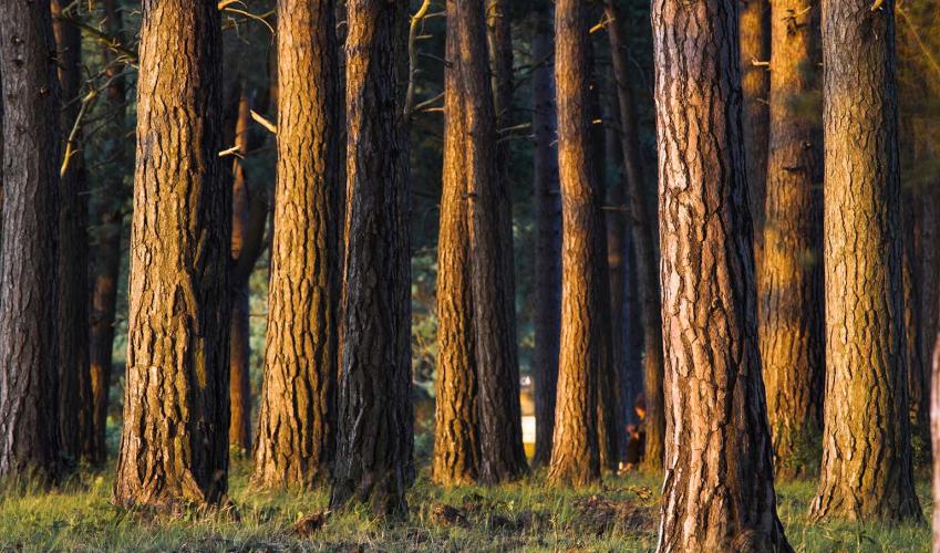
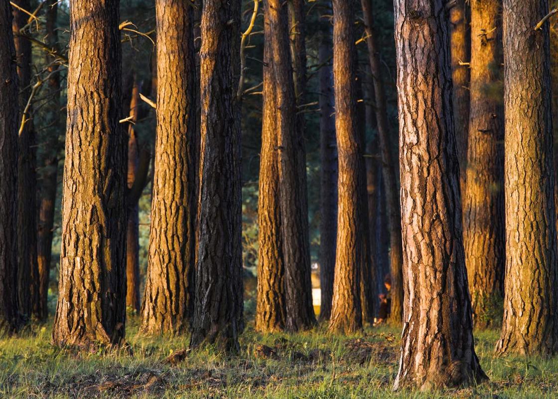
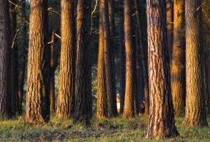
With your back to the car park entrance, turn right at the Shatterford name board and follow the broad grassy swathe through the pine trees and out onto the heath. Cross the causeway and footbridge, then follow the firm gravel path across the heath, keeping left at the grassy divide. Keep left again after a few paces, taking the narrower grassy path between the outlying clumps of birch trees and the woods on your right.
Follow the path into the woods, bear left and then curve right with the path as it tracks the woodland edge. The path drops gradually downhill, levels out, then swings left through the low bank of the Bishop’s Dyke to a wooden-railed footbridge 100yds (91m) ahead.
Turn left over the bridge, cross the short causeway and bear left over the larger of the two bridges ahead. Follow the broad grassy swathe across the heath and bear gently left over another railed bridge as the path picks its way across another low bridge between outlying trees and the woods on your right. Breaking clear of the trees, the path continues beside the woods to a large crater on your right.
Turn left at the grassy crossways just beyond the crater as the path ahead plunges back into the woods. Walk between a few scattered trees, then cross the pools ahead on two substantial wooden bridges.
Follow the firm sandy track as it draws closer to the railway on your right. Pass the turning to a railway bridge on your right, cross a causeway and footbridge and follow the path back to the car park.
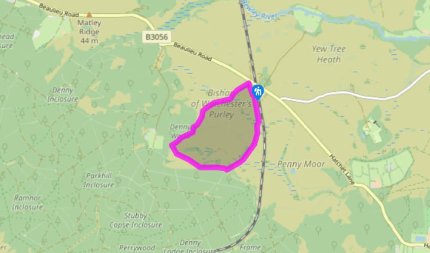
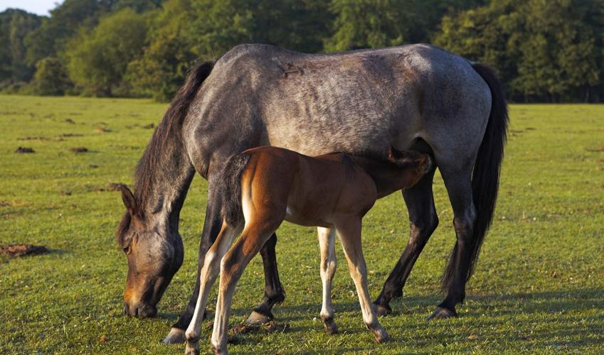
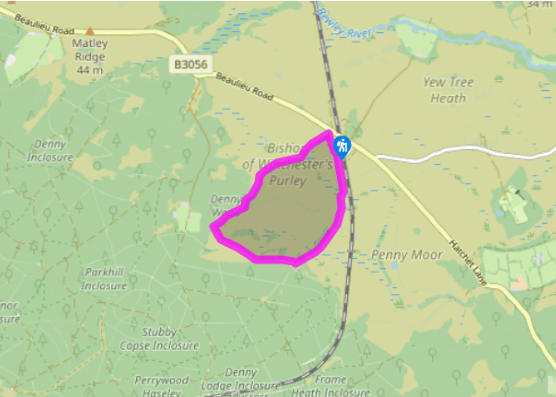
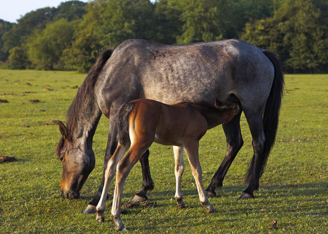
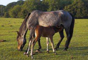
This is a lovely, largely level route across the wide open heaths between Lyndhurst and Beaulieu, brushing the edges of ancient woodlands and passing a couple of ponds. And, while the route can be boggy in places, you’ll cross most of these areas on well-engineered bridges and causeways. The... varied habitat means that this is a great place for wildlife. You’re almost certain to see ponies, especially along the edges of the woodland, where you may also catch sight of fallow deer. The New Forest’s wetlands are internationally important and these are the places to look for scarce plants like cottongrass, bog orchid and insectivorous sundews, with the possibility of seeing amphibians such as rare great crested newts in the ponds. Higher up, Dartford warbler, woodlark, common redstart and hobby have all been seen around Shatterford. The Crawls Along your way you’ll cross the Bishop of Winchester’s Purlieu, an area of some 500 acres (203ha) of heathland shaped like a distorted dumbbell and enclosed by the Bishop’s Dyke – a low bank and ditch about 4.5 miles (7.2km) long. Now the dull truth is that no one seems very sure about the origins of this 3ft (0.9m) high earthwork. It’s been suggested that it might have enclosed a large decoy pond, which is a plausible idea as the area is very damp and the bank largely follows a level course. Another idea is that the dyke formed the boundary of a medieval deer park, though the low banks and boggy nature of the ground makes this seem less likely. But local tradition alleges that in the late 13th century Edward I offered to grant Bishop John de Pontoise as much land as he could crawl round in a day. Unlikely as this might seem, the tale is remarkably similar to that of Hampshire’s 12th-century Tichborne Dole. In accordance with Lady Tichborne’s dying wish, flour is still ‘doled out’ annually to the people of this Itchen valley village, after her miserly husband agreed to give her all the corn from an area she could crawl round whilst holding a lighted torch. Eight centuries later, the 23-acre (9.3ha) field is still known locally as The Crawls.
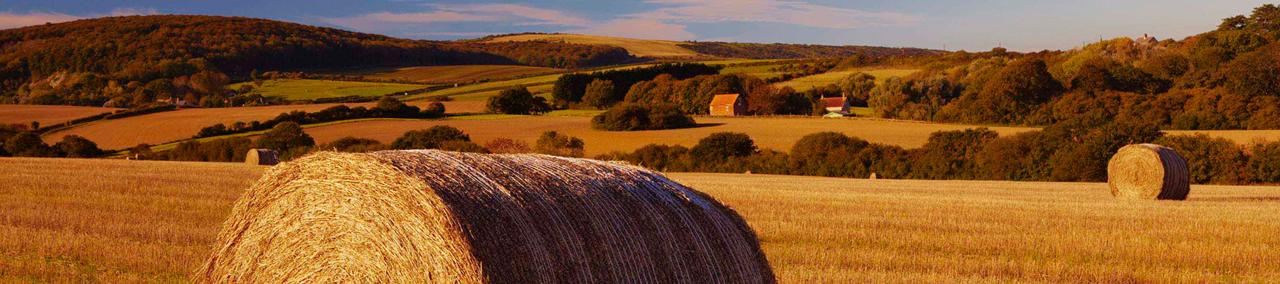
Hampshire’s varied landscape of hills and heaths, downlands and forests, valleys and coast are without rival in southern England. Hike across the chalk downland of the north Hampshire ‘highlands’, meander along peaceful paths through unspoilt river valleys of the Test, Itchen, Avon and Meon, or explore the lonely salt marshes and the beautiful medieval forest and heathland of the New Forest.
"Abundant wildlife and amazing legends await you along this delightfully easy route."
Walk details
1hr
Difficulty:
Easy
Gradient:
Flat
Distance:
2.75 miles (4.4kms)
Ascent:
0ft (0m)
Walk directions
With your back to the car park entrance, turn right at the Shatterford name board and follow the broad grassy swathe through the pine trees and out onto the heath. Cross the causeway and footbridge, then follow the firm gravel path across the heath, keeping left at the grassy divide. Keep left again after a few paces, taking the narrower grassy path between the outlying clumps of birch trees and the woods on your right.
1 of 5
Follow the path into the woods, bear left and then curve right with the path as it tracks the woodland edge. The path drops gradually downhill, levels out, then swings left through the low bank of the Bishop’s Dyke to a wooden-railed footbridge 100yds (91m) ahead.
2 of 5
Turn left over the bridge, cross the short causeway and bear left over the larger of the two bridges ahead. Follow the broad grassy swathe across the heath and bear gently left over another railed bridge as the path picks its way across another low bridge between outlying trees and the woods on your right. Breaking clear of the trees, the path continues beside the woods to a large crater on your right.
3 of 5
Turn left at the grassy crossways just beyond the crater as the path ahead plunges back into the woods. Walk between a few scattered trees, then cross the pools ahead on two substantial wooden bridges.
4 of 5
Follow the firm sandy track as it draws closer to the railway on your right. Pass the turning to a railway bridge on your right, cross a causeway and footbridge and follow the path back to the car park.
This is a lovely, largely level route across the wide open heaths between Lyndhurst and Beaulieu, brushing the edges of ancient woodlands and passing a couple of ponds. And, while the route can be boggy in places, you’ll cross most of these areas on well-engineered bridges and causeways. The... varied habitat means that this is a great place for wildlife. You’re almost certain to see ponies, especially along the edges of the woodland, where you may also catch sight of fallow deer. The New Forest’s wetlands are internationally important and these are the places to look for scarce plants like cottongrass, bog orchid and insectivorous sundews, with the possibility of seeing amphibians such as rare great crested newts in the ponds. Higher up, Dartford warbler, woodlark, common redstart and hobby have all been seen around Shatterford. The Crawls Along your way you’ll cross the Bishop of Winchester’s Purlieu, an area of some 500 acres (203ha) of heathland shaped like a distorted dumbbell and enclosed by the Bishop’s Dyke – a low bank and ditch about 4.5 miles (7.2km) long. Now the dull truth is that no one seems very sure about the origins of this 3ft (0.9m) high earthwork. It’s been suggested that it might have enclosed a large decoy pond, which is a plausible idea as the area is very damp and the bank largely follows a level course. Another idea is that the dyke formed the boundary of a medieval deer park, though the low banks and boggy nature of the ground makes this seem less likely. But local tradition alleges that in the late 13th century Edward I offered to grant Bishop John de Pontoise as much land as he could crawl round in a day. Unlikely as this might seem, the tale is remarkably similar to that of Hampshire’s 12th-century Tichborne Dole. In accordance with Lady Tichborne’s dying wish, flour is still ‘doled out’ annually to the people of this Itchen valley village, after her miserly husband agreed to give her all the corn from an area she could crawl round whilst holding a lighted torch. Eight centuries later, the 23-acre (9.3ha) field is still known locally as The Crawls.
Hampshire’s varied landscape of hills and heaths, downlands and forests, valleys and coast are without rival in southern England. Hike across the chalk downland of the north Hampshire ‘highlands’, meander along peaceful paths through unspoilt river valleys of the Test, Itchen, Avon and Meon, or explore the lonely salt marshes and the beautiful medieval forest and heathland of the New Forest.