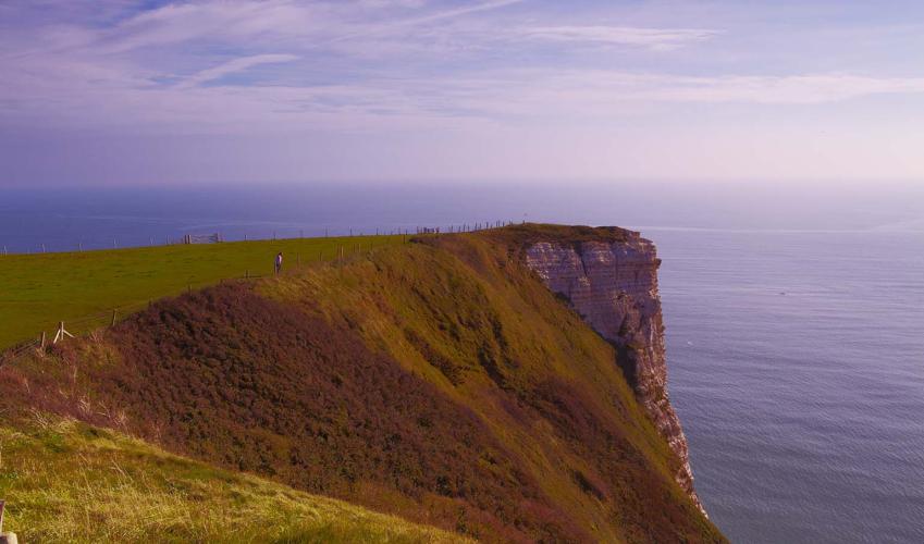
"Above and below the chalk cliffs of East Devon’s World Heritage Coast"
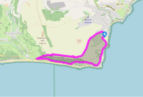
Walk directions
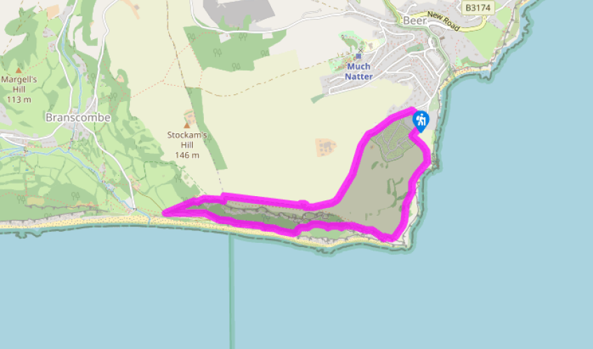
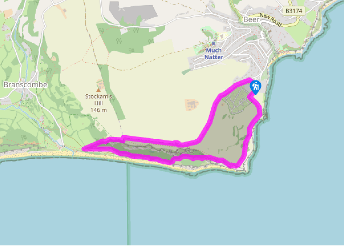
From the car park turn left uphill, past the entrance to Beer Head Caravan Park. Go through a bridlegate by a cattle grid, signed to Branscombe. Where the lane forks, take the left fork, soon passing through a bridlegate.
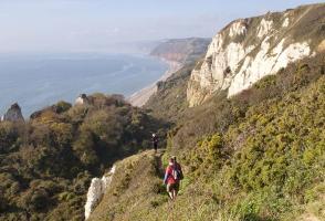
Follow the track along the top edge of a field, with a wire fence right. Pass through a bridlegate by a cattle grid, and follow the track as it bears right towards the old coastguard lookout. The right of way passes to the right of the building, then continues across South Down Common, with views ahead to Sidmouth and High Peak (site of an Iron Age hill-fort).
At the end of the common pass through two gates into National Trust land at East Cliff. Keep straight on, soon reaching a very steep descent towards Branscombe beach. Pass a bridlepath (right) and a bench. Continue downhill, between stands of gorse, to find very steeply descending steps that drop towards the coast, crossing a stile on route. Descend the left edge of the next field and pass through a gate in the corner to reach a path junction.
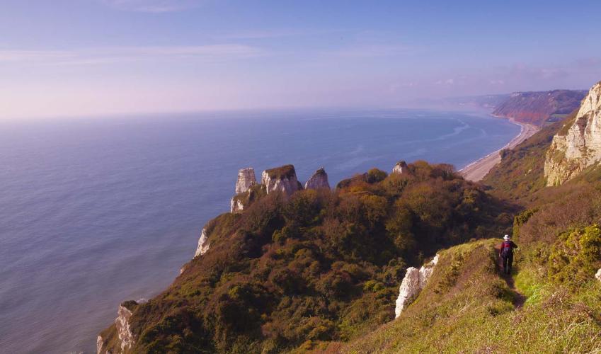
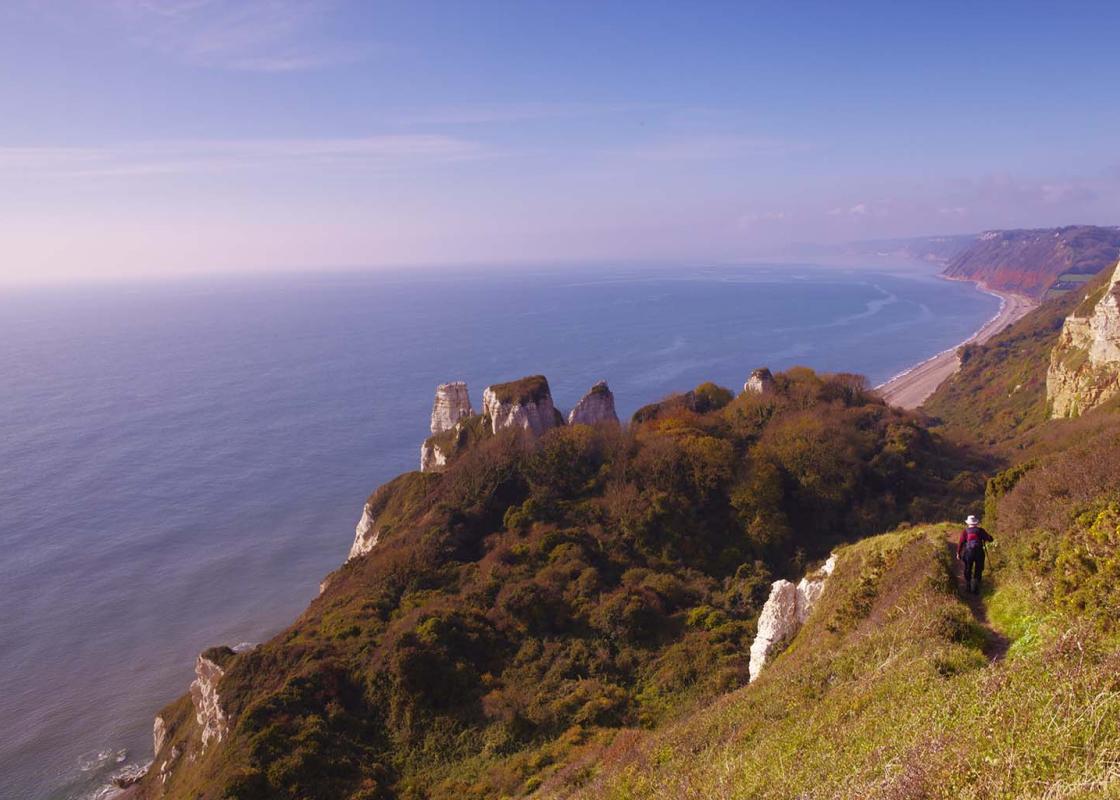
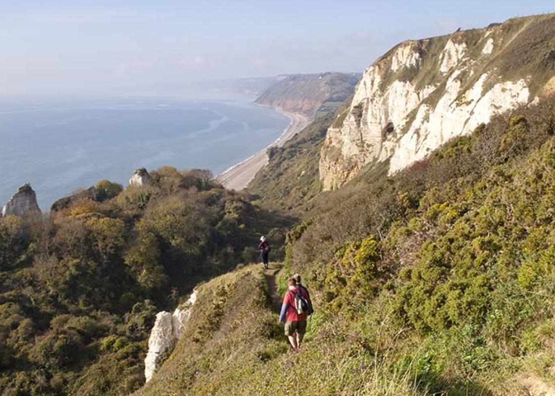
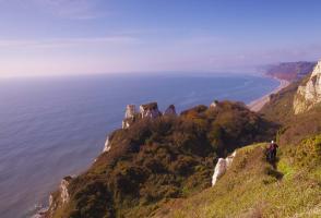
Turn left on the Coast Path and follow yellow arrows through The Sea Shanty Caravan Park, a wonderful collection of wooden chalets scattered along the lower cliffs. At a rough fork keep straight on, noting high chalk cliffs ahead. Follow the narrow path as it winds through the tangled jungle of the Hooken Undercliff, a secret and somewhat exotic wildlife paradise beneath friable chalk cliffs.
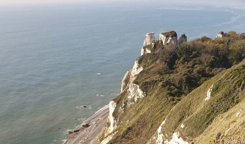
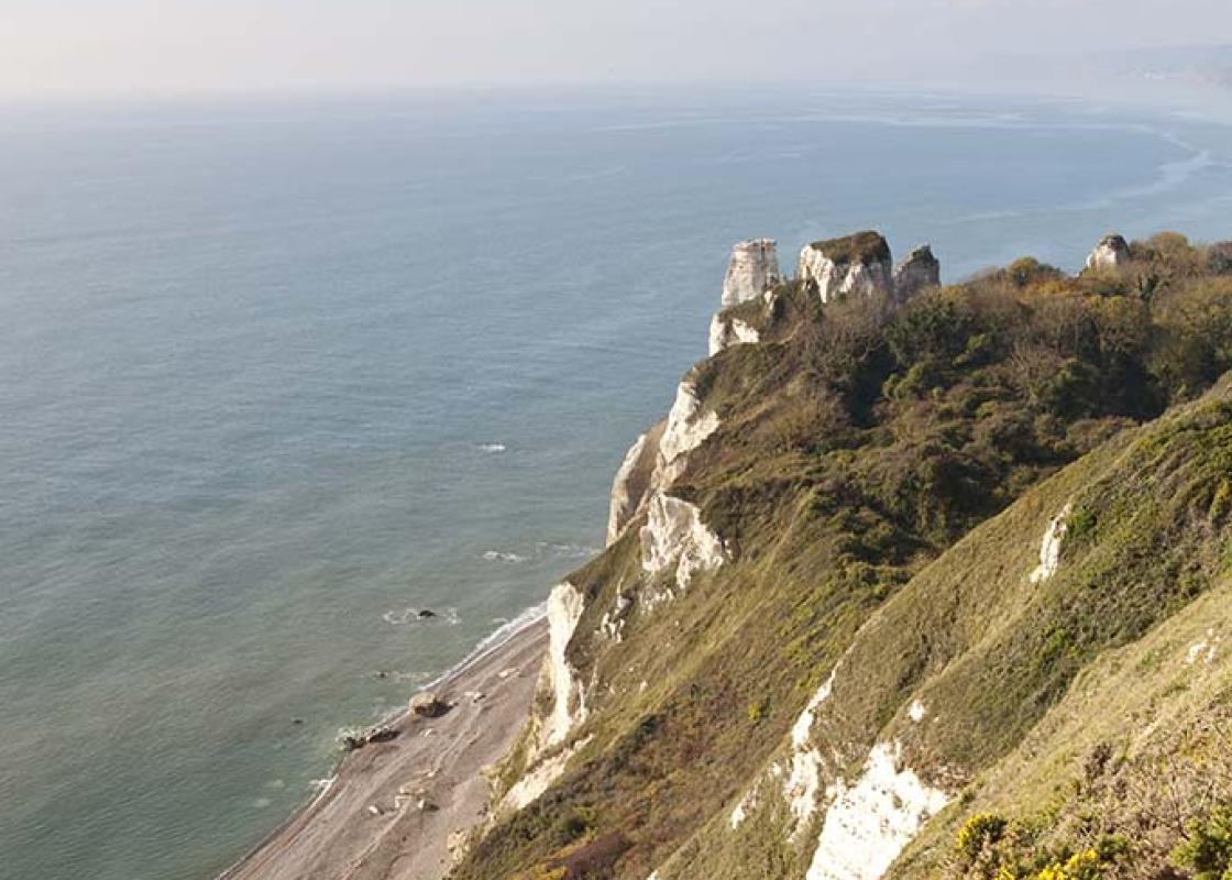
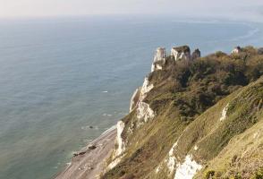
Pass a small path leading to the beach. Soon after, your path bears inland a little and starts to ascend gently under willow and ash, with tall chalk stacks now to the right. The path steepens and zig-zags left, then right, to reach a kissing gate onto the cliff top, at a path junction.
Turn right along the Coast Path and walk on to Beer Head. Go through a kissing gate and keep ahead, soon bearing left along the cliffs. Continue through a gateway, then a kissing gate. Follow the right edge of the next field and go through a bank, then bear left inland.
Pass through a gate onto a hedged path, with the caravan park left, soon bearing right to return to the car park.
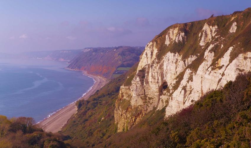
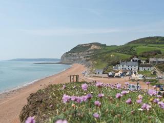
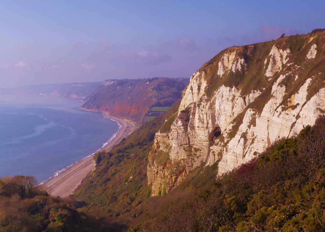
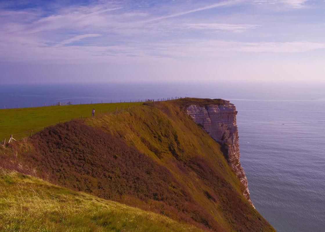
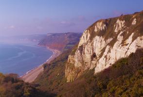
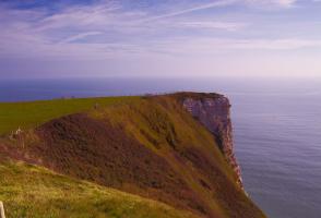
In late 2001 the 95-mile (155m) coast of East Devon and Dorset – from Exmouth to near Old Harry Rocks – was designated as England’s first natural World Heritage Site on account of the unique insight it provides into 185 million years of the earth’s history. The Jurassic Coast Popularly known as... ‘the Jurassic Coast’, this section of coast contains rocks from the Triassic, Jurassic and Cretaceous periods. Any walk on the South West Coast Path in this area will encounter a range of varied landscapes and wildlife habitats, from Budleigh Salterton’s pebble beds and the towering red sandstone cliffs around Sidmouth to the fossil beds of Lyme Regis and Charmouth, and the extraordinary 17-mile (28km) shingle and pebble barrier known as Chesil Beach in Dorset. The village of Beer is surrounded by high cliffs of white chalk, formed over 70 million years ago during the Cretaceous period when this area was more like the present-day Gulf of Arabia in terms of climate, The walk passes through the Hooken Undercliff (a ‘slumped’ section of chalk cliff), which occurred in 1789 and is today a magical place – a luxuriant tangle of trees and plants, a secret wilderness, and one of the most extraordinary spots on the whole 630-mile (1,014km) South West Coast Path. A smuggling hotspot The attractive seaside village of Beer has a long history of smuggling, and is also famous for Honiton lace, a craft brought here by 16th-century Flemish refugees: the lace for Queen Victoria’s wedding dress was made here at a cost of £1,000. The village’s most notorious son was Jack Rattenbury, born in 1778, who took up a life of fishing and smuggling, with the occasional press-ganged stint in the Navy, and in gaol. It is said he used to store his contraband deep in the Beer Quarry caves, and in caves on the Hooken Undercliff.
Devon sums up all that is best about the British landscape, with its magnificent coastlines, two historic cities, the world-famous Dartmoor National Park and south Devon’s glorious English Riviera. A fashionable and much-loved holiday destination, hiking and cycling in the National Parks is extremely popular among visitors, with a great choice of off-road routes.
"Above and below the chalk cliffs of East Devon’s World Heritage Coast"
Walk details
2hrs
Difficulty:
Hard
Gradient:
Challenging
Distance:
3.25 miles (5.3kms)
Ascent:
245ft (75m)
Walk directions
From the car park turn left uphill, past the entrance to Beer Head Caravan Park. Go through a bridlegate by a cattle grid, signed to Branscombe. Where the lane forks, take the left fork, soon passing through a bridlegate.
1 of 7
Follow the track along the top edge of a field, with a wire fence right. Pass through a bridlegate by a cattle grid, and follow the track as it bears right towards the old coastguard lookout. The right of way passes to the right of the building, then continues across South Down Common, with views ahead to Sidmouth and High Peak (site of an Iron Age hill-fort).
2 of 7
At the end of the common pass through two gates into National Trust land at East Cliff. Keep straight on, soon reaching a very steep descent towards Branscombe beach. Pass a bridlepath (right) and a bench. Continue downhill, between stands of gorse, to find very steeply descending steps that drop towards the coast, crossing a stile on route. Descend the left edge of the next field and pass through a gate in the corner to reach a path junction.
3 of 7
Turn left on the Coast Path and follow yellow arrows through The Sea Shanty Caravan Park, a wonderful collection of wooden chalets scattered along the lower cliffs. At a rough fork keep straight on, noting high chalk cliffs ahead. Follow the narrow path as it winds through the tangled jungle of the Hooken Undercliff, a secret and somewhat exotic wildlife paradise beneath friable chalk cliffs.
4 of 7
Pass a small path leading to the beach. Soon after, your path bears inland a little and starts to ascend gently under willow and ash, with tall chalk stacks now to the right. The path steepens and zig-zags left, then right, to reach a kissing gate onto the cliff top, at a path junction.
5 of 7
Turn right along the Coast Path and walk on to Beer Head. Go through a kissing gate and keep ahead, soon bearing left along the cliffs. Continue through a gateway, then a kissing gate. Follow the right edge of the next field and go through a bank, then bear left inland.
6 of 7
Pass through a gate onto a hedged path, with the caravan park left, soon bearing right to return to the car park.
In late 2001 the 95-mile (155m) coast of East Devon and Dorset – from Exmouth to near Old Harry Rocks – was designated as England’s first natural World Heritage Site on account of the unique insight it provides into 185 million years of the earth’s history. The Jurassic Coast Popularly known as... ‘the Jurassic Coast’, this section of coast contains rocks from the Triassic, Jurassic and Cretaceous periods. Any walk on the South West Coast Path in this area will encounter a range of varied landscapes and wildlife habitats, from Budleigh Salterton’s pebble beds and the towering red sandstone cliffs around Sidmouth to the fossil beds of Lyme Regis and Charmouth, and the extraordinary 17-mile (28km) shingle and pebble barrier known as Chesil Beach in Dorset. The village of Beer is surrounded by high cliffs of white chalk, formed over 70 million years ago during the Cretaceous period when this area was more like the present-day Gulf of Arabia in terms of climate, The walk passes through the Hooken Undercliff (a ‘slumped’ section of chalk cliff), which occurred in 1789 and is today a magical place – a luxuriant tangle of trees and plants, a secret wilderness, and one of the most extraordinary spots on the whole 630-mile (1,014km) South West Coast Path. A smuggling hotspot The attractive seaside village of Beer has a long history of smuggling, and is also famous for Honiton lace, a craft brought here by 16th-century Flemish refugees: the lace for Queen Victoria’s wedding dress was made here at a cost of £1,000. The village’s most notorious son was Jack Rattenbury, born in 1778, who took up a life of fishing and smuggling, with the occasional press-ganged stint in the Navy, and in gaol. It is said he used to store his contraband deep in the Beer Quarry caves, and in caves on the Hooken Undercliff.
Devon sums up all that is best about the British landscape, with its magnificent coastlines, two historic cities, the world-famous Dartmoor National Park and south Devon’s glorious English Riviera. A fashionable and much-loved holiday destination, hiking and cycling in the National Parks is extremely popular among visitors, with a great choice of off-road routes.