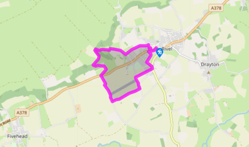
"From Curry Rivel to the Cider Monument for a view over the moors."
Walk directions
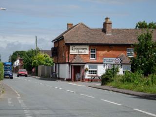
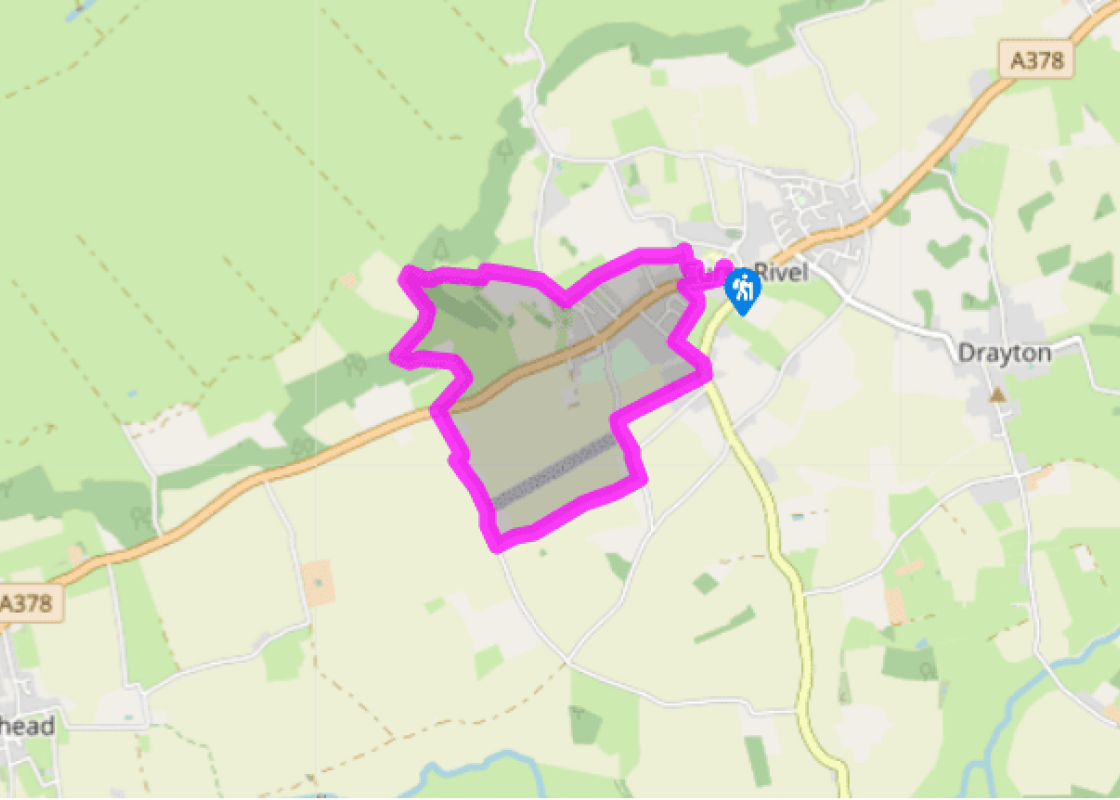
Head back from the car park to turn right along the A378 (Taunton direction). In 110yds (100m), just after the post office turn right on to high-walled path. Through kissing gate at end, turn left opposite cottage with box hedge and through another gate. Follow the right-hand edge of the field beyond, then over a stone stile and cross a driveway to a gate ahead. Soon after this the tall Pynsent Monument comes into sight on the right: a 140ft (43m) waymark for the next part of your walk. Continue always in the same direction, with a fence on your left, to a kissing gate on the left and a lane. Turn right for 170yds(155m) to a gateway with stone pillars.
Take the turning by the first pillar left into a field, and follow its edge round to the right to a kissing gate and the Pynsent Monument with it sudden view ahead over West Sedgemoor. Pass the Monument into a dip, to find a stile at the top corner of open beech wood. A path leads down through the open wood (non-native conifers have been felled here, hence the spindly appearance of the remaining beech and ash trees).
At the bottom turn left, just inside the wood, for 275yds (251m) to a stile on the right. Cross open parkland just to the left of a pond, to a distant gate. This leads back into Burton Wood. Turn left over a stile on to a tarmac track that climbs out of the woods for some 500yds (457m). At the top, some 100yds (91m) later comes a stile to the right.
Cross the stile and bear slightly left across the field to a stile in the hedge of the A387. Cross into Moortown Lane. This jinks right then left to pass an orchard. It then repeats the manoeuvre, jinking right then left to pass a second orchard.
Straight after this second orchard turn left through a gate. With a wide, flat view to your right, cross the top edges of two fields, to a green track. The track emerges onto Holden’s Way. Turn left, uphill, ignoring a side road on the right.
In another 220yds (201m) take a hole in the hedge on the right, with a public footpath waymark. Follow the field edge to a grey stone and red brick house. Pass to its left, to a gap in a tall cupressus hedge. An enclosed path leads out to the B3168. Turn left along the pavement, then take the first left into Stoney Lane. Opposite the turn-off is Old Father Time set on a high wall above a letterbox. After 180yds (165m) take a street on the right just after two houses with red-tiled roofs, it leads back to Curry Rivel’s main street.
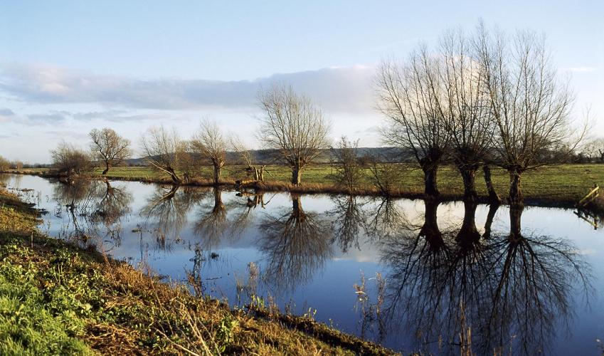
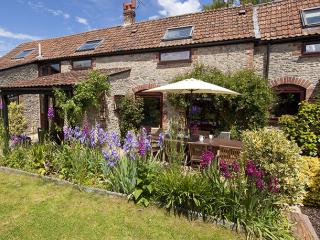
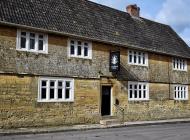
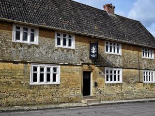
Curry Rivel is a fairly typical Somerset village, with its mixture of small shops, pubs and stone houses, with the church rising above the tiled rooftops. Modern estates around the village have tried to blend in by using traditional building materials – and perhaps with another couple of years... weathering they will. ‘Curry’ is from the Celtic ‘crwy’ meaning boundary; ‘Rivel’ is pronounced like the end of arrival and is the name of the 12th-century overlord Sir Richard Revel. Paying for favours The Pynsent Monument, standing high and elegant on Troy Hill above the moor, was designed by ‘Capability’ Brown and commemorates an act of 18th-century sleaze. Sir William Pynsent lobbied the Prime Minister, Pitt the Elder, on behalf of the cider industry. Pitt refrained from raising the duty on cider and in gratitude Pynsent left the Burton Pynsent estate to Pitt in his will. At the time this was a perfectly respectable proceeding, and in 1756 Pitt built a classical-style mansion, today’s Burton Pynsent Manor, and raised the column to commemorate the events that had led to his inheritance. Remembering Sedgemoor In July 1685 the Earl of Feversham was sent to crush the Monmouth Rebellion. He chose a camp down in that watery moorland, well-protected by the many rhynes (ditches). Outnumbered and outgunned, Monmouth staked all in a surprise attack. In mist, at dead of night, his pitchfork army crept out of Bridgwater. Each man carried a knife, with orders to quietly stab to death the man next to him if he made a sound. However, a shot was fired – either by accident or treachery. Feversham surrounded the rebels among the rhynes. Some 200 were killed outright (against the King’s 16), and in the aftermath many hundreds more were hanged from the signboards of the nearby inns. Out of the ordinary You’ll probably notice mistletoe along your walk, particularly in the branches of apple trees. This parasitic plant, with its odd, yellow-green leaves and cloudy-white berries, feeds on the sap of other trees and is spread by birds. It was considered sacred in pre-Christian times and reverence for the plant was adopted by the Christian church, leading to mistletoe’s importance as part of the Christmas celebrations – and the kissing that goes with it. Look out too, in summer, for a plant with the divided leaves of the elder, the berries of the elder, but that’s clearly not quite the elder. This is the herbaceous danewort, a perennial that dies back in winter. In the Middle Ages people thought it grew only on battle sites connected to the Danish raids; more prosaically, its name is probably linked to an old word for diarrhoea.
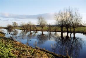
Somerset remains rural and unspoiled, and ever popular areas to visit are the limestone and red sandstone Mendip Hills rising to over 1,000 feet, and by complete contrast, to the south and southwest, the flat landscape of the Somerset Levels. Another popular spot, the Quantocks, once the haunt of poets Coleridge and Wordsworth, are noted for their gentle slopes, heather-covered moorland expanses and red deer.
"From Curry Rivel to the Cider Monument for a view over the moors."
Walk details
1hr 45min
Difficulty:
Easy
Gradient:
Gentle
Distance:
4 miles (6.4kms)
Ascent:
350ft (107m)
Walk directions
Head back from the car park to turn right along the A378 (Taunton direction). In 110yds (100m), just after the post office turn right on to high-walled path. Through kissing gate at end, turn left opposite cottage with box hedge and through another gate. Follow the right-hand edge of the field beyond, then over a stone stile and cross a driveway to a gate ahead. Soon after this the tall Pynsent Monument comes into sight on the right: a 140ft (43m) waymark for the next part of your walk. Continue always in the same direction, with a fence on your left, to a kissing gate on the left and a lane. Turn right for 170yds(155m) to a gateway with stone pillars.
1 of 6
Take the turning by the first pillar left into a field, and follow its edge round to the right to a kissing gate and the Pynsent Monument with it sudden view ahead over West Sedgemoor. Pass the Monument into a dip, to find a stile at the top corner of open beech wood. A path leads down through the open wood (non-native conifers have been felled here, hence the spindly appearance of the remaining beech and ash trees).
2 of 6
At the bottom turn left, just inside the wood, for 275yds (251m) to a stile on the right. Cross open parkland just to the left of a pond, to a distant gate. This leads back into Burton Wood. Turn left over a stile on to a tarmac track that climbs out of the woods for some 500yds (457m). At the top, some 100yds (91m) later comes a stile to the right.
3 of 6
Cross the stile and bear slightly left across the field to a stile in the hedge of the A387. Cross into Moortown Lane. This jinks right then left to pass an orchard. It then repeats the manoeuvre, jinking right then left to pass a second orchard.
4 of 6
Straight after this second orchard turn left through a gate. With a wide, flat view to your right, cross the top edges of two fields, to a green track. The track emerges onto Holden’s Way. Turn left, uphill, ignoring a side road on the right.
5 of 6
In another 220yds (201m) take a hole in the hedge on the right, with a public footpath waymark. Follow the field edge to a grey stone and red brick house. Pass to its left, to a gap in a tall cupressus hedge. An enclosed path leads out to the B3168. Turn left along the pavement, then take the first left into Stoney Lane. Opposite the turn-off is Old Father Time set on a high wall above a letterbox. After 180yds (165m) take a street on the right just after two houses with red-tiled roofs, it leads back to Curry Rivel’s main street.
Curry Rivel is a fairly typical Somerset village, with its mixture of small shops, pubs and stone houses, with the church rising above the tiled rooftops. Modern estates around the village have tried to blend in by using traditional building materials – and perhaps with another couple of years... weathering they will. ‘Curry’ is from the Celtic ‘crwy’ meaning boundary; ‘Rivel’ is pronounced like the end of arrival and is the name of the 12th-century overlord Sir Richard Revel. Paying for favours The Pynsent Monument, standing high and elegant on Troy Hill above the moor, was designed by ‘Capability’ Brown and commemorates an act of 18th-century sleaze. Sir William Pynsent lobbied the Prime Minister, Pitt the Elder, on behalf of the cider industry. Pitt refrained from raising the duty on cider and in gratitude Pynsent left the Burton Pynsent estate to Pitt in his will. At the time this was a perfectly respectable proceeding, and in 1756 Pitt built a classical-style mansion, today’s Burton Pynsent Manor, and raised the column to commemorate the events that had led to his inheritance. Remembering Sedgemoor In July 1685 the Earl of Feversham was sent to crush the Monmouth Rebellion. He chose a camp down in that watery moorland, well-protected by the many rhynes (ditches). Outnumbered and outgunned, Monmouth staked all in a surprise attack. In mist, at dead of night, his pitchfork army crept out of Bridgwater. Each man carried a knife, with orders to quietly stab to death the man next to him if he made a sound. However, a shot was fired – either by accident or treachery. Feversham surrounded the rebels among the rhynes. Some 200 were killed outright (against the King’s 16), and in the aftermath many hundreds more were hanged from the signboards of the nearby inns. Out of the ordinary You’ll probably notice mistletoe along your walk, particularly in the branches of apple trees. This parasitic plant, with its odd, yellow-green leaves and cloudy-white berries, feeds on the sap of other trees and is spread by birds. It was considered sacred in pre-Christian times and reverence for the plant was adopted by the Christian church, leading to mistletoe’s importance as part of the Christmas celebrations – and the kissing that goes with it. Look out too, in summer, for a plant with the divided leaves of the elder, the berries of the elder, but that’s clearly not quite the elder. This is the herbaceous danewort, a perennial that dies back in winter. In the Middle Ages people thought it grew only on battle sites connected to the Danish raids; more prosaically, its name is probably linked to an old word for diarrhoea.
Somerset remains rural and unspoiled, and ever popular areas to visit are the limestone and red sandstone Mendip Hills rising to over 1,000 feet, and by complete contrast, to the south and southwest, the flat landscape of the Somerset Levels. Another popular spot, the Quantocks, once the haunt of poets Coleridge and Wordsworth, are noted for their gentle slopes, heather-covered moorland expanses and red deer.