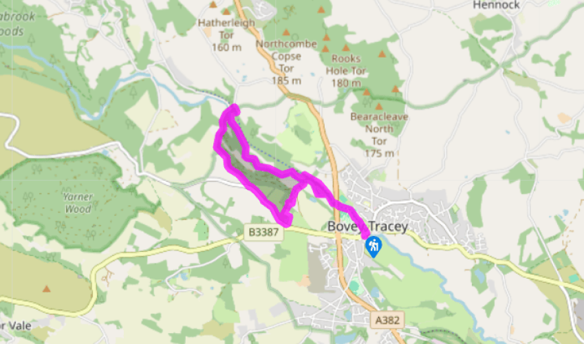
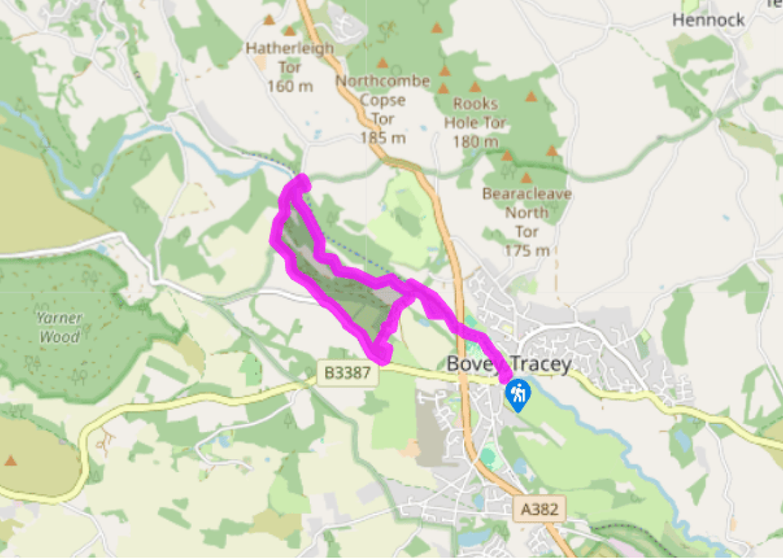
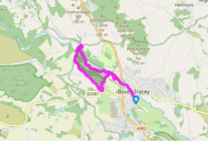
Cross the road and turn right, following the signs for ‘Town centre shops’. Just before you come to the bridge turn left along a concrete walkway into Mill Marsh Park, past the children’s playground and through the arboretum. Keep along the riverbank to pass under the A382 via a walkway.
Bear right along the riverbank to join the trackbed of the old Newton Abbot–Moretonhampstead railway line. Follow the path over the Bovey.
Turn immediately left down wooden steps and through a kissing gate to follow the river. Cross a stile at the field end and continue on a narrow, rough path, high above the river. Descend wooden steps; cross a footbridge into the next field.
Parke is over the bridge to the left, and the old railway line is right, but keep ahead across a pasture into woodland, then go left on a raised wooden walkway to the river. The path winds on, then runs along between woods with fields on the right, then over a footbridge to meet the river at a weir. Keep following the river, eventually passing through two kissing gates. The path bears away from the river through rough ground, then returns to the bank. Keep ahead to pass a footbridge over the river, left. A little later the path bears right to cross the railway track. Turn half left downhill to a lane via a small gate.
Turn left (signed ‘Manaton’) and pass between the old railway bridge piers. Walk across Wilford Bridge, ignoring signs to Lustleigh, right. Continue up the lane to reach Forder Gatehouses.
Turn left though a kissing gate and keep ahead for 150yds (137m); turn right up steps into woodland and climb steeply to meet a path. Turn left. The wooded path is narrow, with wooded views over the Bovey Valley. Go through a beech wood and kissing gate into a large field. Keep to the right edge, gradually going downhill, to leave via a kissing gate and down a narrow wooded path parallel to the road.
The path ends at a kissing gate; turn sharp left to walk across the parkland and the drive to Parke car park (turn left for Home Farm Café and toilets, beyond the car park). Walk downhill to cross the lower drive, then left below the house, ending at a five-bar gate. Go through and turn right to cross the river at Parke Bridge, then ahead to join the old railway track.
Turn right and follow the track until it crosses the Bovey, then bear left to pass under the A382 and enter Mill Marsh Park. Retrace your steps to your car.
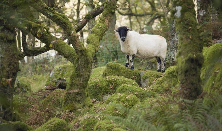
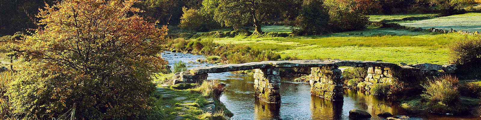
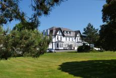
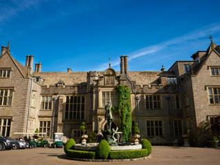
The road signs as you approach Bovey Tracey proudly proclaim the town as being the ‘Gateway to the Moor’, and although this may be debatable (the town is 3 miles/4.8km from the open moor, and gives no impression of Dartmoor proper) it is certainly true that the character of the landscape changes... markedly as you leave the town. To the west the road climbs steadily up towards the tourist honeypot of Hay Tor, and the northern route travels past picturesque Lustleigh through the wooded Wray valley to reach Moretonhampstead and the open moorland beyond. The town’s other claim to fame is that it is home to the headquarters of the Dartmoor National Park Authority, based at Parke, a splendid house set in spacious parkland just to the west of the town. The River Bovey runs through the National Trust’s Parke Estate, and the area provides an excellent range of walking opportunities. The building housing the National Park’s offices at Parke was built around 1826 on the site of a derelict Tudor house, and left to the National Trust by Major Hole in 1974. In 1999 the 11 National Parks of England and Wales celebrated the 50th anniversary of the legislation that established them. Dartmoor National Park, covering 368sq miles (953sq km), was number four (in October 1951), following the Peak District, the Lake District and Snowdonia. Walkers should appreciate the purposes behind the National Parks movement – ‘the conservation of the natural beauty, wildlife and cultural heritage of the area, and the promotion of the understanding and enjoyment of its special qualities by the public’. The office at Parke is open for enquiries during normal office hours. Note too that this route can also be started from the Parke Estate car park, passed on Point 7. The 12-mile (19.3km) Newton Abbot–Moretonhampstead railway line was opened in 1866, and finally closed for passenger traffic in 1959. A group of enthusiasts tried to keep it open as a preserved steam line, but were unsuccessful. The disused section is now known as the Wray Valley Trail, and is a walking and cycling route.
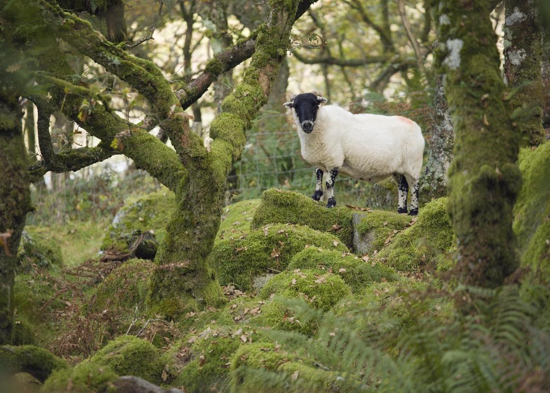
Devon sums up all that is best about the British landscape, with its magnificent coastlines, two historic cities, the world-famous Dartmoor National Park and south Devon’s glorious English Riviera. A fashionable and much-loved holiday destination, hiking and cycling in the National Parks is extremely popular among visitors, with a great choice of off-road routes.
Cross the road and turn right, following the signs for ‘Town centre shops’. Just before you come to the bridge turn left along a concrete walkway into Mill Marsh Park, past the children’s playground and through the arboretum. Keep along the riverbank to pass under the A382 via a walkway.
1 of 8
Bear right along the riverbank to join the trackbed of the old Newton Abbot–Moretonhampstead railway line. Follow the path over the Bovey.
2 of 8
Turn immediately left down wooden steps and through a kissing gate to follow the river. Cross a stile at the field end and continue on a narrow, rough path, high above the river. Descend wooden steps; cross a footbridge into the next field.
3 of 8
Parke is over the bridge to the left, and the old railway line is right, but keep ahead across a pasture into woodland, then go left on a raised wooden walkway to the river. The path winds on, then runs along between woods with fields on the right, then over a footbridge to meet the river at a weir. Keep following the river, eventually passing through two kissing gates. The path bears away from the river through rough ground, then returns to the bank. Keep ahead to pass a footbridge over the river, left. A little later the path bears right to cross the railway track. Turn half left downhill to a lane via a small gate.
4 of 8
Turn left (signed ‘Manaton’) and pass between the old railway bridge piers. Walk across Wilford Bridge, ignoring signs to Lustleigh, right. Continue up the lane to reach Forder Gatehouses.
5 of 8
Turn left though a kissing gate and keep ahead for 150yds (137m); turn right up steps into woodland and climb steeply to meet a path. Turn left. The wooded path is narrow, with wooded views over the Bovey Valley. Go through a beech wood and kissing gate into a large field. Keep to the right edge, gradually going downhill, to leave via a kissing gate and down a narrow wooded path parallel to the road.
6 of 8
The path ends at a kissing gate; turn sharp left to walk across the parkland and the drive to Parke car park (turn left for Home Farm Café and toilets, beyond the car park). Walk downhill to cross the lower drive, then left below the house, ending at a five-bar gate. Go through and turn right to cross the river at Parke Bridge, then ahead to join the old railway track.
7 of 8
Turn right and follow the track until it crosses the Bovey, then bear left to pass under the A382 and enter Mill Marsh Park. Retrace your steps to your car.
The road signs as you approach Bovey Tracey proudly proclaim the town as being the ‘Gateway to the Moor’, and although this may be debatable (the town is 3 miles/4.8km from the open moor, and gives no impression of Dartmoor proper) it is certainly true that the character of the landscape changes... markedly as you leave the town. To the west the road climbs steadily up towards the tourist honeypot of Hay Tor, and the northern route travels past picturesque Lustleigh through the wooded Wray valley to reach Moretonhampstead and the open moorland beyond. The town’s other claim to fame is that it is home to the headquarters of the Dartmoor National Park Authority, based at Parke, a splendid house set in spacious parkland just to the west of the town. The River Bovey runs through the National Trust’s Parke Estate, and the area provides an excellent range of walking opportunities. The building housing the National Park’s offices at Parke was built around 1826 on the site of a derelict Tudor house, and left to the National Trust by Major Hole in 1974. In 1999 the 11 National Parks of England and Wales celebrated the 50th anniversary of the legislation that established them. Dartmoor National Park, covering 368sq miles (953sq km), was number four (in October 1951), following the Peak District, the Lake District and Snowdonia. Walkers should appreciate the purposes behind the National Parks movement – ‘the conservation of the natural beauty, wildlife and cultural heritage of the area, and the promotion of the understanding and enjoyment of its special qualities by the public’. The office at Parke is open for enquiries during normal office hours. Note too that this route can also be started from the Parke Estate car park, passed on Point 7. The 12-mile (19.3km) Newton Abbot–Moretonhampstead railway line was opened in 1866, and finally closed for passenger traffic in 1959. A group of enthusiasts tried to keep it open as a preserved steam line, but were unsuccessful. The disused section is now known as the Wray Valley Trail, and is a walking and cycling route.
Devon sums up all that is best about the British landscape, with its magnificent coastlines, two historic cities, the world-famous Dartmoor National Park and south Devon’s glorious English Riviera. A fashionable and much-loved holiday destination, hiking and cycling in the National Parks is extremely popular among visitors, with a great choice of off-road routes.