"A walk which, more than most, lays bare the past."
Walk directions
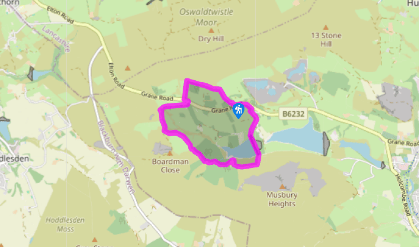
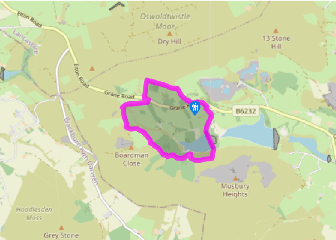
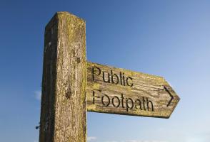
A footpath leaves through a gate to the left of the information centre. Climb through a small plantation and follow a wall uphill to a kissing gate. Through that and over a stile, continue with the Rossendale Way across the slope above a wall. About 100yds (91m) past a plantation, cross a stile on the left and head down to the road.
Go left for 90yds (82m), crossing to leave along a track on the right. Beyond a gate, bear right at a fork. After 0.25 miles (400m), curve left across the head of the valley, occasional wayposts confirming the path as it subsequently descends beside an old water channel.
At the bottom, swing right across a bridge and up a rough, walled track. After 50yds (46m), go left at a waymarker. Continue beyond the end of a flagged path to pass a ruin by a tree. A stony track develops, leading past another abandoned farm and eventually winding round a large derelict building before losing height to a footbridge across a stream. Climb away beside a plantation boundary to a kissing gate. Carry on between beech, oak and larch, shortly descending to a crossing path.
Turn right, dropping to a footbridge. Climb beyond and walk on across the hillside between more trees. Over another stream, zig-zag away. However, don't continue up into the clough, but go left to contour below the plantation. Through a gate, carry on across a bilberry-covered hillside above the Calf Hey Reservoir, passing more ruins and crossing a stream before eventually reaching a lone sycamore.
Drop through a kissing gate and head downhill to a stile beside a gate onto the reservoir drive. Cross the spillway and dam, taking the left fork beyond, to climb past an old gate valve. Emerge through a kissing gate onto a drive.
Go right to a second gate, through which you turn immediately left through a gap and follow a path beside the drive to a small car park. Briefly rejoin the drive before taking another parallel path, this time on the left signed to Clough Head. Crossing a reservoir service track, continue with the path through a small plantation to emerge onto the road. Go left, crossing to a path leaving on the right, which cuts the corner through the trees back to the car park.
It's hard to believe today, but the Grane Valley was once home to well over 1,000 people. Many houses have vanished entirely, but some remain, in varying states of decay. It is tempting to assume that it was the flooding of the lower valley that caused its depopulation, but as a matter of fact the... story is considerably more complicated. Growing population Settlement began in the area, previously a deer park, in the early part of the 16th century. The population grew over the next two centuries as woods were cleared. However, farming here was nearly always marginal. Most families supplemented their income by handloom weaving. Another widespread source of income was the distilling of illicit whisky. Many of the houses had secret passages or cellars to hide the stills. As larger mills developed, handloom weaving became less viable. The construction of the Calf Hey Reservoir in the 1850s robbed the struggling community of its best land, but the final nail in the coffin was the crisis which afflicted agriculture in the 1880s, with drastic falls in commodity prices. There's an echo here of the problems which farmers are facing today. Once more, many farmers are searching for supplementary sources of income and in some cases leaving agriculture altogether. Abandoned farms The crisis of the 1880s led to the abandonment of poorer upland farms in many parts of the region, but the total depopulation of the Grane Valley is one of the most dramatic instances. Even on the opening section of the walk, before crossing the main road, you pass the sites of several farms, a smithy and an inn – though all you're likely to see are a few remnants of wall incorporated into the boundary wall. As the way swings round the head of the valley it passes several ruins. These stand around 1,000ft (305m) above sea level and it must always have been a somewhat bleak and exposed spot. It's hard to imagine these gaunt shells as they were, with adults working and perhaps children playing. Beyond the ruined farmsteads the walk route descends through a shady conifer plantation and then runs through broadleaved woods, notably a fine stand of beech. These plantings give some idea of how the valley might have looked before it was settled. As you cross the dam of Calf Hey Reservoir, there are quarries on the skyline both ahead and behind, which also provided employment in the area. Just before the climb back to the road, the walk passes a graveyard and the sites of both the Methodist chapel and Anglican church. The latter has been reerected lower down the valley, about 0.5 miles (800m) beyond the Duke of Wellington pub.
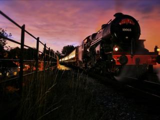
Lancashire was at the centre of the British cotton industry in the 19th century, which lead to the urbanization of great tracts of the area. The cotton boom came and went, but the industrial profile remains.
"A walk which, more than most, lays bare the past."
Walk details
1hr 30min
Difficulty:
Medium
Gradient:
Challenging
Distance:
3.25 miles (5.3kms)
Ascent:
541ft (165m)
Walk directions
A footpath leaves through a gate to the left of the information centre. Climb through a small plantation and follow a wall uphill to a kissing gate. Through that and over a stile, continue with the Rossendale Way across the slope above a wall. About 100yds (91m) past a plantation, cross a stile on the left and head down to the road.
1 of 6
Go left for 90yds (82m), crossing to leave along a track on the right. Beyond a gate, bear right at a fork. After 0.25 miles (400m), curve left across the head of the valley, occasional wayposts confirming the path as it subsequently descends beside an old water channel.
2 of 6
At the bottom, swing right across a bridge and up a rough, walled track. After 50yds (46m), go left at a waymarker. Continue beyond the end of a flagged path to pass a ruin by a tree. A stony track develops, leading past another abandoned farm and eventually winding round a large derelict building before losing height to a footbridge across a stream. Climb away beside a plantation boundary to a kissing gate. Carry on between beech, oak and larch, shortly descending to a crossing path.
3 of 6
Turn right, dropping to a footbridge. Climb beyond and walk on across the hillside between more trees. Over another stream, zig-zag away. However, don't continue up into the clough, but go left to contour below the plantation. Through a gate, carry on across a bilberry-covered hillside above the Calf Hey Reservoir, passing more ruins and crossing a stream before eventually reaching a lone sycamore.
4 of 6
Drop through a kissing gate and head downhill to a stile beside a gate onto the reservoir drive. Cross the spillway and dam, taking the left fork beyond, to climb past an old gate valve. Emerge through a kissing gate onto a drive.
5 of 6
Go right to a second gate, through which you turn immediately left through a gap and follow a path beside the drive to a small car park. Briefly rejoin the drive before taking another parallel path, this time on the left signed to Clough Head. Crossing a reservoir service track, continue with the path through a small plantation to emerge onto the road. Go left, crossing to a path leaving on the right, which cuts the corner through the trees back to the car park.
It's hard to believe today, but the Grane Valley was once home to well over 1,000 people. Many houses have vanished entirely, but some remain, in varying states of decay. It is tempting to assume that it was the flooding of the lower valley that caused its depopulation, but as a matter of fact the... story is considerably more complicated. Growing population Settlement began in the area, previously a deer park, in the early part of the 16th century. The population grew over the next two centuries as woods were cleared. However, farming here was nearly always marginal. Most families supplemented their income by handloom weaving. Another widespread source of income was the distilling of illicit whisky. Many of the houses had secret passages or cellars to hide the stills. As larger mills developed, handloom weaving became less viable. The construction of the Calf Hey Reservoir in the 1850s robbed the struggling community of its best land, but the final nail in the coffin was the crisis which afflicted agriculture in the 1880s, with drastic falls in commodity prices. There's an echo here of the problems which farmers are facing today. Once more, many farmers are searching for supplementary sources of income and in some cases leaving agriculture altogether. Abandoned farms The crisis of the 1880s led to the abandonment of poorer upland farms in many parts of the region, but the total depopulation of the Grane Valley is one of the most dramatic instances. Even on the opening section of the walk, before crossing the main road, you pass the sites of several farms, a smithy and an inn – though all you're likely to see are a few remnants of wall incorporated into the boundary wall. As the way swings round the head of the valley it passes several ruins. These stand around 1,000ft (305m) above sea level and it must always have been a somewhat bleak and exposed spot. It's hard to imagine these gaunt shells as they were, with adults working and perhaps children playing. Beyond the ruined farmsteads the walk route descends through a shady conifer plantation and then runs through broadleaved woods, notably a fine stand of beech. These plantings give some idea of how the valley might have looked before it was settled. As you cross the dam of Calf Hey Reservoir, there are quarries on the skyline both ahead and behind, which also provided employment in the area. Just before the climb back to the road, the walk passes a graveyard and the sites of both the Methodist chapel and Anglican church. The latter has been reerected lower down the valley, about 0.5 miles (800m) beyond the Duke of Wellington pub.
Lancashire was at the centre of the British cotton industry in the 19th century, which lead to the urbanization of great tracts of the area. The cotton boom came and went, but the industrial profile remains.