"A pleasing riverside ramble, an ancient village, and a wood that aspires to being ancient."
Walk directions
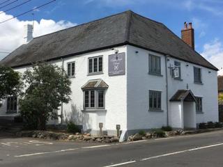
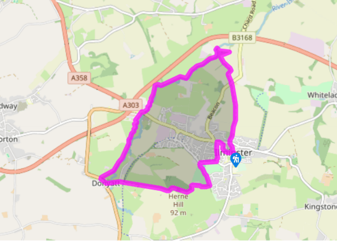
From the Market Square head uphill on North Street. With the ancient Bell Inn on the left, the route continues on a path (Old Road). It rises past communications equipment ancient and modern – a beacon fire-basket and then a mobile phone mast – before descending to the B3168.
Cross with care into a hedged byway to Eames Mill. Turn right, along the waymarked access track. After 220yds (201m) a concrete track turns sharply back left. Just before a bridge, go through a chain gate to follow the River Isle upstream. You have covered 0.25 miles (400m) to pass from the front of Eames Mill to the back, but the rights of way don't allow a more straightforward route.
Cross a weir to head upstream with the river on your left. After a mile (1.6km), and ignoring a couple of bridges over the river, you will reach Powrmatic works car park, and a chain gate to the B3168 beyond.
Cross the B3168 and then follow a track signed 'Rose Mills Industrial Estate'. Pass along the river bank to the left of the buildings, and then between piles of ironwork and round to right of a large white shed to a footbridge back into the real world. Now with the river on your right, head upstream in a fenced way to re-cross the river by another footbridge. Continue crossing over stiles along the right-hand bank. With the tower of Donyatt church ahead of you, cross diagonally right to a gate by a thatched cottage on to the road.
Turn left through the village, and bear left past the church. Head straight up Herne Hill as the lane leads to a track, then a field-edge path, then an earth path through Herne Hill Wood. The summit is under tall beeches. A wide avenue ahead leads to a field corner. Continue just inside the wood, passing a bench and trig point on your right, and going down to the wood's foot. Keep right, to the very corner of the wood, before a path bends back left alongside the field fence to reach a gate on the right.
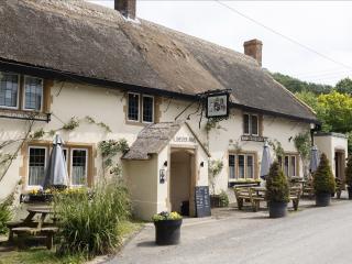
A wide path runs towards Ilminster, with sports fields below. Turn left, between the sports fields and the town, for 200yds (183m) and then through a gap on the right leading to a path alongside a murky remnant of the Chard-Taunton Canal. The slope you just descended was an incline, where barges were hauled on trolleys before the canal continued at a higher level, into a tunnel. Turn right behind tennis courts, and after 250yds (229m) turn left into Abbots Close and on to a tarred path. This leads to West Street, arriving at the Crown Inn. Turn right and bear right into Silver Street, to reach the town centre and the car park.
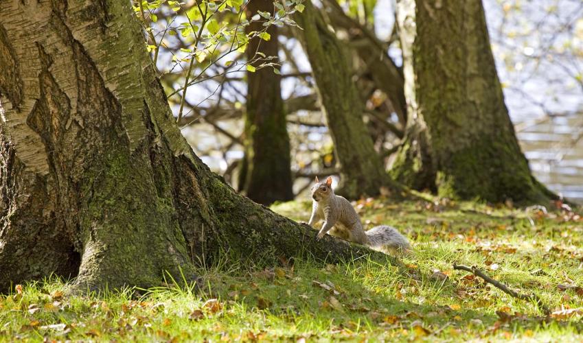
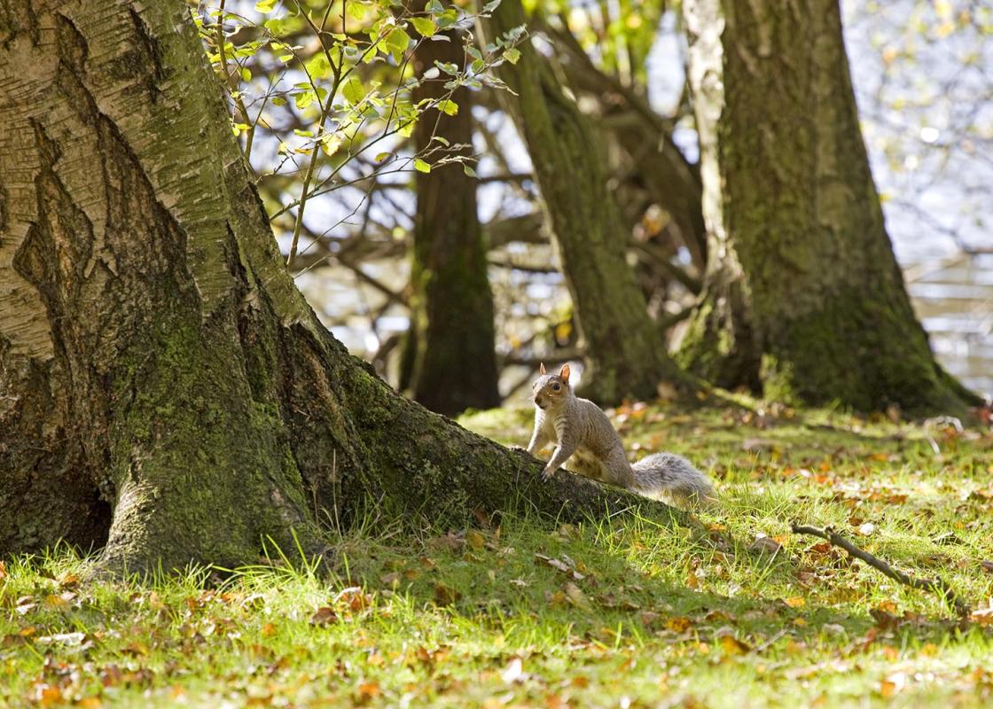
These days, nothing in the countryside just happens naturally. Fields are managed for food, although that is starting to change. Woodlands are managed to save valuable wildlife habitats. In the early Middle Ages forests were managed for deer, and for the men (in particular, the King) who hunted the... deer. A couple of centuries later, woodlands were for pigs. The natural heritage Aage Today, woods are for natural heritage. At the top of the list, this means mammals (apart from the grey squirrel, a 'baddie'), and birds. Slightly further down come butterflies, followed by woodlice, lichens and the rarer sorts of wild flowers. You don't often hear of woodlands (as opposed to commercial timber forests) being managed for the sake of the trees – perhaps that just sounds too circular. But trees too have their league table. The 'aristocrats' who can trace their lineage back to the ice age – oak, beech, hedge maple – are 'good'. The exception is the sycamore: the sycamore is too good at surviving, and so is considered a weed, to be eradicated. The latecomers, and other ones people may have had a hand in, are intruders; walnut and sweet chestnut are to be controlled or rooted out. The dog age Towards the bottom of the list comes the naturalist. And still important, but perhaps less so than any of the others, is the ordinary human being: the child looking for conkers, the young couple looking for privacy, the painter or photographer looking for shades of green in dappled sun, those special qualities of woodland light. The oak and the beech are indeed handsome trees, and the spruce is gloomy. Almost all walkers are interested in wildlife. Still, why is the badger a hero but the fox a dubious character? And is it possible that, in another century or two, woodland will be managed mainly for the sake of its most enthusiastic users – our dogs? The first priorities would therefore be big piles of leaves, things that run away, and things that smell interesting when dead. Herne Hill Wood In Herne Hill Wood you might spot: hazelnuts with tiny holes nibbled in them by dormice ('good!'); tree bark chewed away by the grey squirrels ('bad!'); one or two of the squirrels themselves; and you may notice the ferretty smell of badgers. Herne Hill itself was given to the people of Ilminster in 1931. Another four or five centuries should see it turning into a proper 'ancient woodland'.
Somerset remains rural and unspoiled, and ever popular areas to visit are the limestone and red sandstone Mendip Hills rising to over 1,000 feet, and by complete contrast, to the south and southwest, the flat landscape of the Somerset Levels. Another popular spot, the Quantocks, once the haunt of poets Coleridge and Wordsworth, are noted for their gentle slopes, heather-covered moorland expanses and red deer.
"A pleasing riverside ramble, an ancient village, and a wood that aspires to being ancient."
Walk details
2hrs 45min
Difficulty:
Easy
Gradient:
Gentle
Distance:
5.75 miles (9.2kms)
Ascent:
500ft (152m)
Walk directions
From the Market Square head uphill on North Street. With the ancient Bell Inn on the left, the route continues on a path (Old Road). It rises past communications equipment ancient and modern – a beacon fire-basket and then a mobile phone mast – before descending to the B3168.
1 of 6
Cross with care into a hedged byway to Eames Mill. Turn right, along the waymarked access track. After 220yds (201m) a concrete track turns sharply back left. Just before a bridge, go through a chain gate to follow the River Isle upstream. You have covered 0.25 miles (400m) to pass from the front of Eames Mill to the back, but the rights of way don't allow a more straightforward route.
2 of 6
Cross a weir to head upstream with the river on your left. After a mile (1.6km), and ignoring a couple of bridges over the river, you will reach Powrmatic works car park, and a chain gate to the B3168 beyond.
3 of 6
Cross the B3168 and then follow a track signed 'Rose Mills Industrial Estate'. Pass along the river bank to the left of the buildings, and then between piles of ironwork and round to right of a large white shed to a footbridge back into the real world. Now with the river on your right, head upstream in a fenced way to re-cross the river by another footbridge. Continue crossing over stiles along the right-hand bank. With the tower of Donyatt church ahead of you, cross diagonally right to a gate by a thatched cottage on to the road.
4 of 6
Turn left through the village, and bear left past the church. Head straight up Herne Hill as the lane leads to a track, then a field-edge path, then an earth path through Herne Hill Wood. The summit is under tall beeches. A wide avenue ahead leads to a field corner. Continue just inside the wood, passing a bench and trig point on your right, and going down to the wood's foot. Keep right, to the very corner of the wood, before a path bends back left alongside the field fence to reach a gate on the right.
5 of 6
A wide path runs towards Ilminster, with sports fields below. Turn left, between the sports fields and the town, for 200yds (183m) and then through a gap on the right leading to a path alongside a murky remnant of the Chard-Taunton Canal. The slope you just descended was an incline, where barges were hauled on trolleys before the canal continued at a higher level, into a tunnel. Turn right behind tennis courts, and after 250yds (229m) turn left into Abbots Close and on to a tarred path. This leads to West Street, arriving at the Crown Inn. Turn right and bear right into Silver Street, to reach the town centre and the car park.
These days, nothing in the countryside just happens naturally. Fields are managed for food, although that is starting to change. Woodlands are managed to save valuable wildlife habitats. In the early Middle Ages forests were managed for deer, and for the men (in particular, the King) who hunted the... deer. A couple of centuries later, woodlands were for pigs. The natural heritage Aage Today, woods are for natural heritage. At the top of the list, this means mammals (apart from the grey squirrel, a 'baddie'), and birds. Slightly further down come butterflies, followed by woodlice, lichens and the rarer sorts of wild flowers. You don't often hear of woodlands (as opposed to commercial timber forests) being managed for the sake of the trees – perhaps that just sounds too circular. But trees too have their league table. The 'aristocrats' who can trace their lineage back to the ice age – oak, beech, hedge maple – are 'good'. The exception is the sycamore: the sycamore is too good at surviving, and so is considered a weed, to be eradicated. The latecomers, and other ones people may have had a hand in, are intruders; walnut and sweet chestnut are to be controlled or rooted out. The dog age Towards the bottom of the list comes the naturalist. And still important, but perhaps less so than any of the others, is the ordinary human being: the child looking for conkers, the young couple looking for privacy, the painter or photographer looking for shades of green in dappled sun, those special qualities of woodland light. The oak and the beech are indeed handsome trees, and the spruce is gloomy. Almost all walkers are interested in wildlife. Still, why is the badger a hero but the fox a dubious character? And is it possible that, in another century or two, woodland will be managed mainly for the sake of its most enthusiastic users – our dogs? The first priorities would therefore be big piles of leaves, things that run away, and things that smell interesting when dead. Herne Hill Wood In Herne Hill Wood you might spot: hazelnuts with tiny holes nibbled in them by dormice ('good!'); tree bark chewed away by the grey squirrels ('bad!'); one or two of the squirrels themselves; and you may notice the ferretty smell of badgers. Herne Hill itself was given to the people of Ilminster in 1931. Another four or five centuries should see it turning into a proper 'ancient woodland'.
Somerset remains rural and unspoiled, and ever popular areas to visit are the limestone and red sandstone Mendip Hills rising to over 1,000 feet, and by complete contrast, to the south and southwest, the flat landscape of the Somerset Levels. Another popular spot, the Quantocks, once the haunt of poets Coleridge and Wordsworth, are noted for their gentle slopes, heather-covered moorland expanses and red deer.