"A hilltop near Cambridge once echoed to the sound of Iron Age tribesmen, Roman soldiers and Arabian horses"
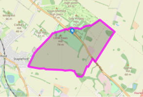
Walk directions
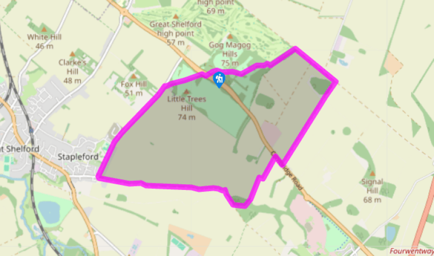
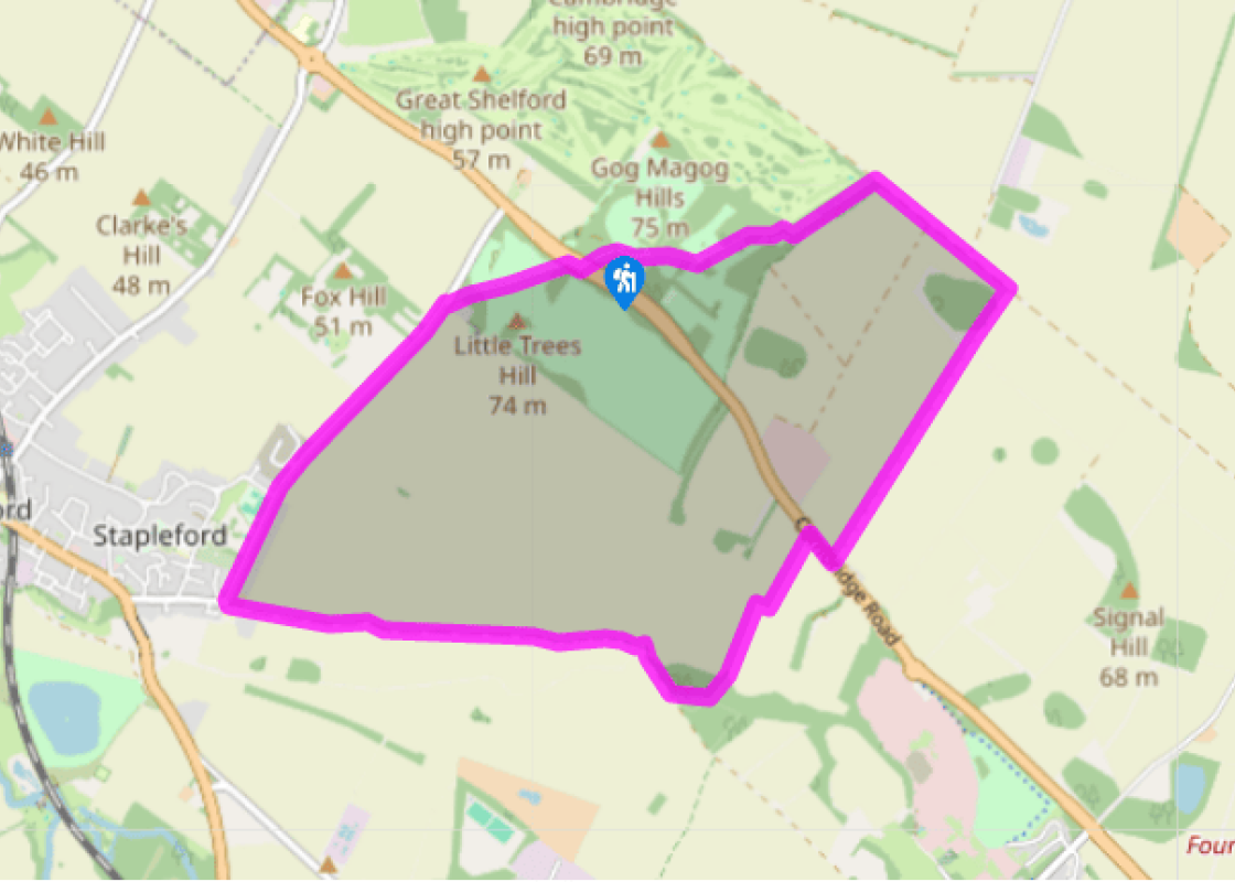
Walk out of the car park and cross the road very carefully, via the wide central reservation. Go through the gate on the far side and turn right for the footpath signposted ‘Magog Down’ and ‘Stapleford’. At the path junction go through the gate ahead and veer half left across the middle of the open downland, which in the spring is covered with yellow cowslips. Continue past a solitary marker post to the far side for a narrow path down through trees to reach Haverhill Road. Turn left and walk the roadside path all the way down to the edge of Stapleford.
Continue past the cricket green and houses until the right bend into Bury Road, by the entrance to Stapleford Granary. Go left on the wide track past Bury Farm, following it out beside, then across wide open fields. At the far end go right to cross a footbridge over the River Granta, next to a shallow ford, with mounting blocks for horse riders on both banks.
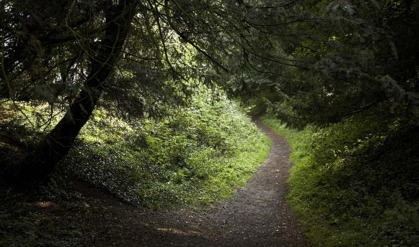
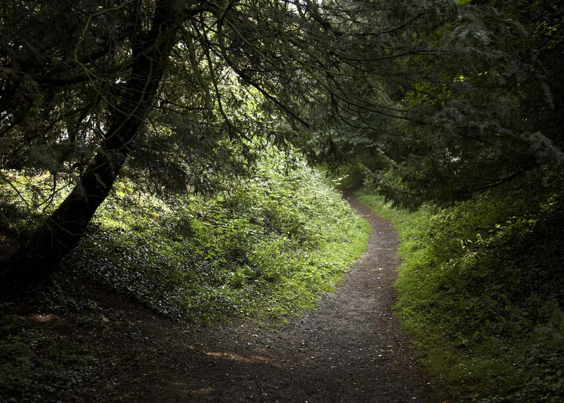
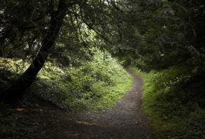
Continue on the track beside woodland and in 200yds (183m) turn left via a metal kissing gate for a path through the trees. At a path junction, with open pasture away to your right, turn left on the waymarked public footpath through the plantation. At the far side go ahead to cross a long footbridge, then walk up the left side of a large field until you eventually reach the main road.
Turn right and walk along the verge for 150yds (137m), then cross carefully for a wide, concrete track between the hedges of houses. Beyond a metal gate the route soon becomes a peaceful green lane, known as Mile Road, and climbs directly and gently up towards Copley Hill.
At the junction at the far end turn left on to the Roman Road, which you won’t be surprised to find is a dead straight route through the gently undulating Cambridgeshire countryside. After 0.25 miles (400m) go left at a signpost for ‘Wandlebury Ring & Cambridge’ through a kissing gate. Follow the path through a wide strip of woodland back into the Country Park.
At the far end go right by a house, then follow the route to a fork. Go left, indicated to the car park, and after passing open fields bear right at another junction on the main track past the picnic area and games field. At the far end turn right to visit the information centre and toilets, or left to return to the car park.
Wandlebury Country Park is located just to the southeast of Cambridge and is open daily from dawn to dusk. The 110-acre (44.5ha) site is made up of woods and chalk grassland, criss-crossed with paths and inviting open green spaces, which make it popular with families and groups. From marching... Romans to galloping stallions Human activity at Wandlebury goes back a long way, however. The hilltop is ringed by the grassy banks of a 5th-century Iron Age hill-fort. Two large circular ramparts are separated by a ditch and in the centre is a large space almost 0.25 miles (400m) wide that was probably a key defensive position for the local tribes. In later centuries there is evidence of Roman activity on the site, which is not surprising given that a Roman road passes close by (you follow some of it on this walk). It runs for about 10 miles (16.1km) from Cambridge into Suffolk, but has in fact been traced as far as Sible Hedingham in Essex one way and the Roman town and fort at Godmanchester the other way. In the late 1600s stables were built inside the old hill-fort for King James II and Wandlebury became an important centre for training racehorses. It was acquired by Francis, 2nd Earl of Godolphin, and although the mansion built for him was later demolished, some of the stable blocks remain, plus the grave of a horse called Godolphin Arabian, probably the most famous Arabian stallion brought to England at that time and believed to be the ancestor of many of today’s thoroughbred racehorses. It died in 1753 at the age of 29. The Gog Magog Hills Wandlebury sits among the oddly named Gog Magog Hills, supposedly named after Gog and Magog, which appear in both the Old Testament and the Koran but rather confusingly sometimes refer to individuals (Magog was a grandson of Noah, for instance), peoples and even whole regions. Their names are particularly associated with various prophecies of impending conflict and war – quite at odds with the peaceful green setting at Wandlebury. Protecting the past, present and future Wandlebury Country Park is owned and managed by an organisation called Cambridge Past, Present & Future. Formed in 1928 as the Cambridge Preservation Society, it’s a registered charity set up to protect and manage green spaces and historic buildings in and around the city, as well as influence planning developments and deliver environmental education. Their other properties include the Chapel of St Mary Magdalene, known as the Leper Chapel and located off the Newmarket Road, and Coton Countryside Reserve, west of the city. For further details visit the information foyer in the former stable buildings at Wandlebury
Much of the fenland around the Wash has been drained of its marshes and reclaimed as highly productive farmland. Further north, the coastline, with its sandy beaches, has been developed to accommodate the holiday industry, with caravans, campsites and the usual seaside paraphernalia.
"A hilltop near Cambridge once echoed to the sound of Iron Age tribesmen, Roman soldiers and Arabian horses"
Walk details
3hrs
Difficulty:
Medium
Gradient:
Moderate
Distance:
6.5 miles (10.1kms)
Ascent:
311ft (95m)
Walk directions
Walk out of the car park and cross the road very carefully, via the wide central reservation. Go through the gate on the far side and turn right for the footpath signposted ‘Magog Down’ and ‘Stapleford’. At the path junction go through the gate ahead and veer half left across the middle of the open downland, which in the spring is covered with yellow cowslips. Continue past a solitary marker post to the far side for a narrow path down through trees to reach Haverhill Road. Turn left and walk the roadside path all the way down to the edge of Stapleford.
1 of 6
Continue past the cricket green and houses until the right bend into Bury Road, by the entrance to Stapleford Granary. Go left on the wide track past Bury Farm, following it out beside, then across wide open fields. At the far end go right to cross a footbridge over the River Granta, next to a shallow ford, with mounting blocks for horse riders on both banks.
2 of 6
Continue on the track beside woodland and in 200yds (183m) turn left via a metal kissing gate for a path through the trees. At a path junction, with open pasture away to your right, turn left on the waymarked public footpath through the plantation. At the far side go ahead to cross a long footbridge, then walk up the left side of a large field until you eventually reach the main road.
3 of 6
Turn right and walk along the verge for 150yds (137m), then cross carefully for a wide, concrete track between the hedges of houses. Beyond a metal gate the route soon becomes a peaceful green lane, known as Mile Road, and climbs directly and gently up towards Copley Hill.
4 of 6
At the junction at the far end turn left on to the Roman Road, which you won’t be surprised to find is a dead straight route through the gently undulating Cambridgeshire countryside. After 0.25 miles (400m) go left at a signpost for ‘Wandlebury Ring & Cambridge’ through a kissing gate. Follow the path through a wide strip of woodland back into the Country Park.
5 of 6
At the far end go right by a house, then follow the route to a fork. Go left, indicated to the car park, and after passing open fields bear right at another junction on the main track past the picnic area and games field. At the far end turn right to visit the information centre and toilets, or left to return to the car park.
Wandlebury Country Park is located just to the southeast of Cambridge and is open daily from dawn to dusk. The 110-acre (44.5ha) site is made up of woods and chalk grassland, criss-crossed with paths and inviting open green spaces, which make it popular with families and groups. From marching... Romans to galloping stallions Human activity at Wandlebury goes back a long way, however. The hilltop is ringed by the grassy banks of a 5th-century Iron Age hill-fort. Two large circular ramparts are separated by a ditch and in the centre is a large space almost 0.25 miles (400m) wide that was probably a key defensive position for the local tribes. In later centuries there is evidence of Roman activity on the site, which is not surprising given that a Roman road passes close by (you follow some of it on this walk). It runs for about 10 miles (16.1km) from Cambridge into Suffolk, but has in fact been traced as far as Sible Hedingham in Essex one way and the Roman town and fort at Godmanchester the other way. In the late 1600s stables were built inside the old hill-fort for King James II and Wandlebury became an important centre for training racehorses. It was acquired by Francis, 2nd Earl of Godolphin, and although the mansion built for him was later demolished, some of the stable blocks remain, plus the grave of a horse called Godolphin Arabian, probably the most famous Arabian stallion brought to England at that time and believed to be the ancestor of many of today’s thoroughbred racehorses. It died in 1753 at the age of 29. The Gog Magog Hills Wandlebury sits among the oddly named Gog Magog Hills, supposedly named after Gog and Magog, which appear in both the Old Testament and the Koran but rather confusingly sometimes refer to individuals (Magog was a grandson of Noah, for instance), peoples and even whole regions. Their names are particularly associated with various prophecies of impending conflict and war – quite at odds with the peaceful green setting at Wandlebury. Protecting the past, present and future Wandlebury Country Park is owned and managed by an organisation called Cambridge Past, Present & Future. Formed in 1928 as the Cambridge Preservation Society, it’s a registered charity set up to protect and manage green spaces and historic buildings in and around the city, as well as influence planning developments and deliver environmental education. Their other properties include the Chapel of St Mary Magdalene, known as the Leper Chapel and located off the Newmarket Road, and Coton Countryside Reserve, west of the city. For further details visit the information foyer in the former stable buildings at Wandlebury
Much of the fenland around the Wash has been drained of its marshes and reclaimed as highly productive farmland. Further north, the coastline, with its sandy beaches, has been developed to accommodate the holiday industry, with caravans, campsites and the usual seaside paraphernalia.