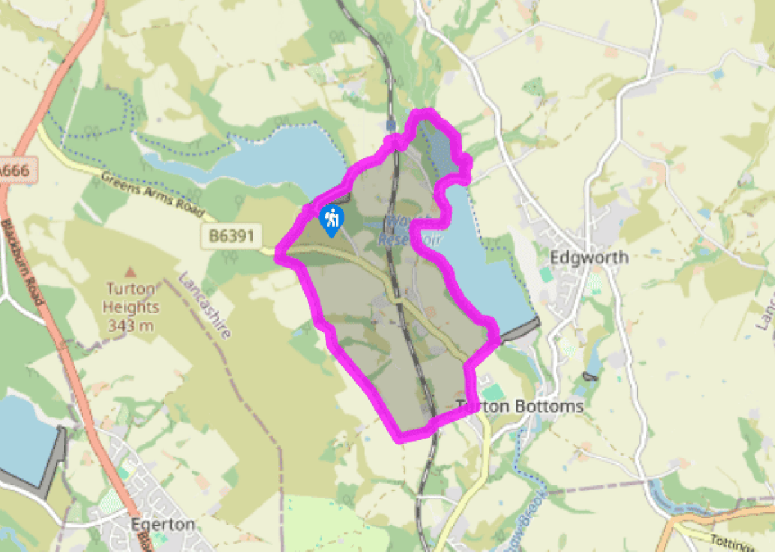
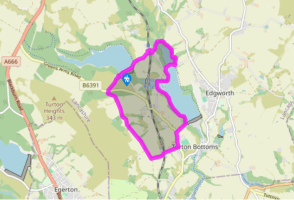
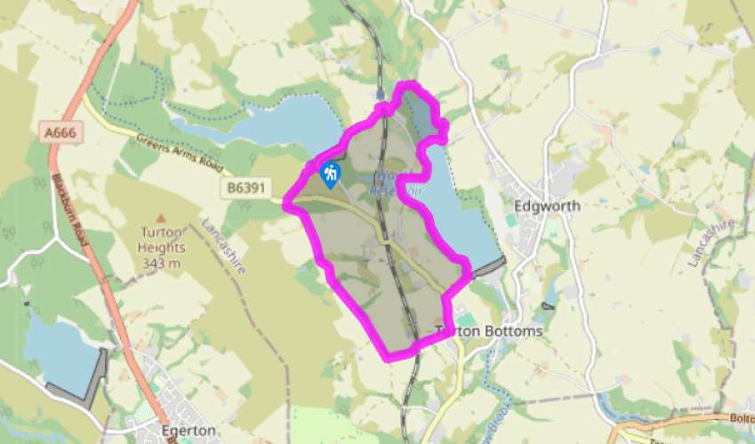
Wayoh and Entwistle

To moorland, then around reservoirs that are havens for wildlife.

NEAREST LOCATION

Entwistle

RECOMMENDED BY
DISTANCE

4.5 miles (7.2kms)

ASCENT
525ft (160m)
TIME
1hr 45min
GRADIENT
DIFFICULTY
Easy
STARTING POINT
SD721172

About the walk

Lakes are not a feature of the Pennines, but there's no shortage of reservoirs tucked among the innumerable valleys that cleave the moors. Until the 19th century, many of the fast-flowing streams were harnessed to power small mills used for grinding grain, textile manufacture, papermaking and a host of other processes. Weirs and small dams helped regulate the water, but summer drought and winter ice often disrupted production. With the move to the factory system, a more reliable source of power was needed, and full-scale dams were developed, converting narrow, deep valleys into sizeable reservoirs that could sustain mills throughout the year. Reservoirs for drinking water were constructed too, and often these followed on from industrial needs as the population of towns increased.

Three dams

The three dams along the Bradshaw valley were built over 150 years, the oldest being for the Turton and Entwistle Reservoir, opened in 1832. Rising 108ft (33m) from the valley floor, when built, it was the highest dam in Britain. The Wayoh Dam followed some 40 years later, and with a capacity now of over 500 million gallons (following enlargement in 1962), is over 60 times larger than Turton. Although both were originally built to serve the town's mills, they now yield around half of Bolton's drinking water, processed in a treatment plant below the Wayoh Dam. Jumbles, the third reservoir was opened in 1971.

Local industry

At one time, the valley supported several small mills. One was flooded beneath the Wayoh Reservoir and another, by the former station at Chapeltown, has only recently been demolished to make way for housing after standing derelict for many years. Even before then, the valley prospered with several farms or 'folds' dotting the hillside, whose occupants supplemented their income by home weaving. There are fine examples of period houses lining the street in Chapeltown and the pub is named for Humphrey Chetham, who owned Turton Tower. Born the son of a Manchester merchant in 1580, he traded in cloth and became immensely wealthy. On his death he left money for a school and library, today the Chetham's School of Music and Chetham's Library, the oldest public library in the country.

Nature reserve

Today Jumbles is the focus of a country park, while the shores surrounding the upper reservoirs are popular with walkers and birders, since the waters attract many wildfowl. Much of the land surrounding Wayoh is a nature reserve, where you will find a multitude of woodland flowers. Look out for hemp agrimony, recognised by its rough-edged, spear-shaped leaves and clusters of tiny pink flowers, and lesser celandine, which has yellow flowers and fleshy heart-shaped leaves.

Walk directions

Leave the far right corner of the car park along a climbing path beside a wooded clough. At the top, cross the car park's access drive and continue across rough grazing to the main road. Directly opposite, a short path leads to the Witton Weavers Way. Follow the track left, eventually passing Clough House Farm. Carry on for a further 0.25 miles (400m) to reach a crossing footpath.

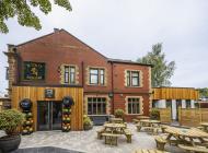
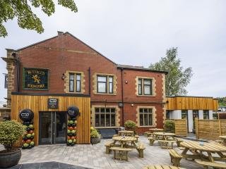
Through the gate on the left, head down into the valley, emerging beside the former Turton and Edgeworth railway station. The station closed in 1961, although the line still carries passenger trains between Manchester and Clitheroe. Go over the level crossing, but at a fork lower down, bear off left on a gravel track to emerge in Chapeltown beside the 18th-century Chetham Arms. Turn left through the village, passing the old school house and village cross. At the far end of the village, swing right along Embankment Road. Where it forks, keep ahead beside iron gates to the Wayoh Reservoir.

Wander onto the dam to see the elegant outlet tower and enjoy a view down the valley, but return to follow a woodland path above the western shore. After 0.5 miles (800m), branch right across a causeway dam, from which there is a view to an impressive viaduct carrying the railway. Swing right on the far bank, rounding a stubby peninsula and shortly climbing out to a road. To the right, it drops across another causeway.

At the far side, go left to continue above the wooded shore. After winding around a small inlet, the path enters the twisted carr woodland crowding the head of the lake. In early spring, the understorey is rich in wild flowers, with lesser celandine, hemp agrimony, spurge and bluebell among those you might see. Veering left, cross two bridges, immediately beyond which the path splits. Take the branch ahead, passing right of a bench seat to then climb left among the trees. Through a gate at the top, a contained path leads between fields to a lane.

Climbing to the right, swing over a railway bridge to the Strawbury Duck. Turn left in front of the pub and follow the ongoing track past railway cottages. Keep going beyond more houses and then straight on past a junction, descending to cross the dam retaining the Turton and Entwistle Reservoir. At a fork on the far side, bear left past a car park. As the lane rises away, leave on the bend, climbing steps to the right that lead back to the Batridge Barn car park.

Additional information

Mostly on good tracks

Rough pasture on edge of moors, wooded watersides

Reasonable scope for dogs to run free around reservoirs

OS Explorer 287 West Pennine Moors

Batridge Barn pay-and-display car park

Nearest at Jumbles Country Park, 3 miles (4.8km) away

Been on this walk?

Send us photos or a comment about this route.

Know a good walk?

Share your route with us.

Walking in safety

Read our tips to look after yourself and the environment when following this walk.

Find out more

About the area

Discover Lancashire

Lancashire was at the centre of the British cotton industry in the 19th century, which lead to the urbanization of great tracts of the area. The cotton boom came and went, but the industrial profile remains. Lancashire’s resorts, Blackpool, Southport and Morecambe Bay, were originally developed to meet the leisure needs of the cotton mill town workers. Blackpool is the biggest and brashest, celebrated for it tower, miles of promenade, and the coloured light ‘illuminations’. Amusements are taken very seriously here, day and night, and visitors can be entertained in a thousand different ways.

The former county town, Lancaster, boasts one of the younger English universities, dating from 1964. Other towns built up to accommodate the mill-workers with back-to-back terraced houses, are Burnley, Blackburn, Rochdale and Accrington. To get out of town, you can head for the Pennines, the ‘backbone of England’, a series of hills stretching from the Peak District National Park to the Scottish borders. To the north of the country is the Forest of Bowland, which despite its name is fairly open country, high up, with great views.