"Exploring some unusually expansive Shropshire countryside"
Walk directions
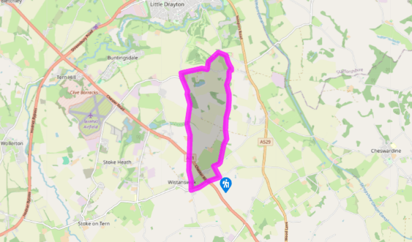
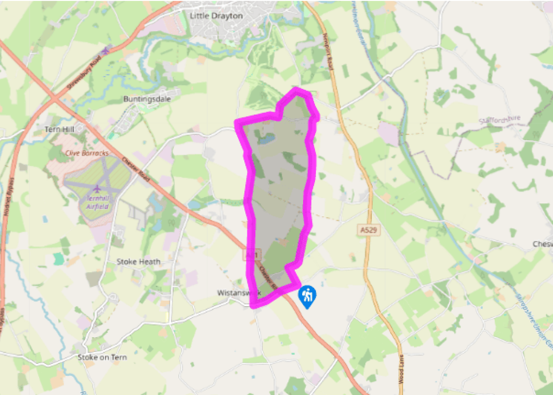
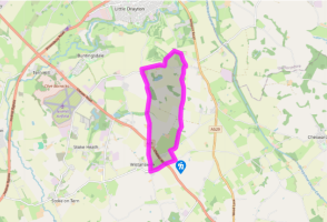
Go through a gate with a footpath sign at the west end of the lay-by, up a field to a hedge-corner. Continue with the hedge on your left. Cross a stile to a road and turn right, passing the houses of Crickmery Bank. After 100yds (91m) there’s a footpath sign on the left, with a gap in the hedge just to its right.
Cross a field to a stile almost hidden in trees under a power line pole (the third from the road). Follow the fence to another stile, cross and go diagonally to the far corner of the field. Cross a stile and join a track. Bear left, then go straight ahead, passing right of a white house, to a stile
Bear slightly left to another stile, and continue in the same line towards a stile between two gates left of a tall oak. Walk up the slope, heading towards the left-most trees on the skyline. Reaching the top, you’ll see two gates: go through the left-hand one and along the hedge
Where the hedge turns away, go straight ahead across the large field to a gate and stile. Continue ahead towards the right side of a clump of trees. (Theoretically, the right of way goes straight through, but vegetation and pools make it impassable). Keep the trees on your left, then bear right to a gate and stile.
Go straight ahead, pass farm buildings and join a lane. Turn right, pass a bungalow, then go left at a footpath sign. Follow the left-hand hedge then continue, following a furrow where a hedge used to be. A short green track leads to Sandy Lane. Turn left.
Where the lane bends right, go left on a track. At another bridleway junction, go slightly left down a beautiful sunken track. Follow this and emerge onto another lane. Turn right then left at a T-junction. As the road bends right, go straight ahead over a stile to a gate. Continue straight across a large field, aiming left of a clump of trees in front of a larger wood.
Cross a stile and continue alongside the wood, then straight ahead to the point where a hedge on your left meets a track. Go a few paces left then cross another field to trees in a dip, in line with farm buildings, and The Wrekin beyond. Find a stile left of the trees, then bear left to another stile. Aim left of trees to the left of the farm, to find a way-mark post. Follow the edge of the trees to a stile and continue straight ahead over several more to the A41.
Cross into a lane. Walk to a crossroads and straight across into Chapel Bank. Pass the Wistanswick Institute and United Reformed Church then turn left. Walk to the A41 and go straight across (signed Goldstone, Cheswardine). Walk along here to the lay-by.
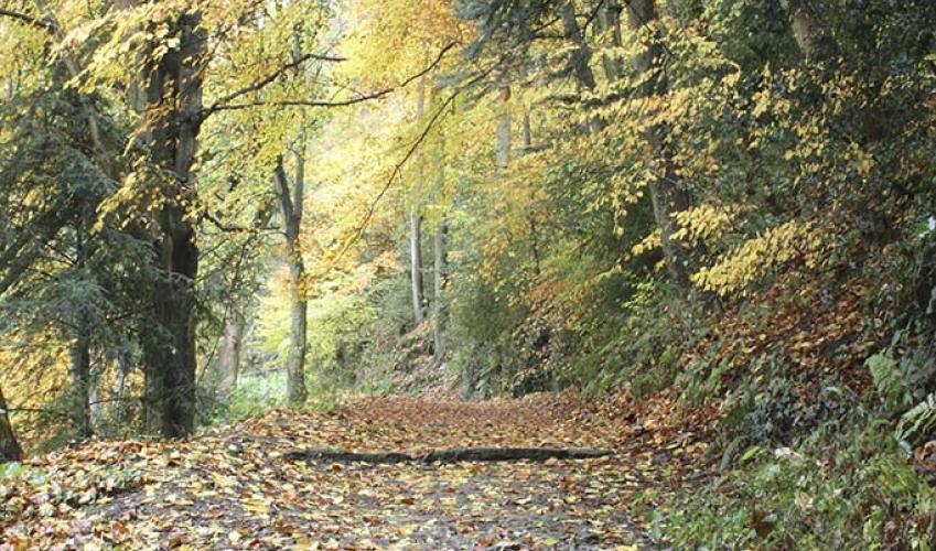
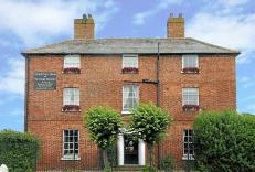
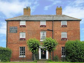
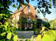
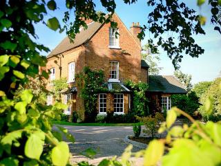
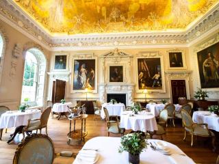
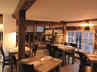
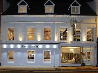
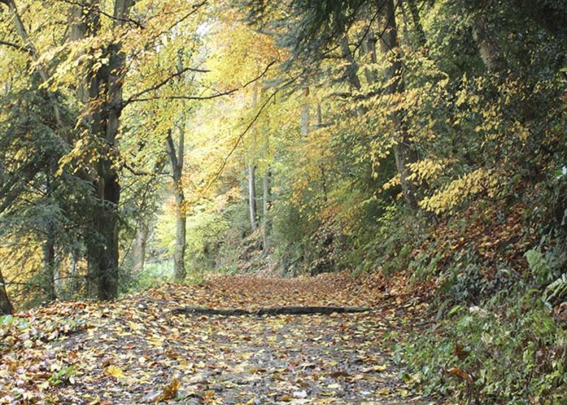
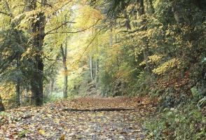
There’s an openness about this walk which is unusual in lowland Shropshire. Partly this is due to the large size of many of the fields the walk crosses, where old hedgerows have been grubbed out to allow cultivation on a larger scale. For instance, what is now a single field, south of the track... which you cross between Points 7 and 8, is shown on maps of the late 19th century as no fewer than eight. But it’s not all ‘grain prairies’, and the openness is also due to the fact that the walk crosses a couple of gentle ridges. You may barely notice the gradients but you can’t fail to notice the way the views open out on the rises. There are also some more enclosed, intimate passages on the walk, never more so than on the delightful – but all too short – bridleway that takes the return leg as you turn off Sandy Lane. Sunken and tree-shaded, it has all the hallmarks of an ancient track, and it’s a natural continuation of a lane to/from Market Drayton. It’s tempting to wonder if it continued further south, but those Victorian maps don’t show any sign of it and it looks far more likely that the footpaths further west, which you follow a little later in the walk, correspond with an older track. The only village on the walk is Wistanswick, a small place with fewer than 50 houses. It has a small but handsome United Reformed Church, but Church of England worshippers use St Peter’s at Stoke upon Tern, a couple of miles to the west. Much of the walk crosses land historically belonging to Colehurst Manor. This is a Grade II* listed Elizabethan manor house, though the estate’s history stretches back much further. It’s a shame the walk doesn’t go past it, but the road has become rather too busy for comfort. It had become partly derelict when acquired by the present owners but has been lovingly restored. It’s not normally open to the public but is a popular wedding venue and also offers luxury accommodation.
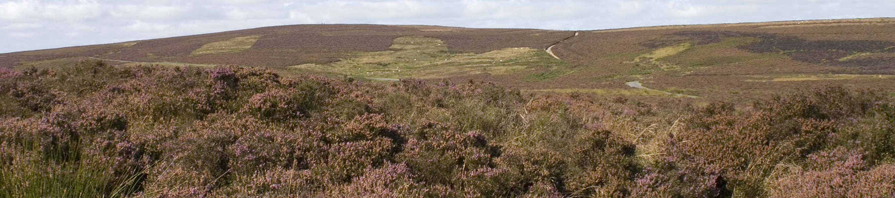
Perhaps nowhere else in England will you find a county so deeply rural and with so much variety as Shropshire. Choose a clear day, climb to the top of The Wrekin, and look down on that ‘land of lost content’ so wistfully evoked by A E Housman.
"Exploring some unusually expansive Shropshire countryside"
Walk details
2hrs 15min
Difficulty:
Easy
Gradient:
Gentle
Distance:
5.5 miles (8.9kms)
Ascent:
256ft (78m)
Walk directions
Go through a gate with a footpath sign at the west end of the lay-by, up a field to a hedge-corner. Continue with the hedge on your left. Cross a stile to a road and turn right, passing the houses of Crickmery Bank. After 100yds (91m) there’s a footpath sign on the left, with a gap in the hedge just to its right.
1 of 8
Cross a field to a stile almost hidden in trees under a power line pole (the third from the road). Follow the fence to another stile, cross and go diagonally to the far corner of the field. Cross a stile and join a track. Bear left, then go straight ahead, passing right of a white house, to a stile
2 of 8
Bear slightly left to another stile, and continue in the same line towards a stile between two gates left of a tall oak. Walk up the slope, heading towards the left-most trees on the skyline. Reaching the top, you’ll see two gates: go through the left-hand one and along the hedge
3 of 8
Where the hedge turns away, go straight ahead across the large field to a gate and stile. Continue ahead towards the right side of a clump of trees. (Theoretically, the right of way goes straight through, but vegetation and pools make it impassable). Keep the trees on your left, then bear right to a gate and stile.
4 of 8
Go straight ahead, pass farm buildings and join a lane. Turn right, pass a bungalow, then go left at a footpath sign. Follow the left-hand hedge then continue, following a furrow where a hedge used to be. A short green track leads to Sandy Lane. Turn left.
5 of 8
Where the lane bends right, go left on a track. At another bridleway junction, go slightly left down a beautiful sunken track. Follow this and emerge onto another lane. Turn right then left at a T-junction. As the road bends right, go straight ahead over a stile to a gate. Continue straight across a large field, aiming left of a clump of trees in front of a larger wood.
6 of 8
Cross a stile and continue alongside the wood, then straight ahead to the point where a hedge on your left meets a track. Go a few paces left then cross another field to trees in a dip, in line with farm buildings, and The Wrekin beyond. Find a stile left of the trees, then bear left to another stile. Aim left of trees to the left of the farm, to find a way-mark post. Follow the edge of the trees to a stile and continue straight ahead over several more to the A41.
7 of 8
Cross into a lane. Walk to a crossroads and straight across into Chapel Bank. Pass the Wistanswick Institute and United Reformed Church then turn left. Walk to the A41 and go straight across (signed Goldstone, Cheswardine). Walk along here to the lay-by.
There’s an openness about this walk which is unusual in lowland Shropshire. Partly this is due to the large size of many of the fields the walk crosses, where old hedgerows have been grubbed out to allow cultivation on a larger scale. For instance, what is now a single field, south of the track... which you cross between Points 7 and 8, is shown on maps of the late 19th century as no fewer than eight. But it’s not all ‘grain prairies’, and the openness is also due to the fact that the walk crosses a couple of gentle ridges. You may barely notice the gradients but you can’t fail to notice the way the views open out on the rises. There are also some more enclosed, intimate passages on the walk, never more so than on the delightful – but all too short – bridleway that takes the return leg as you turn off Sandy Lane. Sunken and tree-shaded, it has all the hallmarks of an ancient track, and it’s a natural continuation of a lane to/from Market Drayton. It’s tempting to wonder if it continued further south, but those Victorian maps don’t show any sign of it and it looks far more likely that the footpaths further west, which you follow a little later in the walk, correspond with an older track. The only village on the walk is Wistanswick, a small place with fewer than 50 houses. It has a small but handsome United Reformed Church, but Church of England worshippers use St Peter’s at Stoke upon Tern, a couple of miles to the west. Much of the walk crosses land historically belonging to Colehurst Manor. This is a Grade II* listed Elizabethan manor house, though the estate’s history stretches back much further. It’s a shame the walk doesn’t go past it, but the road has become rather too busy for comfort. It had become partly derelict when acquired by the present owners but has been lovingly restored. It’s not normally open to the public but is a popular wedding venue and also offers luxury accommodation.
Perhaps nowhere else in England will you find a county so deeply rural and with so much variety as Shropshire. Choose a clear day, climb to the top of The Wrekin, and look down on that ‘land of lost content’ so wistfully evoked by A E Housman.