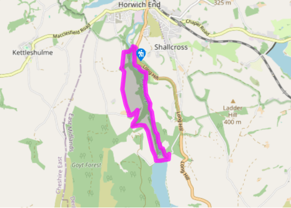
"Human influences have had a dramatic effect on the Goyt Valley, as this walk of two halves shows."
Walk directions
From the lay-by follow the track steeply downhill. Nearing but not at the bottom go round a sharp bend and take the gated footpath on the left. Follow this route through the woods with the River Goyt below on your right. Continue across a series of wide, gated meadows, now close to the river bank, until you reach a footbridge.
Ignore the bridge and stay on the east bank, carrying on across the open fields. Beyond a gate join a firmer track, and continuing in the same direction go past some woodland until eventually you reach a cluster of large and unlovely waterworks buildings.
Go left, across the yard, and follow the public footpath up the tarmac drive to the very top. Turn right along the road to reach the small car park by the dam. Here turn right and go along the road across the top of Fernilee Reservoir dam to the far side.
At the junction of routes turn right for a broad, stony track back along the valley, but this time high up on the open western slopes. Continue along this obvious route, ignoring all turnings off, until you reach Knipe Farm.
Stay on the main track as it bends left before the farm then angles down the hillside, avoiding paths off left and right. At the bottom cross Mill Clough and continue up the track to Madscar Farm. Before the farmyard branch left for the steep surfaced lane above the buildings. Keep going beyond the hairpin to reach Overton Hall Farm.
Just before the farm buildings take the wide and sometimes muddy track on your right. Follow this direct and unmade route, called Whiteleas Road, across the pasture and all the way down to Taxal. Go through the gate and along the lane until just before the Church of St James.
Turn right down a steep, surfaced track beside the graveyard. At the bottom take the short path on the left to cross the river by a footbridge. On the far bank go right, then immediately left, for the steep track up to the start.
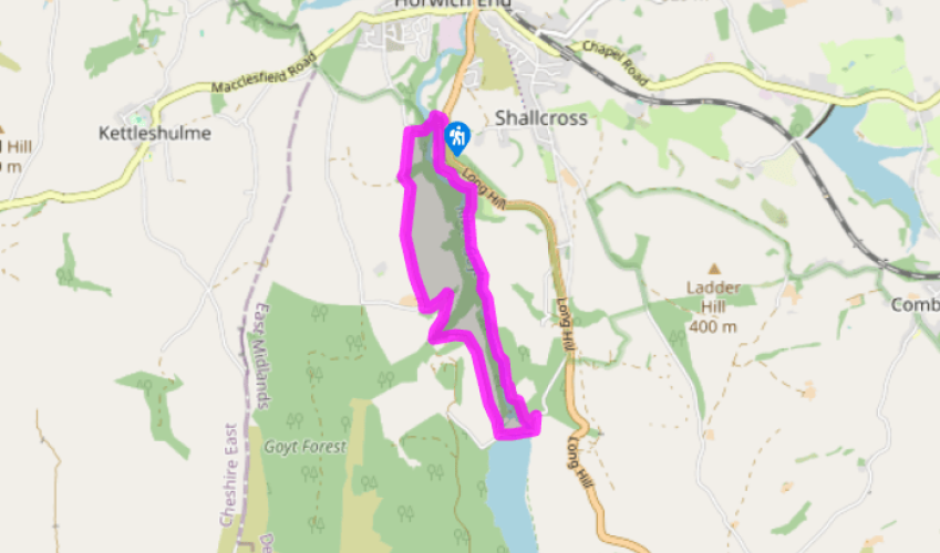
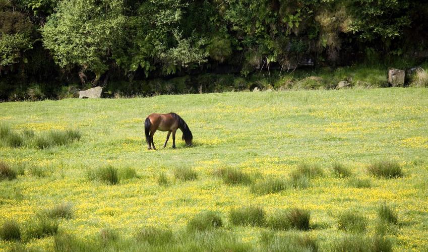
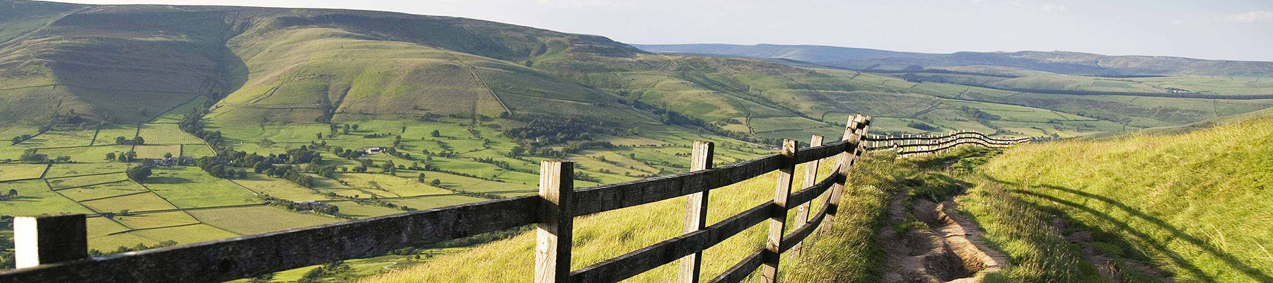
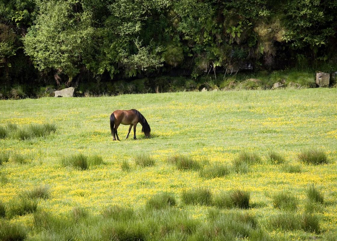
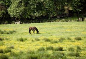
As befits an area of mostly high ground in the centre of England, the rivers of the Peak District drain in many different directions. The Derwent and Dove flow south to join the Trent, on route to the Humber and the North Sea; the River Rivelin heads eastwards to feed the River Don via Sheffield;... while the Dane makes its way through Cheshire to the River Weaver. The principal river in the northwest is the Goyt, flowing initially northwards via Whaley Bridge and New Mills, where it’s joined by the Sett, then on to Stockport to meet the Tame and Etherow to become the River Mersey. A gentle valley The Goyt Valley’s name, from the Old English gota, is now a northern dialect term (sometimes spelled goit) for watercourse or channel. The river itself rises on the high, bare moors of Axe Edge, near the Cat and Fiddle inn southwest of Buxton, but its narrow upper section has been transformed by the building of two reservoirs, Errwood and Fernilee, and the planting of dense conifer woodlands on the western slopes. It gives the valley a harsher, perhaps rather artificial feel, but still with a sense of upland remoteness and element of wildness. This walk covers the area below the reservoirs and presents a broader and gentler valley of more mixed habitat, including wooded lower slopes and enclosed farmland. It’s also a walk of two halves, both giving a different perspective of the valley. The route up to Fernilee Reservoir is along the valley floor, initially on paths through lovely woodland of oak, birch and beech. Soon you are out into riverside meadows, following the open river bank, before climbing up past waterworks buildings to cross the dam. As you do so, look over the reservoir towards the head of the valley and imagine how it might have been before construction began in the 1930s. A number of farms and cottages were demolished to make way for the reservoir; then more again when Erwood was built further up the valley, 30 years later. Return to Taxal You can make a shrewd guess at the likely picture by studying the view the other way, for the route back follows open farm tracks high on the western slopes of the valley, giving sweeping views across the Goyt to the distant moors. As you wander down to the hamlet of Taxal, broadleaved woodland clothes the valley floor, above which is walled pasture and a few ploughed fields, then managed moorland higher up. It’s a reminder, despite National Park designation, of just how much the Peak District landscape has been fashioned by human hands.
The natural features of this central English county range from the modest heights of the Peak District National Park, where Kinder Scout stands at 2,088 ft (636 m), to the depths of its remarkable underground caverns, floodlit to reveal exquisite Blue John stone. Walkers and cyclists will enjoy the High Peak Trail which extends from the Derwent Valley to the limestone plateau near Buxton, and for many, the spectacular scenery is what draws them to the area.
"Human influences have had a dramatic effect on the Goyt Valley, as this walk of two halves shows."
Walk details
2hrs 30min
Difficulty:
Medium
Gradient:
Moderate
Distance:
3.5 miles (5.7kms)
Ascent:
590ft (180m)
Walk directions
From the lay-by follow the track steeply downhill. Nearing but not at the bottom go round a sharp bend and take the gated footpath on the left. Follow this route through the woods with the River Goyt below on your right. Continue across a series of wide, gated meadows, now close to the river bank, until you reach a footbridge.
1 of 7
Ignore the bridge and stay on the east bank, carrying on across the open fields. Beyond a gate join a firmer track, and continuing in the same direction go past some woodland until eventually you reach a cluster of large and unlovely waterworks buildings.
2 of 7
Go left, across the yard, and follow the public footpath up the tarmac drive to the very top. Turn right along the road to reach the small car park by the dam. Here turn right and go along the road across the top of Fernilee Reservoir dam to the far side.
3 of 7
At the junction of routes turn right for a broad, stony track back along the valley, but this time high up on the open western slopes. Continue along this obvious route, ignoring all turnings off, until you reach Knipe Farm.
4 of 7
Stay on the main track as it bends left before the farm then angles down the hillside, avoiding paths off left and right. At the bottom cross Mill Clough and continue up the track to Madscar Farm. Before the farmyard branch left for the steep surfaced lane above the buildings. Keep going beyond the hairpin to reach Overton Hall Farm.
5 of 7
Just before the farm buildings take the wide and sometimes muddy track on your right. Follow this direct and unmade route, called Whiteleas Road, across the pasture and all the way down to Taxal. Go through the gate and along the lane until just before the Church of St James.
6 of 7
Turn right down a steep, surfaced track beside the graveyard. At the bottom take the short path on the left to cross the river by a footbridge. On the far bank go right, then immediately left, for the steep track up to the start.
As befits an area of mostly high ground in the centre of England, the rivers of the Peak District drain in many different directions. The Derwent and Dove flow south to join the Trent, on route to the Humber and the North Sea; the River Rivelin heads eastwards to feed the River Don via Sheffield;... while the Dane makes its way through Cheshire to the River Weaver. The principal river in the northwest is the Goyt, flowing initially northwards via Whaley Bridge and New Mills, where it’s joined by the Sett, then on to Stockport to meet the Tame and Etherow to become the River Mersey. A gentle valley The Goyt Valley’s name, from the Old English gota, is now a northern dialect term (sometimes spelled goit) for watercourse or channel. The river itself rises on the high, bare moors of Axe Edge, near the Cat and Fiddle inn southwest of Buxton, but its narrow upper section has been transformed by the building of two reservoirs, Errwood and Fernilee, and the planting of dense conifer woodlands on the western slopes. It gives the valley a harsher, perhaps rather artificial feel, but still with a sense of upland remoteness and element of wildness. This walk covers the area below the reservoirs and presents a broader and gentler valley of more mixed habitat, including wooded lower slopes and enclosed farmland. It’s also a walk of two halves, both giving a different perspective of the valley. The route up to Fernilee Reservoir is along the valley floor, initially on paths through lovely woodland of oak, birch and beech. Soon you are out into riverside meadows, following the open river bank, before climbing up past waterworks buildings to cross the dam. As you do so, look over the reservoir towards the head of the valley and imagine how it might have been before construction began in the 1930s. A number of farms and cottages were demolished to make way for the reservoir; then more again when Erwood was built further up the valley, 30 years later. Return to Taxal You can make a shrewd guess at the likely picture by studying the view the other way, for the route back follows open farm tracks high on the western slopes of the valley, giving sweeping views across the Goyt to the distant moors. As you wander down to the hamlet of Taxal, broadleaved woodland clothes the valley floor, above which is walled pasture and a few ploughed fields, then managed moorland higher up. It’s a reminder, despite National Park designation, of just how much the Peak District landscape has been fashioned by human hands.
The natural features of this central English county range from the modest heights of the Peak District National Park, where Kinder Scout stands at 2,088 ft (636 m), to the depths of its remarkable underground caverns, floodlit to reveal exquisite Blue John stone. Walkers and cyclists will enjoy the High Peak Trail which extends from the Derwent Valley to the limestone plateau near Buxton, and for many, the spectacular scenery is what draws them to the area.