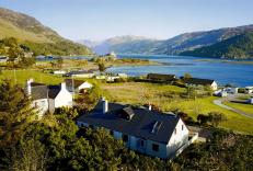
"Deer stalkers' paths lead into the heart of the South Torridon mountains."
Walk directions
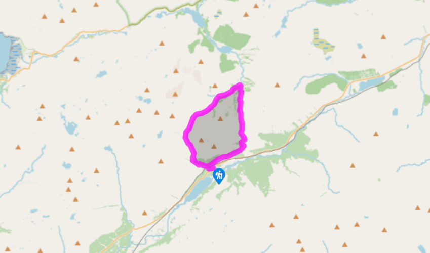
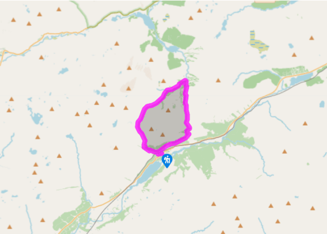
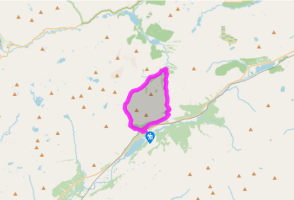
The track to the station runs up behind a red phone box, then turns right to reach the platform end. Cross the line through two gates (marked 'Private Crossing' but a right of way for walkers) and head up the stony track opposite. After 100yds (91m) you reach a junction under low-voltage power lines. Turn left here on a smooth gravel road to a gate through a deer fence. After 600yds (549m), look out for a waymarker post where a path turns down to the left.
This path goes back through the deer fence, then runs up alongside the River Lair. As the slope steepens above the treeline, a short side path on the left gives a view of the gorge. The well-maintained stalkers' path runs over slabs of bare sandstone. The path eases, then finally levels off in the upper valley, Coire Lair, with a view to the high pass at its head, 2 miles (3.2km) away.
At the point where the valley floor levels off, a cairn marks a junction of paths. Bear right here, between two pools. In 110yds (100m) there is a second junction with a tall, well-built cairn. Bear right, on a path that leaves the corrie through a wide, shallow col just 350yds (320m) above. An elegant conical cairn marks a final path junction. Bear right; in a few steps you're heading downhill. The path runs among drumlins and sandstone boulders, slanting down to the right to join the wooded Allt nan Dearcag. The path now runs down alongside this stream; you may notice pale grey quartzite. The path drops to reach a footbridge across a side stream, the Allt Coire Beinne Leithe, with the Easan Geal, White Waterfalls, just above.
At an open bothy hut, a track continues downhill, with the gorge of the Easan Dorcha (Dark Waterfalls) on its right. After a mile (1.6km) there's a stone bridge on the right. Turn across this, on to a track that runs up the wide, open valley to the Coulin Pass at its head. After the pass, the track goes through a gate into plantations, then bends right to slant down the side of Strath Carron.
At a Scottish Rights of Way Society signpost, follow the main track ahead towards Achnashellach. After 0.75 miles (1.2km) you cross a bridge to a mobile phone mast. Fork left, just before a second mast, and descend gently to reach the junction above Achnashellach Station. From 2014, however, this track will sometimes be closed for tree felling. If so, from Point 5, follow signs down a path to the left. It contours left, then drops quite steeply to a path junction with a forest track seen on the right. Turn right to join this track, which leads to Achnashellach Station.
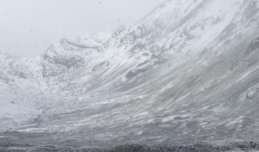
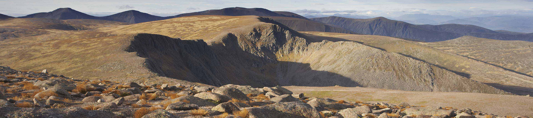
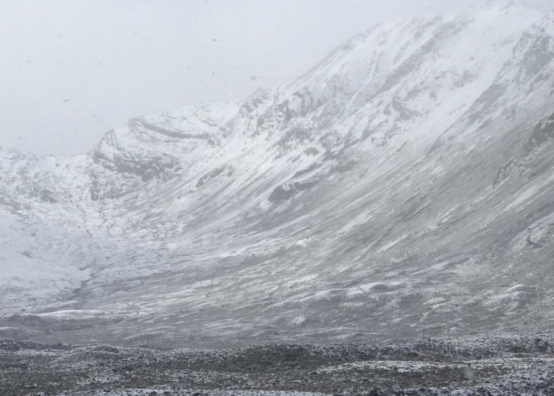
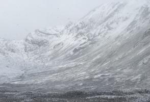
The path winds up from Strath Carron into Coire Lair. The corrie is a fine one, with scattered pines, waterfalls and craggy mountains. The path that takes you there is terraced at the steep places, drained at the level places and avoids the boggy places altogether. Over a century old, it was built... not for walkers but stalkers – or rather for their sturdy Highland ponies bringing down a deer corpse weighing 2cwt (100kg) or more. Recent resurfacing has been done sympathetically in the traditional style. Deer stalking calls on the legs and the intelligence in equal measure, appealing to man's ancient hunting urges. 'The beautiful motions of the deer, his sagacity and the skilful generalship that can alone ensure success in the pursuit of him, keep the mind in a pleasurable state of constant excitement.' Thus said William Scrope Esq, in the book Days of Deerstalking, which presented this sport to the leisured and affluent of 1845. Red bedrock As the path rises above the tree line, you'll notice slabs of Torridonian sandstone underfoot – the ghillies have deliberately routed it over this maintenance-free surface. On the left, Fuar Tholl ('cold hole') is of the same red rock, but ahead on the right, Beinn Liath Mhor is composed of pale Cambrian quartzite. As you top the pass and look east, the hills ahead are rounded, grey and slightly less exciting all the way to the North Sea. As you come to know Scotland you realise that all the way along its northwestern edge there's a zone of rather special hills. Applecross, Torridon, the Great wilderness, Coigach, Inverpolly: these names mean sandstone and quartzite to the geologist, and pure magic to the mountaineer. The rest of the Northern Highlands is made of a speckly grey rock – Moinian schist. The boundary line is the Moine Thrust. It's called a 'thrust' because these grey mountains have been pushed in over the top of the Torridonian red and the Cambrian white. It marks the western limit of the crumple zone from when England crashed into Scotland 400 million years ago. On the face of Beinn Liath Mhor, the arrival of the Moinian has crumpled the quartzite, like a boot landing on a carelessly placed cheese sandwich. A short wander from Point 3 further into the corrie will show this more clearly, and you'll also see the famous Mainreachan Buttress on the north side of Fuar Tholl.
Apart from the Orkneys and the Shetlands, Highland is Scotland’s northernmost county. Probably its most famous feature is the mysterious and evocative Loch Ness, allegedly home to an ancient monster that has embedded itself in the world’s modern mythology, and the region’s tourist industry.
"Deer stalkers' paths lead into the heart of the South Torridon mountains."
Walk details
5hrs
Difficulty:
Medium
Gradient:
Challenging
Distance:
9 miles (14.5kms)
Ascent:
1700ft (518m)
Walk directions
The track to the station runs up behind a red phone box, then turns right to reach the platform end. Cross the line through two gates (marked 'Private Crossing' but a right of way for walkers) and head up the stony track opposite. After 100yds (91m) you reach a junction under low-voltage power lines. Turn left here on a smooth gravel road to a gate through a deer fence. After 600yds (549m), look out for a waymarker post where a path turns down to the left.
1 of 5
This path goes back through the deer fence, then runs up alongside the River Lair. As the slope steepens above the treeline, a short side path on the left gives a view of the gorge. The well-maintained stalkers' path runs over slabs of bare sandstone. The path eases, then finally levels off in the upper valley, Coire Lair, with a view to the high pass at its head, 2 miles (3.2km) away.
2 of 5
At the point where the valley floor levels off, a cairn marks a junction of paths. Bear right here, between two pools. In 110yds (100m) there is a second junction with a tall, well-built cairn. Bear right, on a path that leaves the corrie through a wide, shallow col just 350yds (320m) above. An elegant conical cairn marks a final path junction. Bear right; in a few steps you're heading downhill. The path runs among drumlins and sandstone boulders, slanting down to the right to join the wooded Allt nan Dearcag. The path now runs down alongside this stream; you may notice pale grey quartzite. The path drops to reach a footbridge across a side stream, the Allt Coire Beinne Leithe, with the Easan Geal, White Waterfalls, just above.
3 of 5
At an open bothy hut, a track continues downhill, with the gorge of the Easan Dorcha (Dark Waterfalls) on its right. After a mile (1.6km) there's a stone bridge on the right. Turn across this, on to a track that runs up the wide, open valley to the Coulin Pass at its head. After the pass, the track goes through a gate into plantations, then bends right to slant down the side of Strath Carron.
4 of 5
At a Scottish Rights of Way Society signpost, follow the main track ahead towards Achnashellach. After 0.75 miles (1.2km) you cross a bridge to a mobile phone mast. Fork left, just before a second mast, and descend gently to reach the junction above Achnashellach Station. From 2014, however, this track will sometimes be closed for tree felling. If so, from Point 5, follow signs down a path to the left. It contours left, then drops quite steeply to a path junction with a forest track seen on the right. Turn right to join this track, which leads to Achnashellach Station.
The path winds up from Strath Carron into Coire Lair. The corrie is a fine one, with scattered pines, waterfalls and craggy mountains. The path that takes you there is terraced at the steep places, drained at the level places and avoids the boggy places altogether. Over a century old, it was built... not for walkers but stalkers – or rather for their sturdy Highland ponies bringing down a deer corpse weighing 2cwt (100kg) or more. Recent resurfacing has been done sympathetically in the traditional style. Deer stalking calls on the legs and the intelligence in equal measure, appealing to man's ancient hunting urges. 'The beautiful motions of the deer, his sagacity and the skilful generalship that can alone ensure success in the pursuit of him, keep the mind in a pleasurable state of constant excitement.' Thus said William Scrope Esq, in the book Days of Deerstalking, which presented this sport to the leisured and affluent of 1845. Red bedrock As the path rises above the tree line, you'll notice slabs of Torridonian sandstone underfoot – the ghillies have deliberately routed it over this maintenance-free surface. On the left, Fuar Tholl ('cold hole') is of the same red rock, but ahead on the right, Beinn Liath Mhor is composed of pale Cambrian quartzite. As you top the pass and look east, the hills ahead are rounded, grey and slightly less exciting all the way to the North Sea. As you come to know Scotland you realise that all the way along its northwestern edge there's a zone of rather special hills. Applecross, Torridon, the Great wilderness, Coigach, Inverpolly: these names mean sandstone and quartzite to the geologist, and pure magic to the mountaineer. The rest of the Northern Highlands is made of a speckly grey rock – Moinian schist. The boundary line is the Moine Thrust. It's called a 'thrust' because these grey mountains have been pushed in over the top of the Torridonian red and the Cambrian white. It marks the western limit of the crumple zone from when England crashed into Scotland 400 million years ago. On the face of Beinn Liath Mhor, the arrival of the Moinian has crumpled the quartzite, like a boot landing on a carelessly placed cheese sandwich. A short wander from Point 3 further into the corrie will show this more clearly, and you'll also see the famous Mainreachan Buttress on the north side of Fuar Tholl.
Apart from the Orkneys and the Shetlands, Highland is Scotland’s northernmost county. Probably its most famous feature is the mysterious and evocative Loch Ness, allegedly home to an ancient monster that has embedded itself in the world’s modern mythology, and the region’s tourist industry.