"Above the Great Glen on the road the English built and Bonnie Prince Charlie marched over."
Walk directions
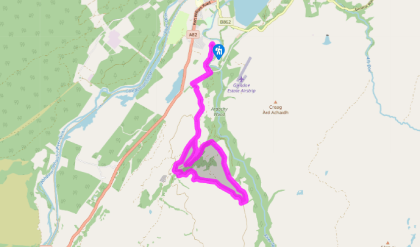
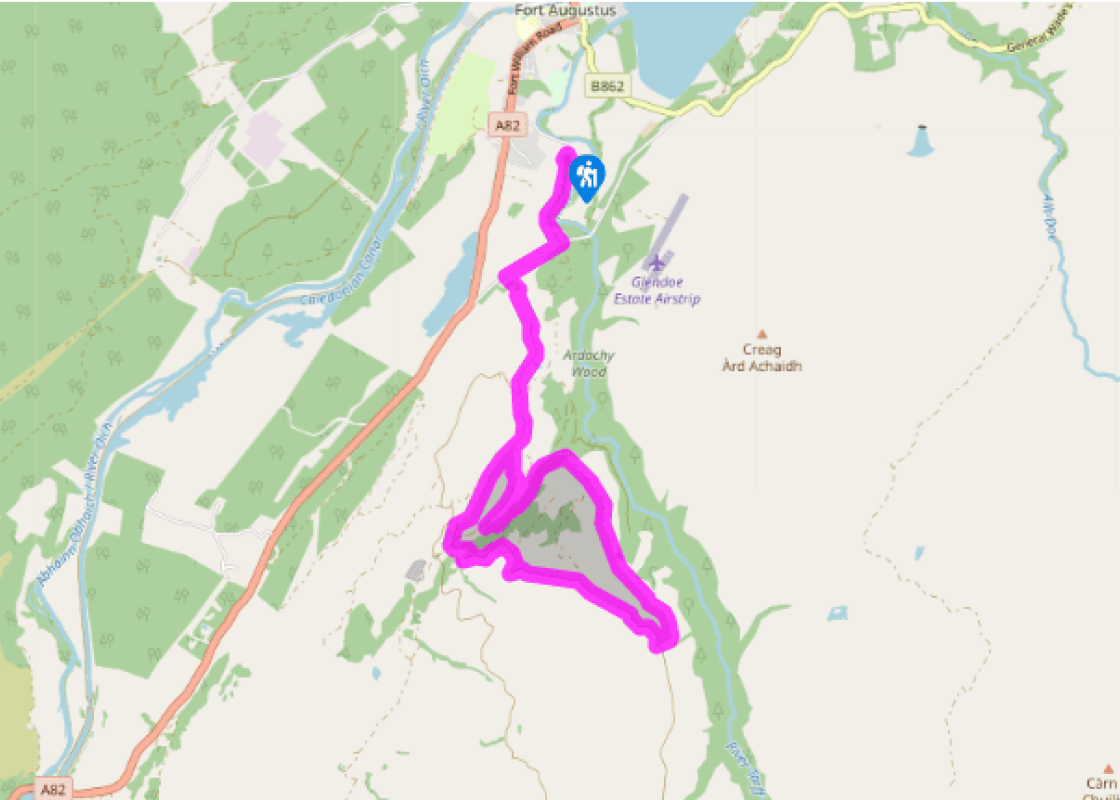
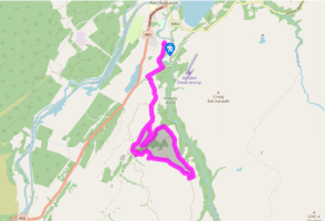
A track leads round to the left of the burial ground to meet a minor road. Turn right for about 550yds (503m) to the foot of a path just to the left of a driveway and signed as the Corrieyairack Pass. The path runs up between a wall and a stream, to join onto a wide, new gravel track.
Continue uphill on this new track (ignoring an older one on its left leading to the pink-coloured Culachy House). After another 0.25 miles (400m), bear left up a smaller track. Soon a gate leads out onto the open hill. About 350yds (320m) further on, the track passes under high-tension wires. At once take a stony track left across a grassy meadow then dropping towards a stream. Bear left off the track to pass the corner of a deer fence down to the stream. Cross and turn downstream through a tall gate. The track recrosses the stream and runs down its little valley. Bear left up an old grassy track to a sudden view across deep and wooded Glen Tarff.
Turn back right across a high stone bridge to rejoin the previous stony track. It climbs through birch woods then, as a terraced shelf, crosses the high side of Glen Tarff to a gate. Here a side stream forms a wooded re-entrant. Behind a fallen willow tree, a faint, old track runs level in to this and crosses below a narrow waterfall – the former bridge has disappeared.
Contour out across the steep slope to pick up the old track as it runs gently uphill to a gateless gateway in a fence. Turn up the fence to another gateway, 150yds (137m) above. Here turn left for 20yds (18m) to the brink of another stream hollow. (Its delightful Gaelic name – Sidhean Ceum na Goibhre – means 'Fairy Goat-step'.) Don't go into this, but turn uphill alongside it, through pathless bracken, to its top. A deer fence is just above; turn left alongside it to go through a nearby gate, then left beside the fence. When it turns downhill, a green path continues ahead, gently uphill through heather. The path bends right to join the Corrieyairack track just above.
Turn right. The track descends in sweeping curves for 1.25 miles (2km) – ignore a couple of side-tracks on the right. Dropping towards a stream, ignore various new construction tracks (Beauly-Denny Power Line) ahead. The old track crosses the stream, bends right, and forks slightly left, then climbs gently to rejoin the upward route. At the final bend, a stile offers a short cut through (rather than round) the ancient burial ground.
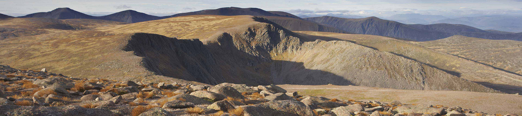
The most striking feature of Scotland's geography is the 2,000ft (610m) deep Great Glen. It runs perfectly straight from Fort William to Inverness as if a giant ploughshare had been dragged across the country. Scotland's San Andreas Around 400 million years ago, the northern part of Scotland... slipped 65 miles (105km) to the left. Looking across from Corrieyairack you'd have seen ground that's now the Island of Mull. The Great Glen represents a tear-fault, similar to the San Andreas Fault in California, but no longer active, so that there isn't going to be any Fort Augustus Earthquake. Where two ground masses slide past each other, the rock where they touch is shattered. Rivers and glaciers have worn away this broken rock to make the striking valley. Wade's ways After the uprising of 1715, General Wade became the military commander of Scotland. He constructed and repaired forts along the Great Glen at Fort William, Fort Augustus and Inverness, as well as at Ruthven on the present A9 and Glenelg. To link them, he built 260 miles (418km) of roads across the Highlands. The most spectacular of these was the one through the Corrieyairack Pass, rising to 2,500ft (762m) to link the Great Glen with the Spey. The construction was little changed since Roman times. Large rocks were jammed together into a firm bed, up to 15ft (4.6m) wide, and then surfaced with smaller stones and gravel packed down. Modern path-builders know that however well you build it, if it's got water running down it, it turns into a stream. Wade paid particular attention to drainage. The 500 soldiers working through the summer of 1731 got a bonus of 6d a day – about £5 in today's money – and celebrated its completion with a barbecue of six oxen. The chieftains worried that the roads would soften their people, making them unfit for raids across rough country. But they soon came to appreciate the convenience. 'If you'd seen these roads before they were made, You'd lift up your hands and bless General Wade.' And when Prince Charles Stuart landed 14 years later, it was the Jacobite army that marched triumphantly across the Corrieyairack. At the Speyside end of the pass, a small and ill-prepared force under General John Cope fled before him into England. And a new Wade rhyme was inserted, temporarily, into the National Anthem itself: 'God grant that Marshal Wade, May by Thy mighty aid, Victory bring, May he sedition hush, and like a torrent rush, Rebellious Scots to crush, God save the King.'
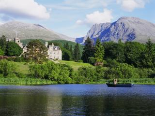
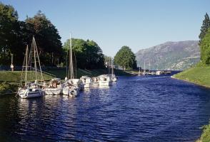
Apart from the Orkneys and the Shetlands, Highland is Scotland’s northernmost county. Probably its most famous feature is the mysterious and evocative Loch Ness, allegedly home to an ancient monster that has embedded itself in the world’s modern mythology, and the region’s tourist industry.
"Above the Great Glen on the road the English built and Bonnie Prince Charlie marched over."
Walk details
4hrs
Difficulty:
Hard
Gradient:
Challenging
Distance:
7.25 miles (11.7kms)
Ascent:
1300ft (396m)
Walk directions
A track leads round to the left of the burial ground to meet a minor road. Turn right for about 550yds (503m) to the foot of a path just to the left of a driveway and signed as the Corrieyairack Pass. The path runs up between a wall and a stream, to join onto a wide, new gravel track.
1 of 5
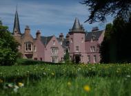
Continue uphill on this new track (ignoring an older one on its left leading to the pink-coloured Culachy House). After another 0.25 miles (400m), bear left up a smaller track. Soon a gate leads out onto the open hill. About 350yds (320m) further on, the track passes under high-tension wires. At once take a stony track left across a grassy meadow then dropping towards a stream. Bear left off the track to pass the corner of a deer fence down to the stream. Cross and turn downstream through a tall gate. The track recrosses the stream and runs down its little valley. Bear left up an old grassy track to a sudden view across deep and wooded Glen Tarff.
2 of 5
Turn back right across a high stone bridge to rejoin the previous stony track. It climbs through birch woods then, as a terraced shelf, crosses the high side of Glen Tarff to a gate. Here a side stream forms a wooded re-entrant. Behind a fallen willow tree, a faint, old track runs level in to this and crosses below a narrow waterfall – the former bridge has disappeared.
3 of 5
Contour out across the steep slope to pick up the old track as it runs gently uphill to a gateless gateway in a fence. Turn up the fence to another gateway, 150yds (137m) above. Here turn left for 20yds (18m) to the brink of another stream hollow. (Its delightful Gaelic name – Sidhean Ceum na Goibhre – means 'Fairy Goat-step'.) Don't go into this, but turn uphill alongside it, through pathless bracken, to its top. A deer fence is just above; turn left alongside it to go through a nearby gate, then left beside the fence. When it turns downhill, a green path continues ahead, gently uphill through heather. The path bends right to join the Corrieyairack track just above.
4 of 5
Turn right. The track descends in sweeping curves for 1.25 miles (2km) – ignore a couple of side-tracks on the right. Dropping towards a stream, ignore various new construction tracks (Beauly-Denny Power Line) ahead. The old track crosses the stream, bends right, and forks slightly left, then climbs gently to rejoin the upward route. At the final bend, a stile offers a short cut through (rather than round) the ancient burial ground.
The most striking feature of Scotland's geography is the 2,000ft (610m) deep Great Glen. It runs perfectly straight from Fort William to Inverness as if a giant ploughshare had been dragged across the country. Scotland's San Andreas Around 400 million years ago, the northern part of Scotland... slipped 65 miles (105km) to the left. Looking across from Corrieyairack you'd have seen ground that's now the Island of Mull. The Great Glen represents a tear-fault, similar to the San Andreas Fault in California, but no longer active, so that there isn't going to be any Fort Augustus Earthquake. Where two ground masses slide past each other, the rock where they touch is shattered. Rivers and glaciers have worn away this broken rock to make the striking valley. Wade's ways After the uprising of 1715, General Wade became the military commander of Scotland. He constructed and repaired forts along the Great Glen at Fort William, Fort Augustus and Inverness, as well as at Ruthven on the present A9 and Glenelg. To link them, he built 260 miles (418km) of roads across the Highlands. The most spectacular of these was the one through the Corrieyairack Pass, rising to 2,500ft (762m) to link the Great Glen with the Spey. The construction was little changed since Roman times. Large rocks were jammed together into a firm bed, up to 15ft (4.6m) wide, and then surfaced with smaller stones and gravel packed down. Modern path-builders know that however well you build it, if it's got water running down it, it turns into a stream. Wade paid particular attention to drainage. The 500 soldiers working through the summer of 1731 got a bonus of 6d a day – about £5 in today's money – and celebrated its completion with a barbecue of six oxen. The chieftains worried that the roads would soften their people, making them unfit for raids across rough country. But they soon came to appreciate the convenience. 'If you'd seen these roads before they were made, You'd lift up your hands and bless General Wade.' And when Prince Charles Stuart landed 14 years later, it was the Jacobite army that marched triumphantly across the Corrieyairack. At the Speyside end of the pass, a small and ill-prepared force under General John Cope fled before him into England. And a new Wade rhyme was inserted, temporarily, into the National Anthem itself: 'God grant that Marshal Wade, May by Thy mighty aid, Victory bring, May he sedition hush, and like a torrent rush, Rebellious Scots to crush, God save the King.'
Apart from the Orkneys and the Shetlands, Highland is Scotland’s northernmost county. Probably its most famous feature is the mysterious and evocative Loch Ness, allegedly home to an ancient monster that has embedded itself in the world’s modern mythology, and the region’s tourist industry.