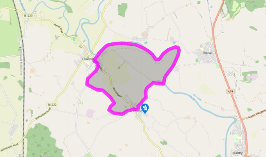
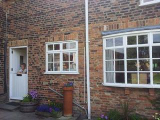
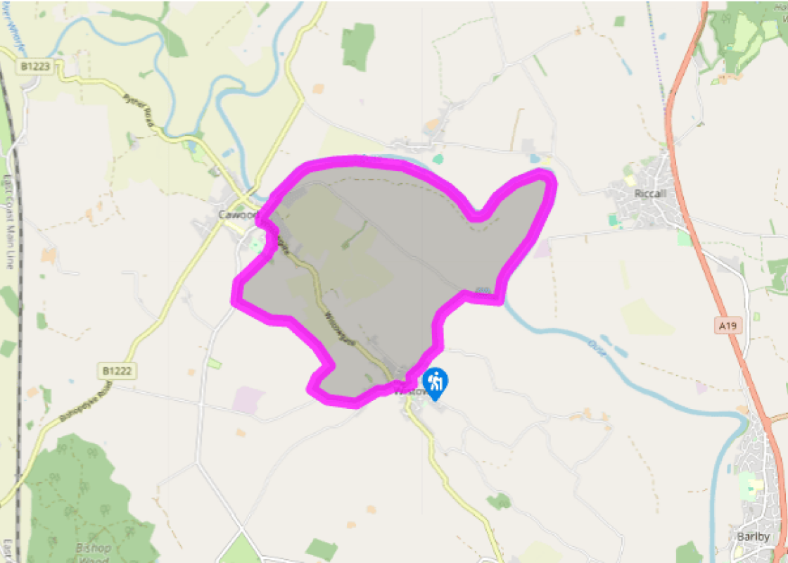
From the parking place by the former railway bridge, walk towards the village, turning right at the T-junction. Bear left past the school and right between two ‘no entry’ signs to pass the church and The Black Swan public house. At the road junction beyond, turn left along Station Road. At the next junction turn right. Where the road bends left, go straight ahead up a track by a footpath sign.
Where the track divides, go right at a yellow waymarker. The path goes half left across the field (standing crops may hide it) to the end of a hedge and crosses a ditch. Go straight ahead with another ditch on your right. A little way down, go over this ditch on a footbridge and turn left along the field edge. After 50yds (46m), go left over another footbridge with a stile at the end. Go straight ahead with, first, a ditch on your right. In the second field, bear slightly left to a metal gate in a hedge. Beyond, the path goes straight towards the red-brick house and then on to a lane.
Turn right, then go left beyond the house, up the field side to cross a footbridge. Turn right and walk down the field edge with the hedge on your right. The path becomes a grassy track and emerges onto a road. Turn right.
Just beyond Park View Farm and Livery, go over a stile on the right and bear left to follow a track that goes to the left of a paddock. Where the track bends right, go straight on, to follow the field egde as it curves right. Near the end of the allotments, go through a hedge gap by playing fields and turn right to a footpath sign. Follow the fenced path to a road. Turn left, and left again at a junction. Go straight on to the road head, turning right beyond the last house to follow a path to the main street. Turn left. At a T-junction, turn right, signed ‘York’. Follow the road past the gatehouse to Cawood Castle.
At the traffic lights turn right and, just before the bridge, go right again, down Old Road. Where the road bends, continue ahead down Water Row to a gate. Do not enter the churchyard but turn left and then right before the gate onto the bank, going left of the church. Walk along the river bank for 3.25 miles (5.3km).
Beyond a brick building with a footbridge to it, turn right at a crossing track, passing a pond. Turn left at the T-junction and follow the road back to the start.
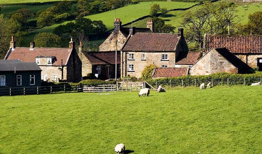
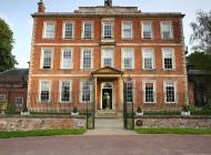
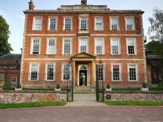
The rich flood plain of the River Ouse provides fertile farming country, where a wide variety of crops are grown on land drained by a network of ditches. It’s part of the Humberhead Levels, an area of more than 2,000 square miles (5,180sq km) designated by Natural England that includes all the... rivers, like the Ouse, that feed into the Humber. Natural England is working with local farmers keep this important landscape as a habitat for wetland species by creating ribbons of habitat alongside the drains, field headlands and wet field corners. Near the start of the walk you are close to the former Wistow Mine, one of four deep mines on the Selby coalfield. It was estimated that there were 2,000 million tonnes of coal under the fields you walk through. Wistow was the first mine to open, in June 1983. Like the other mines, its coal was taken by underground tunnel to the surface at Gascoigne Wood about 5 miles (8km) southwest. At its peak between 1993 and 1994 the coalfield produced 12 million tonnes, but geological problems, low UK coal prices and the loss of subsidy after the mining industry was privatised led to the closure of the mines. Mining ended at Wistow in May 2004. At Cawood Castle the limestone gatehouse and adjoining brick banqueting hall are all that remains of the former seat of the Archbishops of York, on a site given to them by King Athelstan around ad 930. The gatehouse is 15th century, and is now let for holidays by the Landmark Trust. Cawood was home to Cardinal Wolsey, and it was here, in November 1530, that he was arrested for treason against King Henry VIII. It was the nearest Wolsey ever got to York, even though he was its archbishop. He died in Leicester later in the month, saying, ‘If I had served my God as diligently as I did my king, He would not have given me over in my grey hairs.’ As the river bends south towards the end of the walk you are opposite Riccall Landing. This is where the Norwegian fleet of Harald Hardrada, King of Norway, landed in 1066, in its attempt to defeat King Harold Godwinson. Three hundred fearsome Viking ships were sailed or rowed up the Ouse, and after the troops disembarked, they marched to Stamford Bridge. Although superior in numbers, they were defeated by the English army, who then marched south to defeat at the hands of William the Conqueror at the Battle of Hastings. Of the 300 ships in Harald Hardrada’s fleet only two dozen sailed back to Norway.
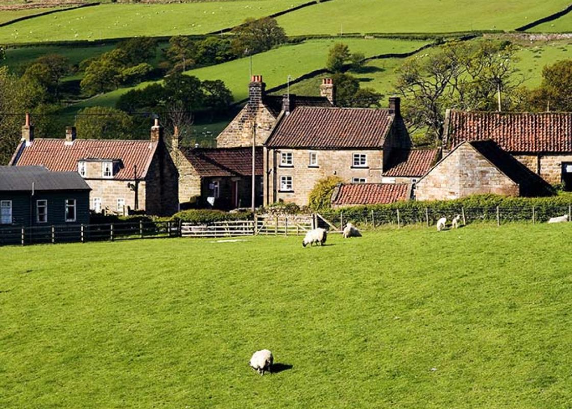
North Yorkshire, with its two National Parks and two designated Areas of Outstanding Natural Beauty, is England’s largest county and one of the most rural. This is prime walking country, from the heather-clad heights of the North York Moors to the limestone country that is so typical of the Yorkshire Dales – a place of contrasts and discoveries, of history and legend.
From the parking place by the former railway bridge, walk towards the village, turning right at the T-junction. Bear left past the school and right between two ‘no entry’ signs to pass the church and The Black Swan public house. At the road junction beyond, turn left along Station Road. At the next junction turn right. Where the road bends left, go straight ahead up a track by a footpath sign.
1 of 6
Where the track divides, go right at a yellow waymarker. The path goes half left across the field (standing crops may hide it) to the end of a hedge and crosses a ditch. Go straight ahead with another ditch on your right. A little way down, go over this ditch on a footbridge and turn left along the field edge. After 50yds (46m), go left over another footbridge with a stile at the end. Go straight ahead with, first, a ditch on your right. In the second field, bear slightly left to a metal gate in a hedge. Beyond, the path goes straight towards the red-brick house and then on to a lane.
2 of 6
Turn right, then go left beyond the house, up the field side to cross a footbridge. Turn right and walk down the field edge with the hedge on your right. The path becomes a grassy track and emerges onto a road. Turn right.
3 of 6
Just beyond Park View Farm and Livery, go over a stile on the right and bear left to follow a track that goes to the left of a paddock. Where the track bends right, go straight on, to follow the field egde as it curves right. Near the end of the allotments, go through a hedge gap by playing fields and turn right to a footpath sign. Follow the fenced path to a road. Turn left, and left again at a junction. Go straight on to the road head, turning right beyond the last house to follow a path to the main street. Turn left. At a T-junction, turn right, signed ‘York’. Follow the road past the gatehouse to Cawood Castle.
4 of 6
At the traffic lights turn right and, just before the bridge, go right again, down Old Road. Where the road bends, continue ahead down Water Row to a gate. Do not enter the churchyard but turn left and then right before the gate onto the bank, going left of the church. Walk along the river bank for 3.25 miles (5.3km).
5 of 6
Beyond a brick building with a footbridge to it, turn right at a crossing track, passing a pond. Turn left at the T-junction and follow the road back to the start.
The rich flood plain of the River Ouse provides fertile farming country, where a wide variety of crops are grown on land drained by a network of ditches. It’s part of the Humberhead Levels, an area of more than 2,000 square miles (5,180sq km) designated by Natural England that includes all the... rivers, like the Ouse, that feed into the Humber. Natural England is working with local farmers keep this important landscape as a habitat for wetland species by creating ribbons of habitat alongside the drains, field headlands and wet field corners. Near the start of the walk you are close to the former Wistow Mine, one of four deep mines on the Selby coalfield. It was estimated that there were 2,000 million tonnes of coal under the fields you walk through. Wistow was the first mine to open, in June 1983. Like the other mines, its coal was taken by underground tunnel to the surface at Gascoigne Wood about 5 miles (8km) southwest. At its peak between 1993 and 1994 the coalfield produced 12 million tonnes, but geological problems, low UK coal prices and the loss of subsidy after the mining industry was privatised led to the closure of the mines. Mining ended at Wistow in May 2004. At Cawood Castle the limestone gatehouse and adjoining brick banqueting hall are all that remains of the former seat of the Archbishops of York, on a site given to them by King Athelstan around ad 930. The gatehouse is 15th century, and is now let for holidays by the Landmark Trust. Cawood was home to Cardinal Wolsey, and it was here, in November 1530, that he was arrested for treason against King Henry VIII. It was the nearest Wolsey ever got to York, even though he was its archbishop. He died in Leicester later in the month, saying, ‘If I had served my God as diligently as I did my king, He would not have given me over in my grey hairs.’ As the river bends south towards the end of the walk you are opposite Riccall Landing. This is where the Norwegian fleet of Harald Hardrada, King of Norway, landed in 1066, in its attempt to defeat King Harold Godwinson. Three hundred fearsome Viking ships were sailed or rowed up the Ouse, and after the troops disembarked, they marched to Stamford Bridge. Although superior in numbers, they were defeated by the English army, who then marched south to defeat at the hands of William the Conqueror at the Battle of Hastings. Of the 300 ships in Harald Hardrada’s fleet only two dozen sailed back to Norway.
North Yorkshire, with its two National Parks and two designated Areas of Outstanding Natural Beauty, is England’s largest county and one of the most rural. This is prime walking country, from the heather-clad heights of the North York Moors to the limestone country that is so typical of the Yorkshire Dales – a place of contrasts and discoveries, of history and legend.