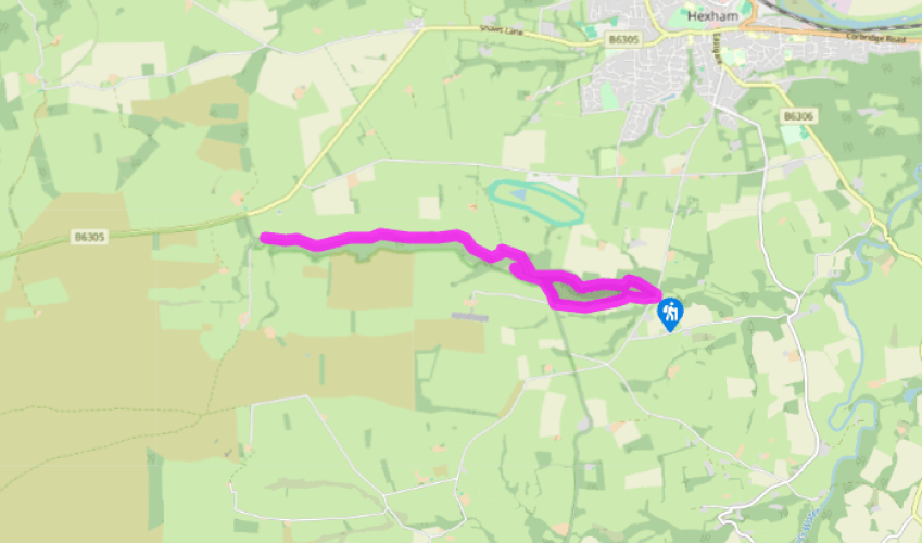
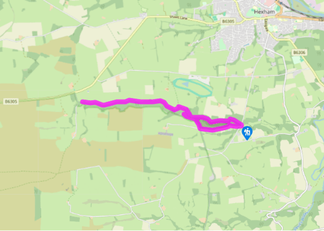
Take the narrow lane out of the village beside the pub, which soon moves away from the river to climb across the hillside. An old windmill stood further up on the right, but cannot be seen from the lane. Passing Shield Green Nurseries, the way levels and occasional breaks in the hedge allow a glimpse across the gash of the valley. Keep going, shortly passing a farm.
Where the lane then swings sharply left, turn right onto a track. An old byway, it drops with increasing steepness into the valley to a ford and footbridge across West Dipton Burn.
On the opposite bank, take the path off left, very soon reaching a fork by an old gatepost. A short detour along the riverside path reveals the wild nature of the bottom of the valley, the trail pushing through lush vegetation between the trees as the craggy sides close in and force the path ever-closer to the stream. It is not long before the path actually disappears into the streambed below the rocky step of a small waterfall. After appreciating the scene, return to the fork and take the other path, which initially climbs steeply through the trees before running more easily along the top.
After almost 0.25 miles (400m), look for a waypost that marks a path branching off to the left. If you miss it, you will very soon reach another junction just before a gate. Both paths combine to run along the rim of the gorge within the fringe of the wood, generally close to the top wall which borders the full length of the valley. The path winds easily on, occasionally crossing the heads of narrow streams that have cut deep grooves into the steep valley side. The way winds on for nearly 2 miles (3.2km), eventually passing a waypost that marks the emergence of a path out of the valley. A little further along the path passes through a break in the wall and then peters out.
Now almost at the head of the valley, it is time to turn back, retracing your steps to the footbridge crossed earlier.
Remain on this bank and follow the path ahead beside the stream. Before long, the valley narrows as a side stream cascades in from the left. Beyond, the path becomes rocky for a short stretch, forced to the water's edge by cliffs. Widening beyond, the trail eventually passes through a gate to continue at the left edge of an overgrown meadow. Re-entering the wood, walk on to a fork and keep left, briefly moving away from the stream. At another fork again bear left, before long crossing a small side stream and then ultimately emerging onto the road beside the bridge at Diptonmill.
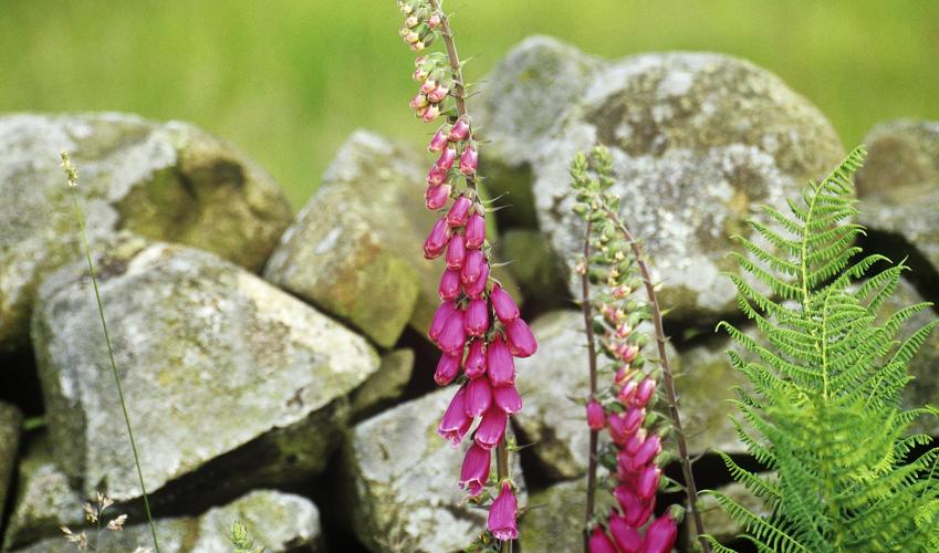
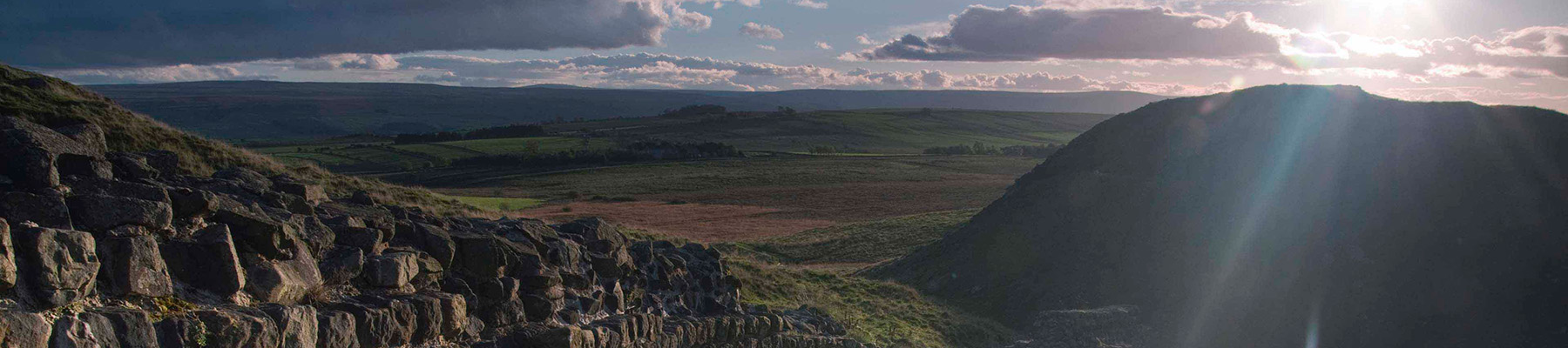
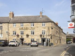
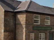
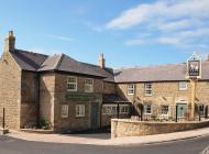
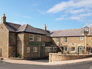
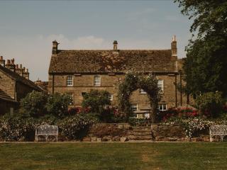
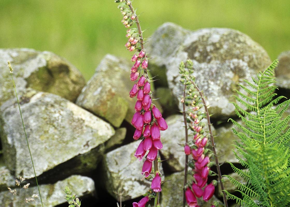
Dipton Burn forms the northern boundary of one England's forgotten counties, Hexhamshire. Created in the early 12th century in a bid to curb the power of the Prince Bishops, it lasted until 1572 when it was absorbed within Northumberland. A wild and rugged gorge Waters from the rolling uplands... south of the River South Tyne come together as a fast-flowing stream that drops dramatically through a deep and densely wooded gorge. The narrow dene runs for 3 miles (4.8km) to Diptonmill, before gradually opening to join Devil's Water, further to the east. The woodland in the upper reaches of the valley has an almost jungle-like character, with trees and saplings shading a dense undergrowth. The valley sides are everywhere steep with cliffs often crowding the burn, which tumbles over dark boulders and shallow falls. The map confidently depicts a path along the base of the valley, but unless you don't mind pushing through thick vegetation, facing the odd scramble and getting wet feet, the route is best left alone. The path along the northern rim, however, suffers no such problems and although a 'there and back' walk, reveals the character of this wonderful little gorge. An old mill The walk begins at the foot of the gorge at Diptonmill, where the pub is an old drovers' inn dating back to the 17th century, the only one left in the area. It stands by the site of a watermill, which was gutted by a blaze in 1783, an ever present danger in mills, where heat generated by the friction of the millstones or a spark from the drying kiln could easily start a fire in the dusty atmosphere. The Wars of the Roses Hidden deep in the valley is the Queen's Cave, reputedly used as a refuge by Margaret of Anjou, wife of Henry VI, after her husband's forces were routed by the Yorkists at the Battle of Hexham in 1464. Henry, perhaps wisely, stayed away from the battle, and Margaret, who wanted her husband back on the throne so that her son could succeed, was in reality nowhere near at the time. But fact shouldn't mar a good tale and local legend relates how she and the young Prince of Wales fled from the battle. Margaret didn't get far before her horse shed a shoe – maps mark the spot as Queen's Letch – an Old English word meaning boggy meadow. Fearful of capture, she came upon a sympathetic brigand who, it is said, led them into the gorge and hid them in his cave until the hue and cry died down.
If it’s history you’re after, there’s heaps of it in Northumberland. On Hadrian’s Wall you can imagine scarlet-cloaked Roman legionaries keeping watch for painted Pictish warriors while cursing the English weather and dreaming of home.
Take the narrow lane out of the village beside the pub, which soon moves away from the river to climb across the hillside. An old windmill stood further up on the right, but cannot be seen from the lane. Passing Shield Green Nurseries, the way levels and occasional breaks in the hedge allow a glimpse across the gash of the valley. Keep going, shortly passing a farm.
1 of 5
Where the lane then swings sharply left, turn right onto a track. An old byway, it drops with increasing steepness into the valley to a ford and footbridge across West Dipton Burn.
2 of 5
On the opposite bank, take the path off left, very soon reaching a fork by an old gatepost. A short detour along the riverside path reveals the wild nature of the bottom of the valley, the trail pushing through lush vegetation between the trees as the craggy sides close in and force the path ever-closer to the stream. It is not long before the path actually disappears into the streambed below the rocky step of a small waterfall. After appreciating the scene, return to the fork and take the other path, which initially climbs steeply through the trees before running more easily along the top.
3 of 5
After almost 0.25 miles (400m), look for a waypost that marks a path branching off to the left. If you miss it, you will very soon reach another junction just before a gate. Both paths combine to run along the rim of the gorge within the fringe of the wood, generally close to the top wall which borders the full length of the valley. The path winds easily on, occasionally crossing the heads of narrow streams that have cut deep grooves into the steep valley side. The way winds on for nearly 2 miles (3.2km), eventually passing a waypost that marks the emergence of a path out of the valley. A little further along the path passes through a break in the wall and then peters out.
4 of 5
Now almost at the head of the valley, it is time to turn back, retracing your steps to the footbridge crossed earlier.
Remain on this bank and follow the path ahead beside the stream. Before long, the valley narrows as a side stream cascades in from the left. Beyond, the path becomes rocky for a short stretch, forced to the water's edge by cliffs. Widening beyond, the trail eventually passes through a gate to continue at the left edge of an overgrown meadow. Re-entering the wood, walk on to a fork and keep left, briefly moving away from the stream. At another fork again bear left, before long crossing a small side stream and then ultimately emerging onto the road beside the bridge at Diptonmill.
Dipton Burn forms the northern boundary of one England's forgotten counties, Hexhamshire. Created in the early 12th century in a bid to curb the power of the Prince Bishops, it lasted until 1572 when it was absorbed within Northumberland. A wild and rugged gorge Waters from the rolling uplands... south of the River South Tyne come together as a fast-flowing stream that drops dramatically through a deep and densely wooded gorge. The narrow dene runs for 3 miles (4.8km) to Diptonmill, before gradually opening to join Devil's Water, further to the east. The woodland in the upper reaches of the valley has an almost jungle-like character, with trees and saplings shading a dense undergrowth. The valley sides are everywhere steep with cliffs often crowding the burn, which tumbles over dark boulders and shallow falls. The map confidently depicts a path along the base of the valley, but unless you don't mind pushing through thick vegetation, facing the odd scramble and getting wet feet, the route is best left alone. The path along the northern rim, however, suffers no such problems and although a 'there and back' walk, reveals the character of this wonderful little gorge. An old mill The walk begins at the foot of the gorge at Diptonmill, where the pub is an old drovers' inn dating back to the 17th century, the only one left in the area. It stands by the site of a watermill, which was gutted by a blaze in 1783, an ever present danger in mills, where heat generated by the friction of the millstones or a spark from the drying kiln could easily start a fire in the dusty atmosphere. The Wars of the Roses Hidden deep in the valley is the Queen's Cave, reputedly used as a refuge by Margaret of Anjou, wife of Henry VI, after her husband's forces were routed by the Yorkists at the Battle of Hexham in 1464. Henry, perhaps wisely, stayed away from the battle, and Margaret, who wanted her husband back on the throne so that her son could succeed, was in reality nowhere near at the time. But fact shouldn't mar a good tale and local legend relates how she and the young Prince of Wales fled from the battle. Margaret didn't get far before her horse shed a shoe – maps mark the spot as Queen's Letch – an Old English word meaning boggy meadow. Fearful of capture, she came upon a sympathetic brigand who, it is said, led them into the gorge and hid them in his cave until the hue and cry died down.
If it’s history you’re after, there’s heaps of it in Northumberland. On Hadrian’s Wall you can imagine scarlet-cloaked Roman legionaries keeping watch for painted Pictish warriors while cursing the English weather and dreaming of home.