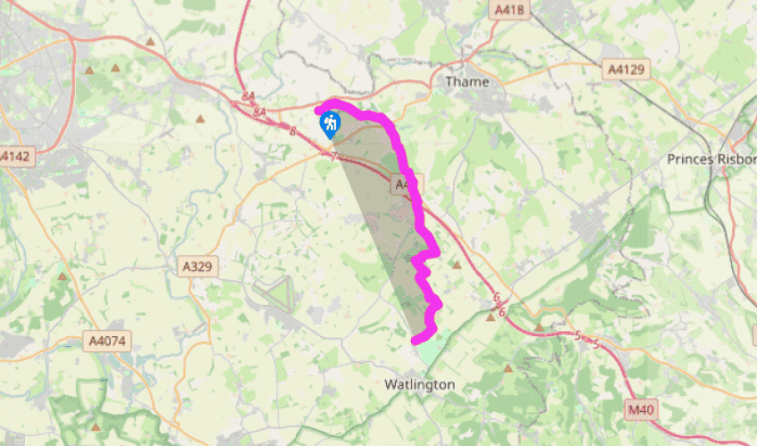
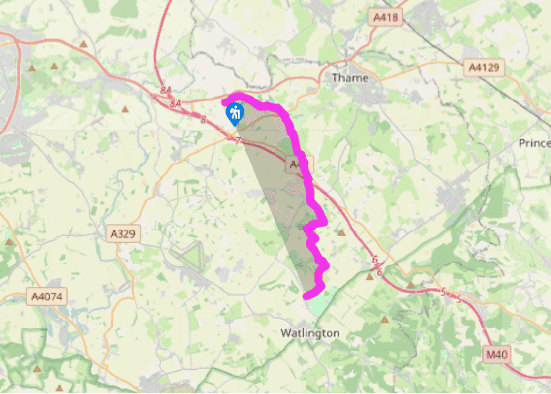
From Tiddington village street, south of the A418, the Oxfordshire Way follows the footpath across meadows to Albury Church, which dates from 1830 and serves both settlements. It has a Norman font, re-cut at the top but with an original lower band of zig-zag and roll moulding. The route turns right on to a broad track before descending to Rycote, where the route passes to the left of a cattle grid, into a small spinney and into Rycote Park towards the Chapel.
From Rycote, the Oxfordshire Way heads along a track through woodland to the A320 opposite a golf course. Cross the road, and continue across the golf course, bearing right to meet the access road by the club house. Arriving in a large meadow in line with the club house, cut half-right to a hedge gap, left for 26 yards (25m) along a bridleway, then right. Then it is on to Tetsworth, passing around Tetsworth Common to emerge at the large village green fronting the A40, the old Oxford, Gloucester and Milford Haven Road.
Crossing the A40 diagonally left, The Oxfordshire Way goes up Back Street to Parkers Hill, across two fields and passes under the motorway to Harlesford Lane, which it also crosses. In the first field cut between telegraph wires and a small clump of trees to a footbridge before further rambles over meadowland, following the Haseley Brook, to Adwell. A right turn along the road leads to Wheatfield, having taken a left-handed track at a right-angled bend in the road. Nothing is left now other than a lonely church and converted stable-block set amid magnificent parkland trees. The church was renovated in the early 18th century at the same time as Wheatfield House, which, until its destruction by fire in 1814, stood between the church and the stable-block. In the church is an eastern window by Morris and Co., while the altar table has been ascribed to Chippendale.
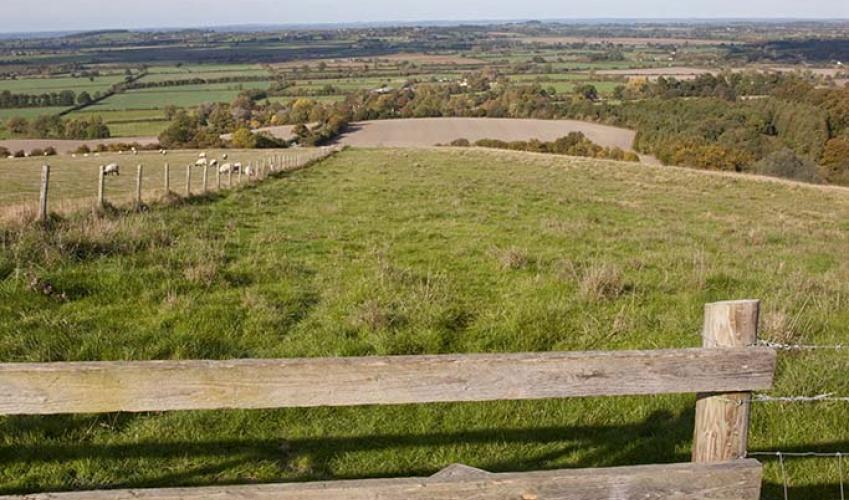
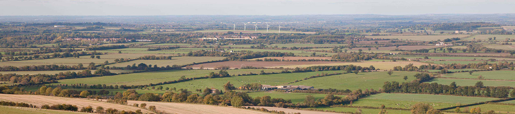
Turning left to leave the old stable-block directly behind you, the walk follows field edges before it skirts past the clump of beeches where Charles I breakfasted after a skirmish in the valley, and follows footpaths downhill towards the great Chiltern scarp, close to ancient Shirburn whose moated castle is hidden behind the trees. Then it turns right on to a bridleroad and so into Pyrton. The village has a peaceful atmosphere and a cluster of houses of brick and flint, some of them picturesquely thatched. In the little flint church on Midsummer Day 1619, John Hampden, that most fearless and fair-minded of Parliamentarians, married Elizabeth Symeon, a daughter of the manor house that stands half hidden among the trees.
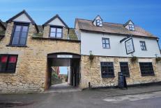
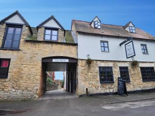
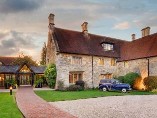
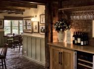
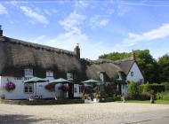
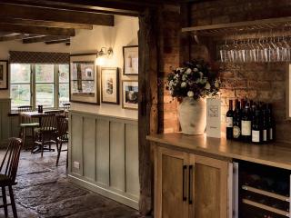
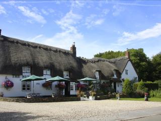
The Oxfordshire Way runs across the heart of England, along ancient rights of way, all of which existed long before they were thus joined together, passing through historic settlements and crossing the grain of the country. The old tracks and field paths have been used for centuries. Some are... prehistoric, some are Roman, and many were first trodden in Saxon times. They link villages and hamlets mentioned in the Domesday Book of 1086. The inns of these places usually provide food and accommodation, bed-and- breakfast can be found on or close to the route, and there are some campsites. Village shops survive in surprising numbers. Rycote was originally a manor of the Quatremains family, and they built the chapel of 1445, which still stands. When Lord Williams came here in 1539 he set about building on a grand scale, in the same plum-coloured brick that he used at Beckley Park. Of his great mansion nothing remains save a turret and a lonely farm among the parkland trees above an ornamental lake, although a new house of substantial proportions and with sympathy to the period has been built in its place. Rycote was a splendid palace. Henry VIII stayed here on his honeymoon with his fifth wife, Catherine Howard. Queen Elizabeth stayed here frequently, so did James I; Charles I visited Rycote in 1625 when the plague was raging in London and Parliament sat at Oxford. He came again in 1643, wearied by the Civil War, his fortunes in decline. By 1745 the property was the home of the Earls of Abingdon, and in November of that year it burned down. Tetsworth, which grew fat and self-important during the coaching era, suffered dearly with the coming of the railways in 1840. Now it has succumbed to the ultimate indignity of rubbing shoulders with the M40, bypassed by the modern world. The Swan, a gracious old coaching inn dating from Elizabethan times, is now an antiques centre and restaurant. Tetsworth has a pub, The Old Red Lion, that serves food, but little else in the way of shops. You can break the walk here (grid ref. SP686018) and catch a bus to Oxford or High Wycombe.
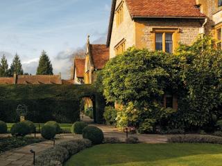
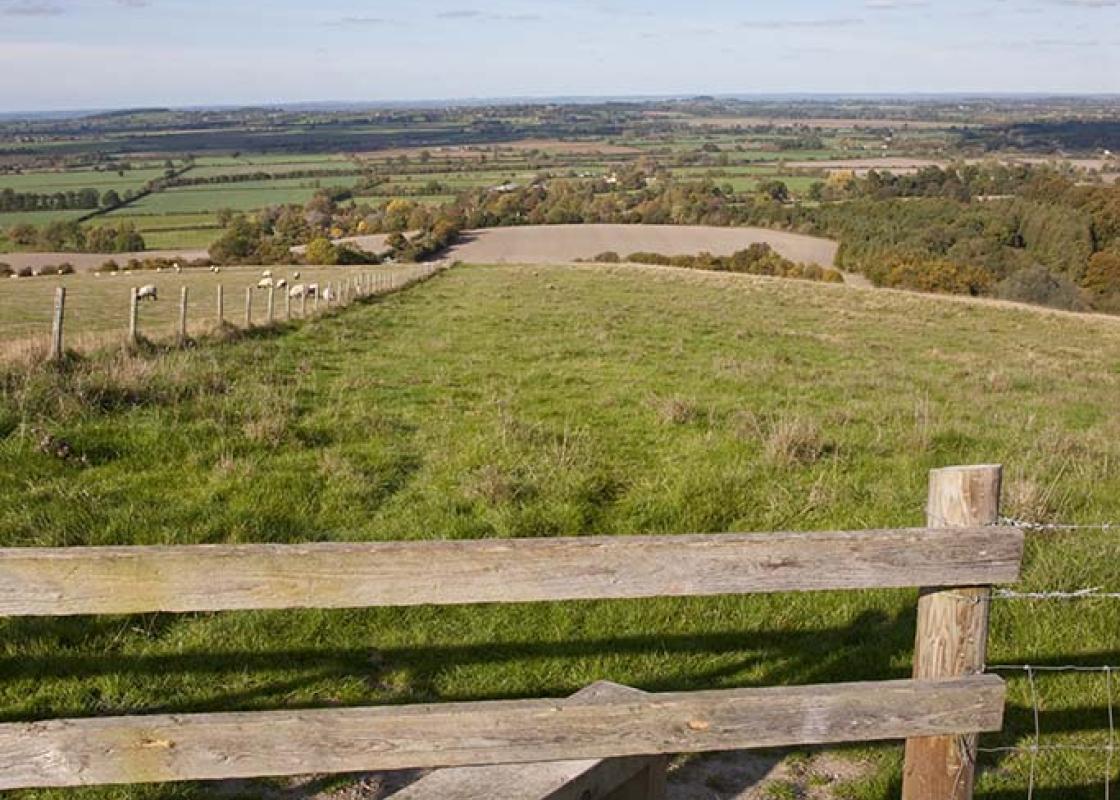
Located at the heart of England, Oxfordshire enjoys a rich heritage and varied scenery, with Oxford’s elegant streets a highlight for visitors. The landscape encompasses open chalk downland, picturesque rivers and attractive villages, while northwest of Oxfordshire is home to the sleepy backwaters of Abingdon, Wallingford, Wantage, Watlington and Witney that reveal how Oxfordshire’s old towns evolved over the centuries.
From Tiddington village street, south of the A418, the Oxfordshire Way follows the footpath across meadows to Albury Church, which dates from 1830 and serves both settlements. It has a Norman font, re-cut at the top but with an original lower band of zig-zag and roll moulding. The route turns right on to a broad track before descending to Rycote, where the route passes to the left of a cattle grid, into a small spinney and into Rycote Park towards the Chapel.
1 of 4
From Rycote, the Oxfordshire Way heads along a track through woodland to the A320 opposite a golf course. Cross the road, and continue across the golf course, bearing right to meet the access road by the club house. Arriving in a large meadow in line with the club house, cut half-right to a hedge gap, left for 26 yards (25m) along a bridleway, then right. Then it is on to Tetsworth, passing around Tetsworth Common to emerge at the large village green fronting the A40, the old Oxford, Gloucester and Milford Haven Road.
2 of 4
Crossing the A40 diagonally left, The Oxfordshire Way goes up Back Street to Parkers Hill, across two fields and passes under the motorway to Harlesford Lane, which it also crosses. In the first field cut between telegraph wires and a small clump of trees to a footbridge before further rambles over meadowland, following the Haseley Brook, to Adwell. A right turn along the road leads to Wheatfield, having taken a left-handed track at a right-angled bend in the road. Nothing is left now other than a lonely church and converted stable-block set amid magnificent parkland trees. The church was renovated in the early 18th century at the same time as Wheatfield House, which, until its destruction by fire in 1814, stood between the church and the stable-block. In the church is an eastern window by Morris and Co., while the altar table has been ascribed to Chippendale.
3 of 4
Turning left to leave the old stable-block directly behind you, the walk follows field edges before it skirts past the clump of beeches where Charles I breakfasted after a skirmish in the valley, and follows footpaths downhill towards the great Chiltern scarp, close to ancient Shirburn whose moated castle is hidden behind the trees. Then it turns right on to a bridleroad and so into Pyrton. The village has a peaceful atmosphere and a cluster of houses of brick and flint, some of them picturesquely thatched. In the little flint church on Midsummer Day 1619, John Hampden, that most fearless and fair-minded of Parliamentarians, married Elizabeth Symeon, a daughter of the manor house that stands half hidden among the trees.
The Oxfordshire Way runs across the heart of England, along ancient rights of way, all of which existed long before they were thus joined together, passing through historic settlements and crossing the grain of the country. The old tracks and field paths have been used for centuries. Some are... prehistoric, some are Roman, and many were first trodden in Saxon times. They link villages and hamlets mentioned in the Domesday Book of 1086. The inns of these places usually provide food and accommodation, bed-and- breakfast can be found on or close to the route, and there are some campsites. Village shops survive in surprising numbers. Rycote was originally a manor of the Quatremains family, and they built the chapel of 1445, which still stands. When Lord Williams came here in 1539 he set about building on a grand scale, in the same plum-coloured brick that he used at Beckley Park. Of his great mansion nothing remains save a turret and a lonely farm among the parkland trees above an ornamental lake, although a new house of substantial proportions and with sympathy to the period has been built in its place. Rycote was a splendid palace. Henry VIII stayed here on his honeymoon with his fifth wife, Catherine Howard. Queen Elizabeth stayed here frequently, so did James I; Charles I visited Rycote in 1625 when the plague was raging in London and Parliament sat at Oxford. He came again in 1643, wearied by the Civil War, his fortunes in decline. By 1745 the property was the home of the Earls of Abingdon, and in November of that year it burned down. Tetsworth, which grew fat and self-important during the coaching era, suffered dearly with the coming of the railways in 1840. Now it has succumbed to the ultimate indignity of rubbing shoulders with the M40, bypassed by the modern world. The Swan, a gracious old coaching inn dating from Elizabethan times, is now an antiques centre and restaurant. Tetsworth has a pub, The Old Red Lion, that serves food, but little else in the way of shops. You can break the walk here (grid ref. SP686018) and catch a bus to Oxford or High Wycombe.
Located at the heart of England, Oxfordshire enjoys a rich heritage and varied scenery, with Oxford’s elegant streets a highlight for visitors. The landscape encompasses open chalk downland, picturesque rivers and attractive villages, while northwest of Oxfordshire is home to the sleepy backwaters of Abingdon, Wallingford, Wantage, Watlington and Witney that reveal how Oxfordshire’s old towns evolved over the centuries.