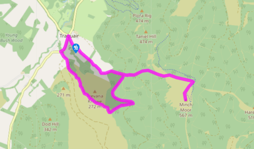
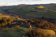
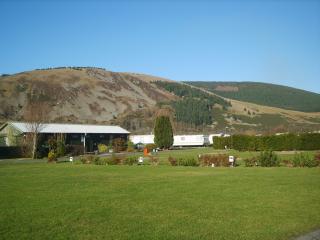
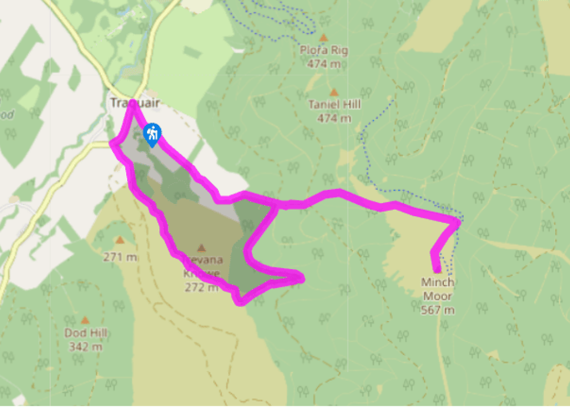
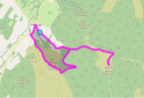
From the Southern Upland Way car park, join the tarmac road and walk left away from Traquair village. Continue ahead and then join the gravel track, following signs for the Minch Moor. After you go through a gate the track becomes grassier, then you hop over a stile and enter Forestry Commission land.
Continue on the obvious track to pass a semi-ruined bothy on the right. When you come to a crossing of tracks, maintain direction, crossing an area of scrub and self-seeded trees. When you reach a forest track, continue ahead, taking a narrow path to the right of a cycleway. The path winds uphill to rejoin the cycle track at The Point of Resolution, an unusual tree sculpture by Charles Poulson.
Maintain direction, enjoying great views over Walkerburn to the left. It feels wilder and windier up here, with large tracts of heather-covered moorland by your path. When you reach a marker post, turn right and walk up to the cairn on the Minch Moor – the views are great on a clear day.
From the cairn, retrace your steps back to the main track, before turning left and walking back downhill. Look out for the Cheese Well, a freshwater spring marked by two weathered stones, on the left – it's by the boggy part of the path. It is said that if you pass the well, you should leave a food offering – usually cheese, hence the name – to the fairies who haunt the area. This will ensure you a safe and successful journey. Turn left 20yds (18m) beyond The Point of Resolution and return downhill across one forest track to reach a second intersection.
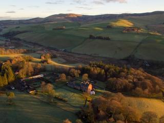
Turn left now and walk downhill. The landscape soon opens out on the right-hand side, giving you pleasant views of the valley and the river winding away. When you reach the apex of a bend, turn right along a grassy path. Follow this as it bears downhill, go through a gate and walk beside Camp Shiel cottage, where two burns meet.
Go through another gate, cross the burn, then follow the grassy track and pass Damhead Shiel cottage. Go through another gate and follow the path across a bridge over a burn. You'll pass an expanse of scree on the right-hand side – the slope is a blaze of yellow gorse throughout spring and summer. Cross another bridge and continue to Damhead farm.
Walk past the farm and down to the road, then turn right. Cross the burn again and walk past some cottages on the right-hand side. When you reach the war memorial on the left, turn right and walk up the track to reach the parking place at the start of the walk on the left.
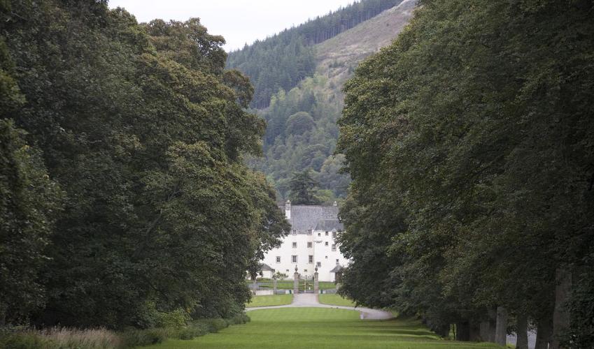
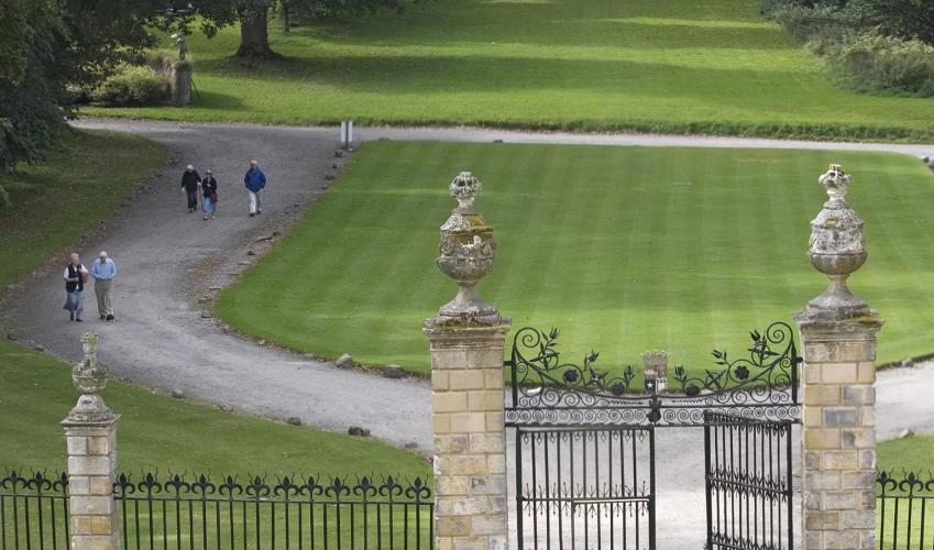
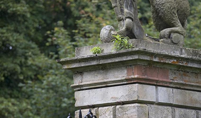
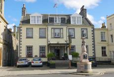
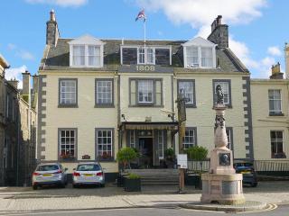
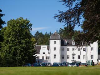
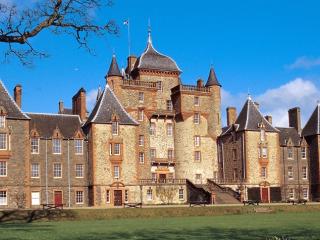
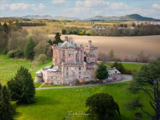
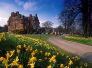
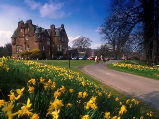
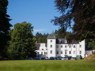
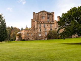
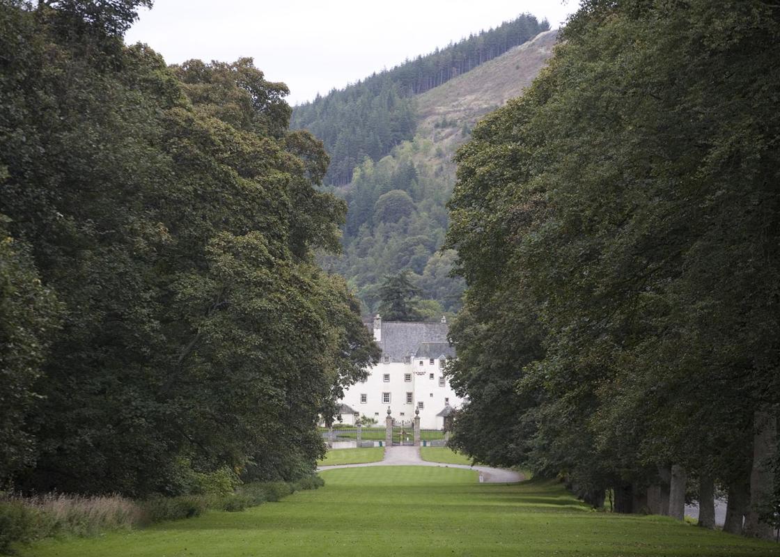
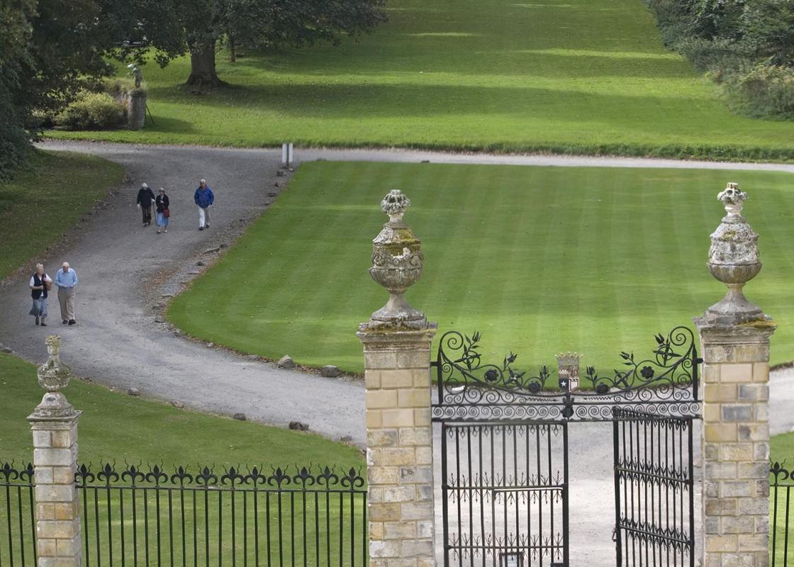
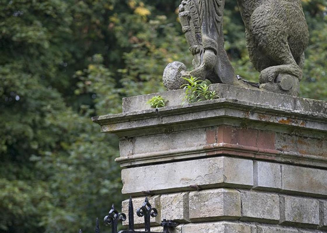
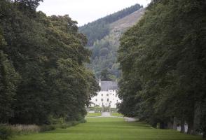
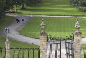
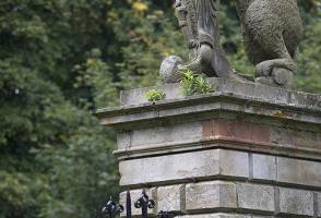
There can be few more romantic places in Britain than Traquair House, just a couple of minutes' drive from the start of this walk. It's the oldest continually inhabited house in Scotland and is still owned by the Maxwell Stuart family, who came here in 1491. Parts of the house date back to the 12th... century, although most of the present building was constructed in 1680. It's a house full of secret stairways and little windows and even has its own brewery, whose origins stretch back to the 16th century. Traquair House is one of those marvellous places that simply ooze atmosphere – perhaps because it is still a family home. All in a good cause The house was always a popular stopping-off point for Scottish monarchs and 27 of them visited over the years, including Mary, Queen of Scots, who stayed here with her husband, Lord Darnley, in 1566. The family were traditionally staunch Catholics and when the Protestant William of Orange took the throne in 1689, they joined many others in supporting the Jacobite cause. This demanded that the Stuart King James II (Charles II's brother) be reinstated on the throne and, contrary to popular myth, attracted support among English people as well as Scots. Years of repression and bloodshed followed. Hiding out at Traquair The Jacobite rebellion eventually culminated in the disastrous defeat at Culloden in 1746. You can, of course, visit the site of the battle itself, but it is somehow easier to understand what it must have been like to live during those times when you see the secret priest's room at Traquair. Often called 'priest's holes', these rooms were made in many of the great houses throughout Britain, allowing priests to live in hiding and take Mass for the devout family. The one in Traquair has such a strong atmosphere that it feels as if the priest has just stepped out for a moment. The 4th Earl of Traquair was imprisoned in the Tower of London and sentenced to death for his part in one of the early Jacobite risings. However, he managed to make a story-book escape, when his wife smuggled him out of prison by dressing him as a maid. The cloak he used as his disguise is on display at Traquair. Years later, the 5th Earl was also held prisoner in the Tower for supporting the Jacobites at Culloden. A royal promise Bonnie Prince Charlie visited Traquair in 1745, passing through the great Bear Gates – so named because of the bear statues that top the gateposts. When the prince left, the 5th Earl wished him a safe journey, closed the gates behind him and promised that they would not be opened again until there was a Stuart monarch on the throne. The gates have remained unopened ever since.
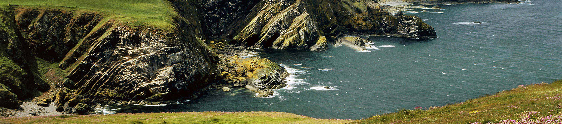
Southern Scotland is often referred to as the Lowlands, to distinguish it from the mountainous grandeur of the North-West Highlands. But don’t be fooled by the description.
From the Southern Upland Way car park, join the tarmac road and walk left away from Traquair village. Continue ahead and then join the gravel track, following signs for the Minch Moor. After you go through a gate the track becomes grassier, then you hop over a stile and enter Forestry Commission land.
1 of 7
Continue on the obvious track to pass a semi-ruined bothy on the right. When you come to a crossing of tracks, maintain direction, crossing an area of scrub and self-seeded trees. When you reach a forest track, continue ahead, taking a narrow path to the right of a cycleway. The path winds uphill to rejoin the cycle track at The Point of Resolution, an unusual tree sculpture by Charles Poulson.
2 of 7
Maintain direction, enjoying great views over Walkerburn to the left. It feels wilder and windier up here, with large tracts of heather-covered moorland by your path. When you reach a marker post, turn right and walk up to the cairn on the Minch Moor – the views are great on a clear day.
3 of 7
From the cairn, retrace your steps back to the main track, before turning left and walking back downhill. Look out for the Cheese Well, a freshwater spring marked by two weathered stones, on the left – it's by the boggy part of the path. It is said that if you pass the well, you should leave a food offering – usually cheese, hence the name – to the fairies who haunt the area. This will ensure you a safe and successful journey. Turn left 20yds (18m) beyond The Point of Resolution and return downhill across one forest track to reach a second intersection.
4 of 7
Turn left now and walk downhill. The landscape soon opens out on the right-hand side, giving you pleasant views of the valley and the river winding away. When you reach the apex of a bend, turn right along a grassy path. Follow this as it bears downhill, go through a gate and walk beside Camp Shiel cottage, where two burns meet.
5 of 7
Go through another gate, cross the burn, then follow the grassy track and pass Damhead Shiel cottage. Go through another gate and follow the path across a bridge over a burn. You'll pass an expanse of scree on the right-hand side – the slope is a blaze of yellow gorse throughout spring and summer. Cross another bridge and continue to Damhead farm.
6 of 7
Walk past the farm and down to the road, then turn right. Cross the burn again and walk past some cottages on the right-hand side. When you reach the war memorial on the left, turn right and walk up the track to reach the parking place at the start of the walk on the left.
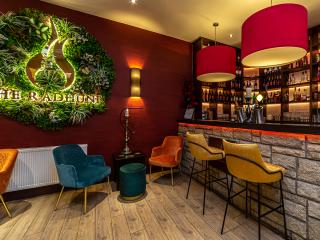
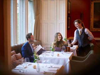
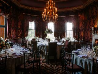
There can be few more romantic places in Britain than Traquair House, just a couple of minutes' drive from the start of this walk. It's the oldest continually inhabited house in Scotland and is still owned by the Maxwell Stuart family, who came here in 1491. Parts of the house date back to the 12th... century, although most of the present building was constructed in 1680. It's a house full of secret stairways and little windows and even has its own brewery, whose origins stretch back to the 16th century. Traquair House is one of those marvellous places that simply ooze atmosphere – perhaps because it is still a family home. All in a good cause The house was always a popular stopping-off point for Scottish monarchs and 27 of them visited over the years, including Mary, Queen of Scots, who stayed here with her husband, Lord Darnley, in 1566. The family were traditionally staunch Catholics and when the Protestant William of Orange took the throne in 1689, they joined many others in supporting the Jacobite cause. This demanded that the Stuart King James II (Charles II's brother) be reinstated on the throne and, contrary to popular myth, attracted support among English people as well as Scots. Years of repression and bloodshed followed. Hiding out at Traquair The Jacobite rebellion eventually culminated in the disastrous defeat at Culloden in 1746. You can, of course, visit the site of the battle itself, but it is somehow easier to understand what it must have been like to live during those times when you see the secret priest's room at Traquair. Often called 'priest's holes', these rooms were made in many of the great houses throughout Britain, allowing priests to live in hiding and take Mass for the devout family. The one in Traquair has such a strong atmosphere that it feels as if the priest has just stepped out for a moment. The 4th Earl of Traquair was imprisoned in the Tower of London and sentenced to death for his part in one of the early Jacobite risings. However, he managed to make a story-book escape, when his wife smuggled him out of prison by dressing him as a maid. The cloak he used as his disguise is on display at Traquair. Years later, the 5th Earl was also held prisoner in the Tower for supporting the Jacobites at Culloden. A royal promise Bonnie Prince Charlie visited Traquair in 1745, passing through the great Bear Gates – so named because of the bear statues that top the gateposts. When the prince left, the 5th Earl wished him a safe journey, closed the gates behind him and promised that they would not be opened again until there was a Stuart monarch on the throne. The gates have remained unopened ever since.
Southern Scotland is often referred to as the Lowlands, to distinguish it from the mountainous grandeur of the North-West Highlands. But don’t be fooled by the description.