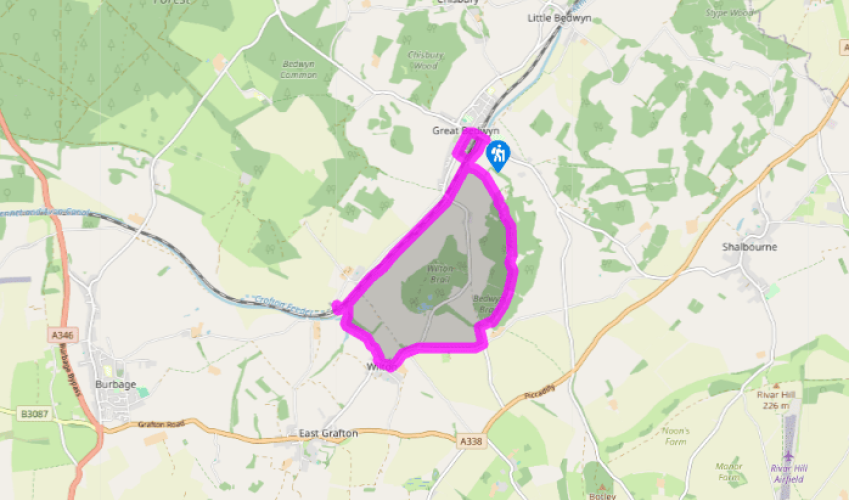
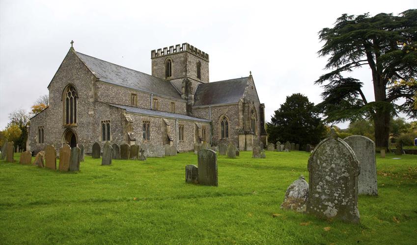
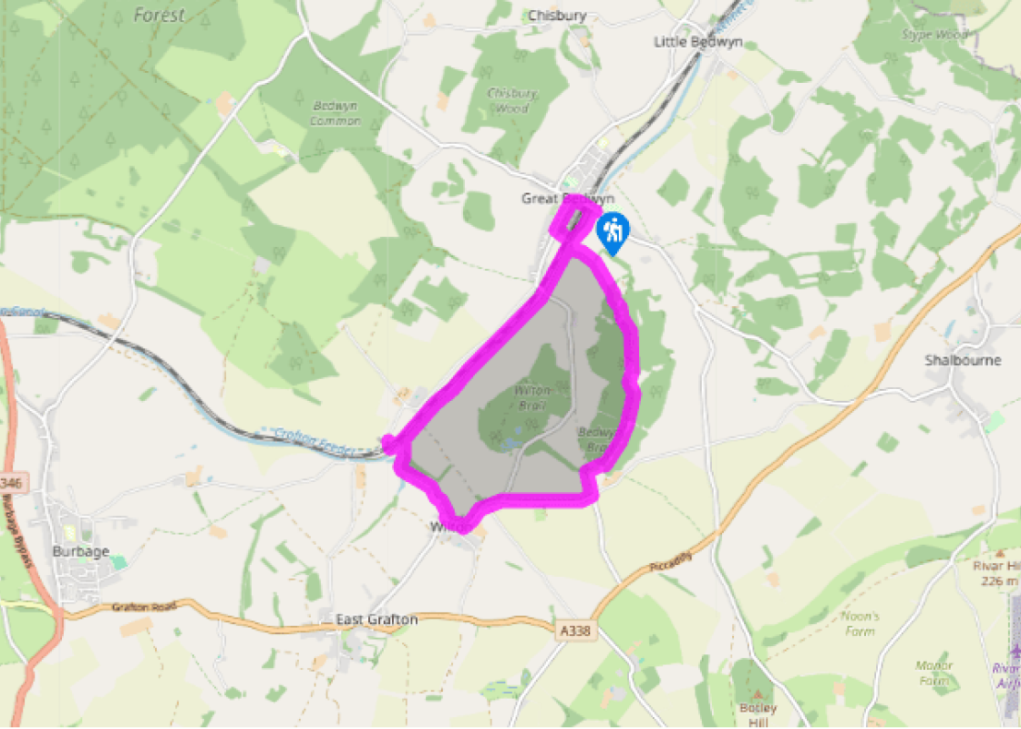
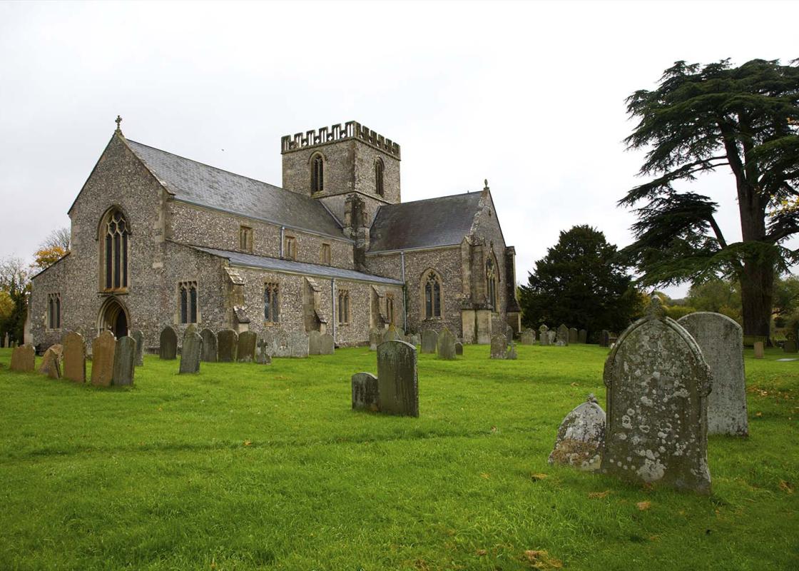
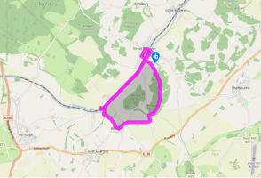
Walk to the main road in Great Bedwyn. Turn right, then left down Church Street. Pass the post office and the church, then take the footpath left between two graveyards. Climb a stile, cross a field to a kissing gate, then carefully cross the railway line to another kissing gate. Cross the footbridge, then the bridge over the Kennet and Avon Canal and descend to the tow path.
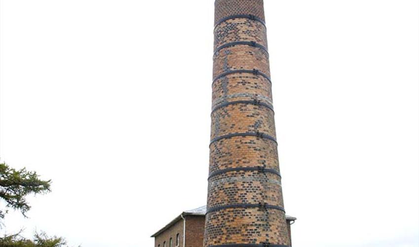
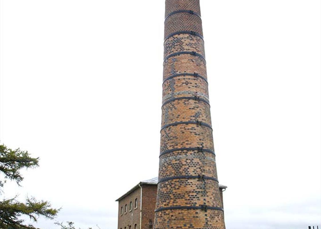
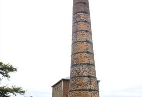
Turn right, pass beneath the bridge and continue along the tow path for 1.5 miles (2.4km), passing three locks and through two gates, to reach Lock 60. Go through a gate and cross the canal here, turn left, then follow a path right and pass through the tunnel beneath the railway. Ascend steps to the Crofton Pumping Station.
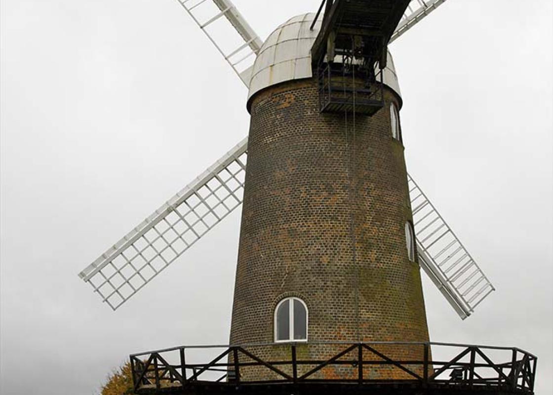
Retrace your steps back to the tow path and Lock 60. Turn left for a few paces, then take the footpath right, waymarked to Wilton Windmill, and walk beside Wilton Water along the edge of fields. Eventually, turn right down a short track to a lane by the village pond in Wilton.
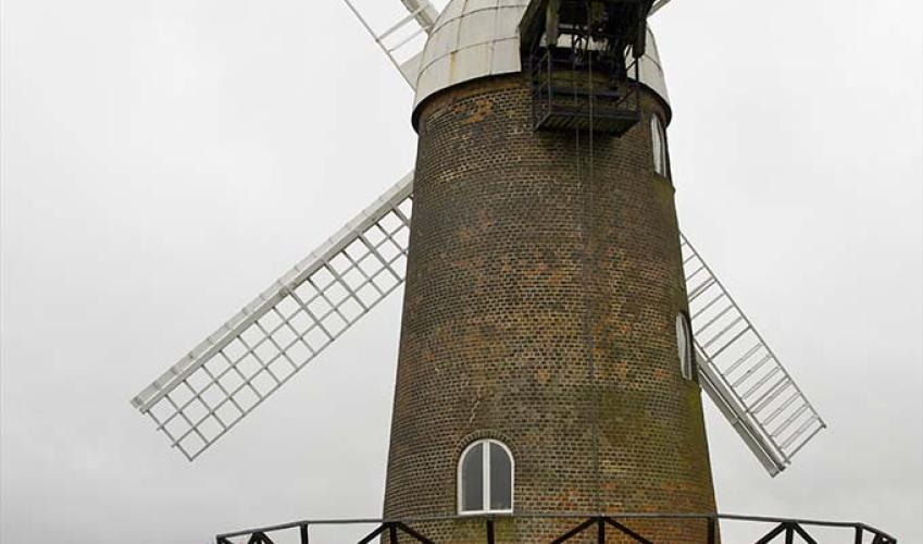
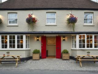
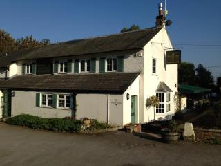
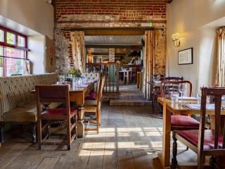
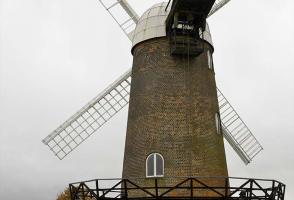
Turn left, then just past the Swan Inn, follow the lane left and uphill through trees. Climb out of the village and turn right to pass close to Wilton Windmill. Continue along the lane and turn left on to a track, opposite the lane to Hungerford. Just before the wooded track snakes downhill, turn right above a pond along a bridle path (unsigned) beside woodland.
At a staggered crossing of paths, turn right, then in 50yds (46m), turn left. Go down a well-surfaced track and through a gate into Bedwyn Brail. Continue though the woods, following signs to Great Bedwyn. The hard track gives way to a grassy track – follow this along a clearing and bear left across a clearing before forking left at a barn to re-enter the woods in the left-hand corner of the clearing.
On emerging in a field corner, keep left along the field boundary. Go through a gap in the hedge and descend along the left-hand side of the next field, with Great Bedwyn visible ahead. Near the bottom of the field, bear half right, downhill to the canal.
Pass through a gate by a bridge and Lock 64 and turn right along the tow path. Go through the car park to the road, then turn left over the canal and rail bridges before turning right back to Great Bedwyn Station.
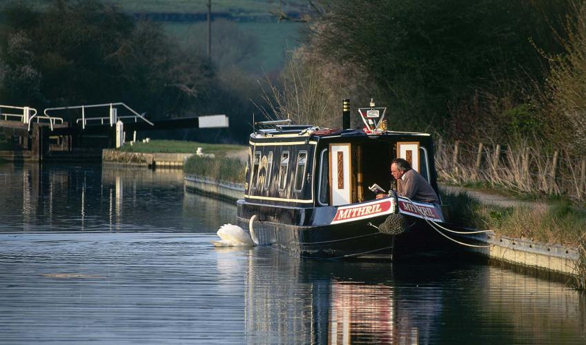
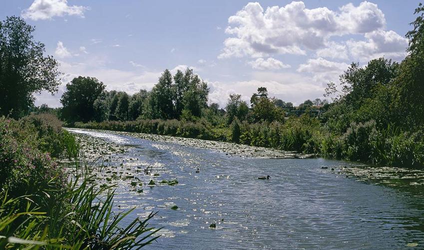
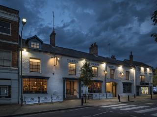
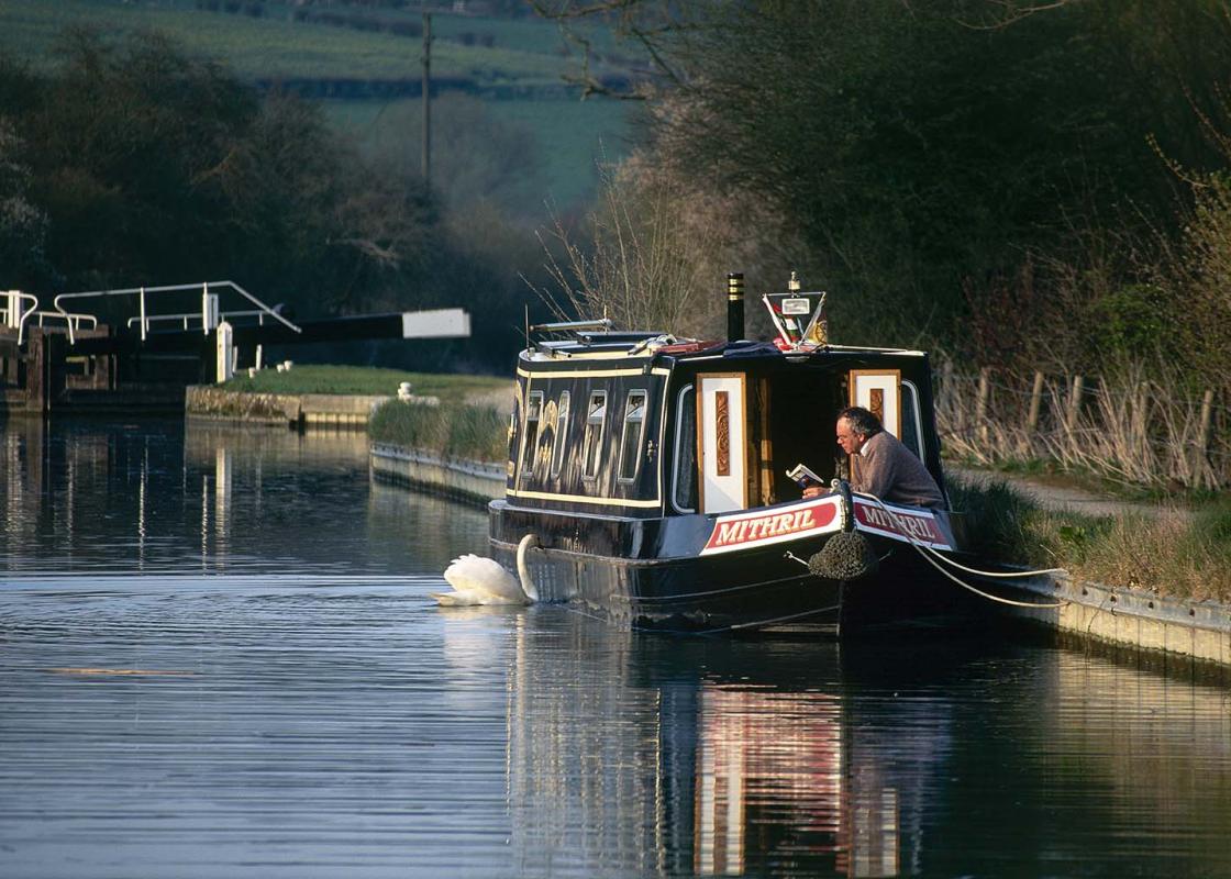
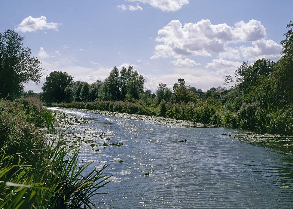
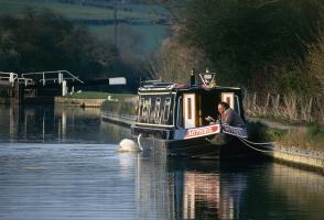
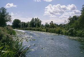
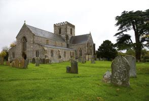
Situated beside a peaceful stretch of the Kennet and Avon Canal, the large village of Great Bedwyn was formerly a market town, with borough status from the 11th century until the Reform Act of 1832 – it even returned two Members of Parliament. It still has the appearance of a small town with a wide... main street, continuous rows of cottages, a few elegant town houses and the flint Church of St Mary the Virgin, one of the largest and finest churches in the area, set in low-lying land near to the canal. Kennet and Avon Canal Undeniably, the main reason most visitors come to Great Bedwyn is to enjoy the sights and sounds of the Kennet and Avon Canal and the beautiful scenery it meanders through southwest of the village. It was in 1788 that the idea of linking the River Kennet, which flows into the Thames at Reading, with the River Avon at Bath by means of an artificial waterway was first mooted. The navigation between the rivers had to rise to 450ft (137m) and then descend on the other side and needed 104 locks, two aqueducts and, at the summit, a tunnel over 500yds (457m) long. Construction on the ambitious project, designed by John Rennie (1761–1821), started in 1794 and was completed in 1810. The canal was used to carry vast quantities of coal from the Somerset coalfield, iron, stone and slate, local agricultural products and timber, and to bring luxuries like tobacco and spirits from London to Bath, Bristol and the intervening towns. Transporting goods along the canal proved successful for 40 years but then, with the completion of the railways offering faster and more efficient transport, the canal began to fall into decline. Since 1962 the Kennet and Avon Canal Trust and British Waterways have revitalised the navigable waterway by clearing the waters and locks for leisure barges and making the banks and tow paths accessible to anglers, naturalists and walkers. Also part of the restoration scheme, and a highlight of your walk along the tow path, are the magnificent beam engines at Crofton Pumping Station. The two beam engines, the 1812 Boulton and Watt and the 1845 Harvey of Hale, operate a huge cast-iron beam and were used to raise water from Wilton Water to the summit level of the canal. They have been beautifully restored and are powered by steam from a hand-stoked, coal-fired Lancashire boiler. You may be lucky to see them working if you're visiting on a summer weekend. Wilton Windmill The county's only complete surviving working windmill stands proudly on a chalk hilltop overlooking the canal. Built in 1821, after the construction of the canal had diverted the water previously used to power mills, it is a five-storey brick tower mill and was fully operational until the 1890s. It closed and became derelict in the 1920s, but was restored in the 1970s. On selected days you can once again see local corn being ground into flour.
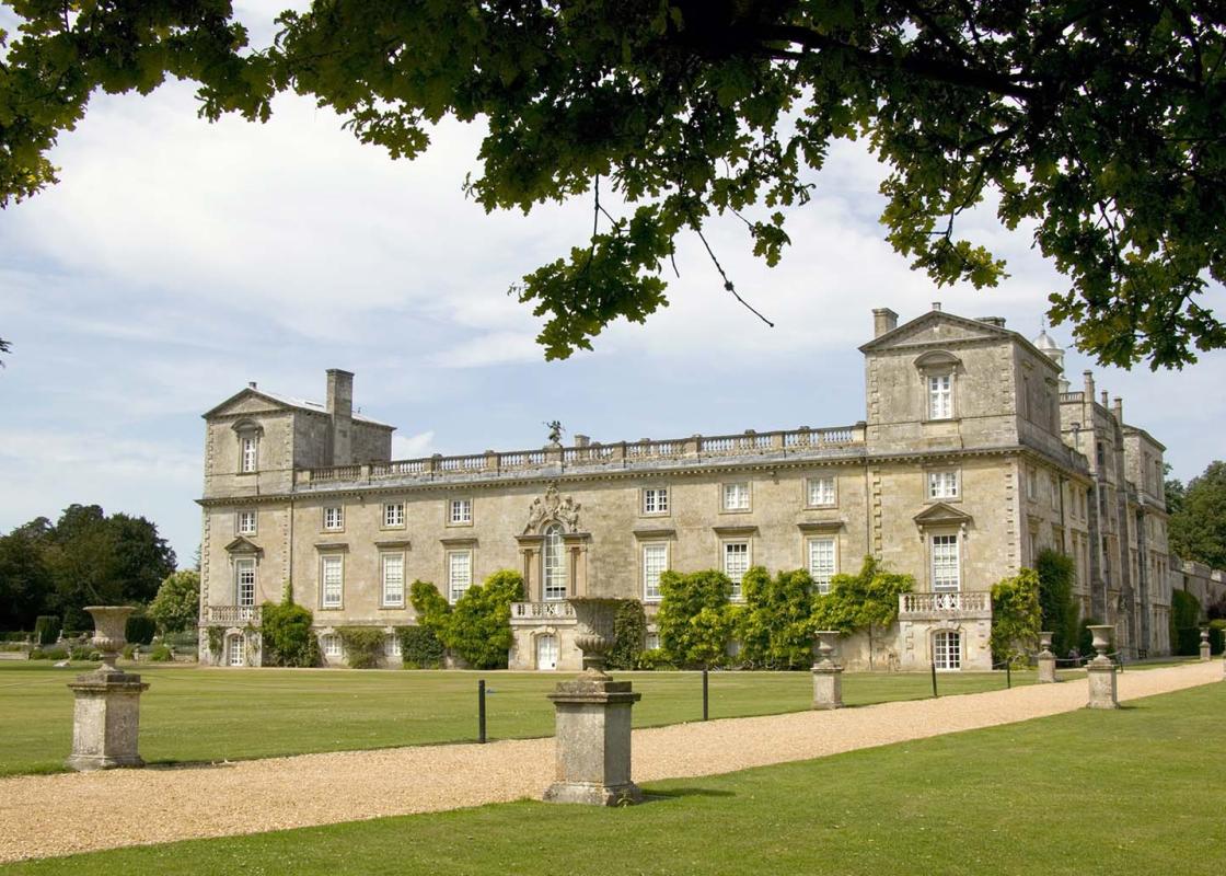
Wiltshire’s charm lies in the beauty of its countryside, with expansive chalk landscapes of the Marlborough and Pewsey downs and miles of uninterrupted views deep into Dorset, Somerset and the Cotswolds. Stroll through quaint timbered and thatched villages in the southern Woodford and Avon valleys and explore the historic streets of the stone villages of Lacock, Castle Combe and Sherston.
Walk to the main road in Great Bedwyn. Turn right, then left down Church Street. Pass the post office and the church, then take the footpath left between two graveyards. Climb a stile, cross a field to a kissing gate, then carefully cross the railway line to another kissing gate. Cross the footbridge, then the bridge over the Kennet and Avon Canal and descend to the tow path.
1 of 7
Turn right, pass beneath the bridge and continue along the tow path for 1.5 miles (2.4km), passing three locks and through two gates, to reach Lock 60. Go through a gate and cross the canal here, turn left, then follow a path right and pass through the tunnel beneath the railway. Ascend steps to the Crofton Pumping Station.
2 of 7
Retrace your steps back to the tow path and Lock 60. Turn left for a few paces, then take the footpath right, waymarked to Wilton Windmill, and walk beside Wilton Water along the edge of fields. Eventually, turn right down a short track to a lane by the village pond in Wilton.
3 of 7
Turn left, then just past the Swan Inn, follow the lane left and uphill through trees. Climb out of the village and turn right to pass close to Wilton Windmill. Continue along the lane and turn left on to a track, opposite the lane to Hungerford. Just before the wooded track snakes downhill, turn right above a pond along a bridle path (unsigned) beside woodland.
4 of 7
At a staggered crossing of paths, turn right, then in 50yds (46m), turn left. Go down a well-surfaced track and through a gate into Bedwyn Brail. Continue though the woods, following signs to Great Bedwyn. The hard track gives way to a grassy track – follow this along a clearing and bear left across a clearing before forking left at a barn to re-enter the woods in the left-hand corner of the clearing.
5 of 7
On emerging in a field corner, keep left along the field boundary. Go through a gap in the hedge and descend along the left-hand side of the next field, with Great Bedwyn visible ahead. Near the bottom of the field, bear half right, downhill to the canal.
6 of 7
Pass through a gate by a bridge and Lock 64 and turn right along the tow path. Go through the car park to the road, then turn left over the canal and rail bridges before turning right back to Great Bedwyn Station.
Situated beside a peaceful stretch of the Kennet and Avon Canal, the large village of Great Bedwyn was formerly a market town, with borough status from the 11th century until the Reform Act of 1832 – it even returned two Members of Parliament. It still has the appearance of a small town with a wide... main street, continuous rows of cottages, a few elegant town houses and the flint Church of St Mary the Virgin, one of the largest and finest churches in the area, set in low-lying land near to the canal. Kennet and Avon Canal Undeniably, the main reason most visitors come to Great Bedwyn is to enjoy the sights and sounds of the Kennet and Avon Canal and the beautiful scenery it meanders through southwest of the village. It was in 1788 that the idea of linking the River Kennet, which flows into the Thames at Reading, with the River Avon at Bath by means of an artificial waterway was first mooted. The navigation between the rivers had to rise to 450ft (137m) and then descend on the other side and needed 104 locks, two aqueducts and, at the summit, a tunnel over 500yds (457m) long. Construction on the ambitious project, designed by John Rennie (1761–1821), started in 1794 and was completed in 1810. The canal was used to carry vast quantities of coal from the Somerset coalfield, iron, stone and slate, local agricultural products and timber, and to bring luxuries like tobacco and spirits from London to Bath, Bristol and the intervening towns. Transporting goods along the canal proved successful for 40 years but then, with the completion of the railways offering faster and more efficient transport, the canal began to fall into decline. Since 1962 the Kennet and Avon Canal Trust and British Waterways have revitalised the navigable waterway by clearing the waters and locks for leisure barges and making the banks and tow paths accessible to anglers, naturalists and walkers. Also part of the restoration scheme, and a highlight of your walk along the tow path, are the magnificent beam engines at Crofton Pumping Station. The two beam engines, the 1812 Boulton and Watt and the 1845 Harvey of Hale, operate a huge cast-iron beam and were used to raise water from Wilton Water to the summit level of the canal. They have been beautifully restored and are powered by steam from a hand-stoked, coal-fired Lancashire boiler. You may be lucky to see them working if you're visiting on a summer weekend. Wilton Windmill The county's only complete surviving working windmill stands proudly on a chalk hilltop overlooking the canal. Built in 1821, after the construction of the canal had diverted the water previously used to power mills, it is a five-storey brick tower mill and was fully operational until the 1890s. It closed and became derelict in the 1920s, but was restored in the 1970s. On selected days you can once again see local corn being ground into flour.
Wiltshire’s charm lies in the beauty of its countryside, with expansive chalk landscapes of the Marlborough and Pewsey downs and miles of uninterrupted views deep into Dorset, Somerset and the Cotswolds. Stroll through quaint timbered and thatched villages in the southern Woodford and Avon valleys and explore the historic streets of the stone villages of Lacock, Castle Combe and Sherston.