"A walk around the village where the last king of East Anglia met his untimely death."
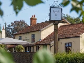
Walk directions
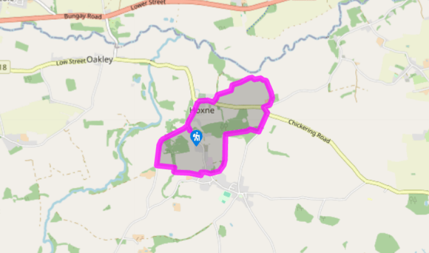
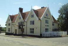
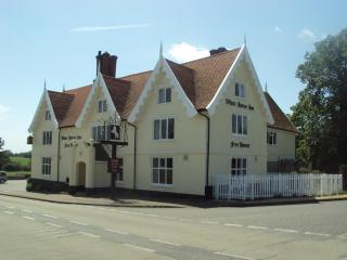
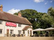
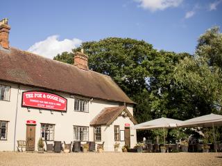
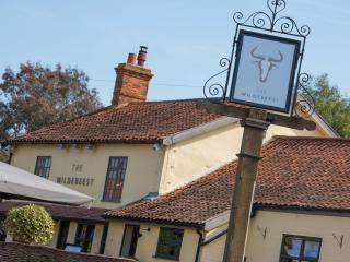
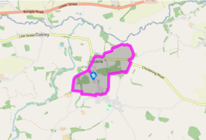
Turn left out of the car park to cross Goldbrook Bridge, noting the inscription on the bridge: ‘King Edmund taken prisoner here, ad 870’. Turn right to cross a tributary of the River Dove and pass the Swan Inn on the left. Fork right to climb past the post office alongside the village green and continue to the top of the lane to arrive opposite the Church of St Peter and St Paul.
Turn right along the road and take the second left, Water Mill Lane. Bear right along a tarmac and chippings lane with a ‘No through road’ sign. The lane drops down into a valley beside the water-meadows of the River Waveney which marks the border between Norfolk and Suffolk. When you reach the entrance drive to the mill, turn right on to another concrete track that swings to the left past some huts to become a green lane bordered by hedges. Turn right on a field-edge path with a house to your left, then right on to a tarmac lane. Turn right at Birch Farm at the end of the lane to return to the main road (B1118).
Turn left, walk around the bend and turn right on to Wittons Lane, also signposted ‘Hoxne Cross Street’. After crossing a stream, turn right through a kissing gate to enter Brakey Wood, a new woodland created to commemorate the millennium. Keep to the right alongside the stream and walk around the edge of the woods before going through a kissing gate to arrive at a sewage works.
Keep straight ahead on a footpath along the edge of the field. St Edmund’s Monument can be seen in a field to your right and it is usually possible to reach it on a permissive footpath. Cross a plank footbridge and stay on the public footpath as it bends to the right around a second field and enters a narrow belt of woodland before arriving at Cross Street by the side of a small garage and shop.
Maintain your direction, walking straight ahead for another 60yds (55m). When the road bends sharply to the right, continue ahead on a public footpath between the houses which then turns left around a field. The path turns right, right again and then left to cross a shallow ditch and drops down steeply beside the next field with a tall hedge on the left-hand side. Cross a stile, turn right and in about 50yds (46m), go left over a footbridge. Pass through a gate and keep walking straight ahead on a sloping cross-field path until you meet a road.
Turn right and walk along the road to return to the start of the walk at Goldbrook Bridge.
Hoxne, which rhymes with ‘oxen’, is best known as the place where King Edmund lost his head. Edmund, the last king of East Anglia, born in ad 841, was a Saxon prince who was named by King Offa as his chosen successor. When Offa died on a pilgrimage to the Holy Land, his companions returned to... Saxony and brought the young boy home to be crowned King at the age of 14. He reigned peacefully for 15 years, but frequent raids by Danish Vikings unsettled his kingdom and eventually led to all-out war. In ad 870, after a particularly bloody battle, Edmund was captured by the Danes. When he refused to renounce his Christian faith, he was tied to a tree. His body was pelted with arrows and his head was cut off and thrown into the woods. Betrayed by a bride So many legends surround the death of King Edmund that it is difficult to separate fact from fiction. One story tells of the King taking refuge beneath Goldbrook Bridge, which you cross at the start of this walk. A newly married couple spotted his golden spurs reflected in the water and betrayed him to the Danes, thereby ensuring his death. Edmund pronounced a curse on all future brides and to this day people take care to avoid Goldbrook Bridge on their wedding day. A relief sculpture on the outside wall of the nearby village hall shows Edmund crouching beneath the bridge while the bridal party passed overhead. St Edmund the Martyr The other colourful story concerns the head itself. Some time after Edmund’s death, his followers returned to Hoxne to search for his body. The cries of a howling wolf led them into the forest, where they found the wolf cradling the King’s head as if it were her child. A chapel was erected on the spot and became an important shrine, but later his body was moved to Bury St Edmunds. The former King is now known as St Edmund the Martyr and was briefly patron saint of England because of his resistance to the Viking invasion. Thousand year tree The walk passes close to St Edmund’s Monument, which sits in the middle of a field where a huge oak tree once stood. The story goes that the oak collapsed suddenly one night in September 1848, without any apparent cause. Tests showed the tree to be more than 1,000 years old and embedded in its trunk were several iron points which could have been the remains of arrowheads. This evidence could suggest that this could have been the very spot where the good King was murdered.
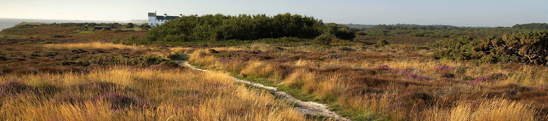
Suffolk is Constable country, where the county’s crumbling, time-ravaged coastline spreads itself under wide skies to convey a wonderful sense of remoteness and solitude. Highly evocative and atmospheric, this is where rivers wind lazily to the sea and notorious 18th-century smugglers hid from the excise men.
"A walk around the village where the last king of East Anglia met his untimely death."
Walk details
1hr 30min
Difficulty:
Easy
Gradient:
Gentle
Distance:
3.5 miles (5.7kms)
Ascent:
197ft (60m)
Walk directions
Turn left out of the car park to cross Goldbrook Bridge, noting the inscription on the bridge: ‘King Edmund taken prisoner here, ad 870’. Turn right to cross a tributary of the River Dove and pass the Swan Inn on the left. Fork right to climb past the post office alongside the village green and continue to the top of the lane to arrive opposite the Church of St Peter and St Paul.
1 of 6
Turn right along the road and take the second left, Water Mill Lane. Bear right along a tarmac and chippings lane with a ‘No through road’ sign. The lane drops down into a valley beside the water-meadows of the River Waveney which marks the border between Norfolk and Suffolk. When you reach the entrance drive to the mill, turn right on to another concrete track that swings to the left past some huts to become a green lane bordered by hedges. Turn right on a field-edge path with a house to your left, then right on to a tarmac lane. Turn right at Birch Farm at the end of the lane to return to the main road (B1118).
2 of 6
Turn left, walk around the bend and turn right on to Wittons Lane, also signposted ‘Hoxne Cross Street’. After crossing a stream, turn right through a kissing gate to enter Brakey Wood, a new woodland created to commemorate the millennium. Keep to the right alongside the stream and walk around the edge of the woods before going through a kissing gate to arrive at a sewage works.
3 of 6
Keep straight ahead on a footpath along the edge of the field. St Edmund’s Monument can be seen in a field to your right and it is usually possible to reach it on a permissive footpath. Cross a plank footbridge and stay on the public footpath as it bends to the right around a second field and enters a narrow belt of woodland before arriving at Cross Street by the side of a small garage and shop.
4 of 6
Maintain your direction, walking straight ahead for another 60yds (55m). When the road bends sharply to the right, continue ahead on a public footpath between the houses which then turns left around a field. The path turns right, right again and then left to cross a shallow ditch and drops down steeply beside the next field with a tall hedge on the left-hand side. Cross a stile, turn right and in about 50yds (46m), go left over a footbridge. Pass through a gate and keep walking straight ahead on a sloping cross-field path until you meet a road.
5 of 6
Turn right and walk along the road to return to the start of the walk at Goldbrook Bridge.
Hoxne, which rhymes with ‘oxen’, is best known as the place where King Edmund lost his head. Edmund, the last king of East Anglia, born in ad 841, was a Saxon prince who was named by King Offa as his chosen successor. When Offa died on a pilgrimage to the Holy Land, his companions returned to... Saxony and brought the young boy home to be crowned King at the age of 14. He reigned peacefully for 15 years, but frequent raids by Danish Vikings unsettled his kingdom and eventually led to all-out war. In ad 870, after a particularly bloody battle, Edmund was captured by the Danes. When he refused to renounce his Christian faith, he was tied to a tree. His body was pelted with arrows and his head was cut off and thrown into the woods. Betrayed by a bride So many legends surround the death of King Edmund that it is difficult to separate fact from fiction. One story tells of the King taking refuge beneath Goldbrook Bridge, which you cross at the start of this walk. A newly married couple spotted his golden spurs reflected in the water and betrayed him to the Danes, thereby ensuring his death. Edmund pronounced a curse on all future brides and to this day people take care to avoid Goldbrook Bridge on their wedding day. A relief sculpture on the outside wall of the nearby village hall shows Edmund crouching beneath the bridge while the bridal party passed overhead. St Edmund the Martyr The other colourful story concerns the head itself. Some time after Edmund’s death, his followers returned to Hoxne to search for his body. The cries of a howling wolf led them into the forest, where they found the wolf cradling the King’s head as if it were her child. A chapel was erected on the spot and became an important shrine, but later his body was moved to Bury St Edmunds. The former King is now known as St Edmund the Martyr and was briefly patron saint of England because of his resistance to the Viking invasion. Thousand year tree The walk passes close to St Edmund’s Monument, which sits in the middle of a field where a huge oak tree once stood. The story goes that the oak collapsed suddenly one night in September 1848, without any apparent cause. Tests showed the tree to be more than 1,000 years old and embedded in its trunk were several iron points which could have been the remains of arrowheads. This evidence could suggest that this could have been the very spot where the good King was murdered.
Suffolk is Constable country, where the county’s crumbling, time-ravaged coastline spreads itself under wide skies to convey a wonderful sense of remoteness and solitude. Highly evocative and atmospheric, this is where rivers wind lazily to the sea and notorious 18th-century smugglers hid from the excise men.