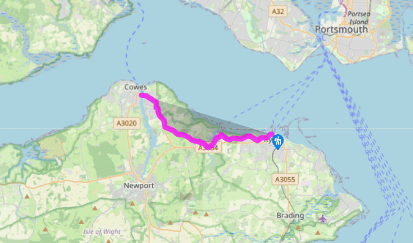
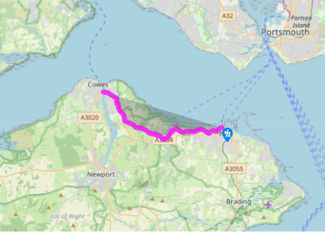
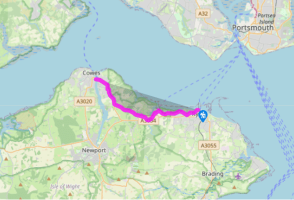
The walk starts in St Thomas Street, to the west of the pier, and picks its way up through quiet streets, then along Spencer Road. Where the road emerges onto the main road, turn right down a footpath, leaving Ryde Golf Club house on your left. This pleasant footpath descends gradually for about 0.5 miles (800m), bordered on both sides by the links of Ryde Golf Club, and then ascends to reach Binstead Church. The elegant and ordered appearance of this building belies its eventful history: part Norman, part Victorian, and part early 1970s (after a fire destroyed much of the old nave roof).
The path continues westward along a bridleway and then Quarr Road. Soon the redbrick towers of the modern Quarr Abbey come onto view.
The track continues straight on westward and, just when you are getting used to the peace and quiet of the countryside, emerges rather unexpectedly at Fishbourne ferry terminal, with all the hustle and bustle.
Turn left onto the main road here (B3331), and then take the path to the right beside the telephone box, which leads to a tree-lined lane and eventually the A3054. Turn right here and descend along the main road to Wootton Bridge.
Cross the bridge itself, with the Old Mill Pond to your left, and turn right up a track just beyond the Sloop Inn. Take the footpath ahead and at the road turn right. Turn left along a track to pass the Old School. Keep ahead, and walk past a barrier by a house called Oakcroft, up a tarmac path, which rises steadily between fences and gardens of a housing estate, passing through Wootton. Continue up and right past garages. At the road turn left and follow this uphill. Where the road bends right, veer left to pass more garages. Turn right at the end, up steps. Emerge at a road. Cross over, and continue ahead up Footways. Bear left at the end, and immediately right up Brocks Copse Road. Follow this road for about a mile. As you walk along, the road starts to descend, leaving the houses behind. It eventually descends through woodland to a bridge, by a sign for Whippingham. Ascend the other side, to pass a cluster of houses at Dallimores. Continue ahead along Alverstone Road for a further half mile, passing a row of redbrick cottages, and more houses.
At the main road (A3021) turn right and follow the pavement to walk over the brow of the hill into Whippingham. The tall square towers of Osborne House may be seen off to the right. Pass the Island Technology Park on your left. At the roundabout turn right and follow the road down the hill into East Cowes.
Pass the entrance to Osborne House and continue down past a park on the left. Pass the old redbrick Town Hall and keep ahead, following signs to reach the chain ferry, which links to West Cowes.
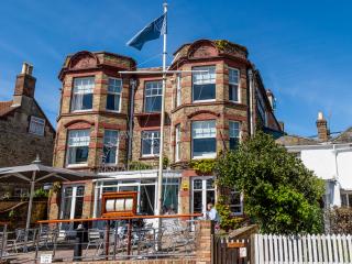
The route follows the Coastal Path (69 miles/111km), which is well signed on the ground with blue signs and a seagull symbol. Constant erosion of the island’s coastline means the path may be rerouted at any point, but this is usually clearly marked. Note that access for dogs to most of the island’s... beaches is restricted in summer. For information about bus links and timetables, see www.islandbuses.info Ryde, queen of the island’s resorts, is the traditional start point for the 69-mile (111km) round the island walk. The town is famous for its Georgian architecture and its magnificent pier, dating to 1813 and the oldest in England, which has its own railway link to collect foot passengers from the Portsmouth catamaran. You’ll also see and hear the hovercrafts which bring passengers over from Southsea. The trail takes in Quarr Abbey, an interesting spot. The name ‘Quarr’ comes from the local Binstead limestone quarry, which exported stone in the Middle Ages for both ecclesiastical and military buildings, including parts of the Tower of London. The route to the new abbey takes you through the grounds of the old one; those low-lying walls to the right are all that is left of the original Abbey of Our Lady of the Quarry, founded in 1311. The original abbey was dissolved by Henry VIII in 1537. The new abbey lies to the right of the path and is worth a quick detour. This was built early in the 20th century by a Benedictine order of monks, and is constructed of bright red bricks brought from Belgium. The second half of the route is through a housing estate and then along a minor road, rather tediously inland and then following the busy main road into East Cowes, with a steady stream of traffic passing to and from the main ferry terminal for Southampton. It passes the gates of Osborne House, the private mansion retreat of Queen Victoria and her consort, Prince Albert, built on the land which they purchased in 1845, and now cared for by English Heritage. Paying visitors can walk through to the Royal beach, but the coastal footpath has to divert inland around the estate.
Small and intimate – at just 23 miles by 13 miles, the Isle of Wight is a popular holiday destination; with its mild climate, long hours of sunshine and colourful architecture, it has something of a continental flavour. Visitors can walk along the island’s varied coastline using the well-established Coast Path or step back in time to explore the island’s history at some of the forts and castles.
The walk starts in St Thomas Street, to the west of the pier, and picks its way up through quiet streets, then along Spencer Road. Where the road emerges onto the main road, turn right down a footpath, leaving Ryde Golf Club house on your left. This pleasant footpath descends gradually for about 0.5 miles (800m), bordered on both sides by the links of Ryde Golf Club, and then ascends to reach Binstead Church. The elegant and ordered appearance of this building belies its eventful history: part Norman, part Victorian, and part early 1970s (after a fire destroyed much of the old nave roof).
1 of 7
The path continues westward along a bridleway and then Quarr Road. Soon the redbrick towers of the modern Quarr Abbey come onto view.
2 of 7
The track continues straight on westward and, just when you are getting used to the peace and quiet of the countryside, emerges rather unexpectedly at Fishbourne ferry terminal, with all the hustle and bustle.
3 of 7
Turn left onto the main road here (B3331), and then take the path to the right beside the telephone box, which leads to a tree-lined lane and eventually the A3054. Turn right here and descend along the main road to Wootton Bridge.
4 of 7
Cross the bridge itself, with the Old Mill Pond to your left, and turn right up a track just beyond the Sloop Inn. Take the footpath ahead and at the road turn right. Turn left along a track to pass the Old School. Keep ahead, and walk past a barrier by a house called Oakcroft, up a tarmac path, which rises steadily between fences and gardens of a housing estate, passing through Wootton. Continue up and right past garages. At the road turn left and follow this uphill. Where the road bends right, veer left to pass more garages. Turn right at the end, up steps. Emerge at a road. Cross over, and continue ahead up Footways. Bear left at the end, and immediately right up Brocks Copse Road. Follow this road for about a mile. As you walk along, the road starts to descend, leaving the houses behind. It eventually descends through woodland to a bridge, by a sign for Whippingham. Ascend the other side, to pass a cluster of houses at Dallimores. Continue ahead along Alverstone Road for a further half mile, passing a row of redbrick cottages, and more houses.
5 of 7
At the main road (A3021) turn right and follow the pavement to walk over the brow of the hill into Whippingham. The tall square towers of Osborne House may be seen off to the right. Pass the Island Technology Park on your left. At the roundabout turn right and follow the road down the hill into East Cowes.
6 of 7
Pass the entrance to Osborne House and continue down past a park on the left. Pass the old redbrick Town Hall and keep ahead, following signs to reach the chain ferry, which links to West Cowes.
The route follows the Coastal Path (69 miles/111km), which is well signed on the ground with blue signs and a seagull symbol. Constant erosion of the island’s coastline means the path may be rerouted at any point, but this is usually clearly marked. Note that access for dogs to most of the island’s... beaches is restricted in summer. For information about bus links and timetables, see www.islandbuses.info Ryde, queen of the island’s resorts, is the traditional start point for the 69-mile (111km) round the island walk. The town is famous for its Georgian architecture and its magnificent pier, dating to 1813 and the oldest in England, which has its own railway link to collect foot passengers from the Portsmouth catamaran. You’ll also see and hear the hovercrafts which bring passengers over from Southsea. The trail takes in Quarr Abbey, an interesting spot. The name ‘Quarr’ comes from the local Binstead limestone quarry, which exported stone in the Middle Ages for both ecclesiastical and military buildings, including parts of the Tower of London. The route to the new abbey takes you through the grounds of the old one; those low-lying walls to the right are all that is left of the original Abbey of Our Lady of the Quarry, founded in 1311. The original abbey was dissolved by Henry VIII in 1537. The new abbey lies to the right of the path and is worth a quick detour. This was built early in the 20th century by a Benedictine order of monks, and is constructed of bright red bricks brought from Belgium. The second half of the route is through a housing estate and then along a minor road, rather tediously inland and then following the busy main road into East Cowes, with a steady stream of traffic passing to and from the main ferry terminal for Southampton. It passes the gates of Osborne House, the private mansion retreat of Queen Victoria and her consort, Prince Albert, built on the land which they purchased in 1845, and now cared for by English Heritage. Paying visitors can walk through to the Royal beach, but the coastal footpath has to divert inland around the estate.
Small and intimate – at just 23 miles by 13 miles, the Isle of Wight is a popular holiday destination; with its mild climate, long hours of sunshine and colourful architecture, it has something of a continental flavour. Visitors can walk along the island’s varied coastline using the well-established Coast Path or step back in time to explore the island’s history at some of the forts and castles.