Otterburn's battlefields

NEAREST LOCATION

Otterburn

RECOMMENDED BY
DISTANCE

5 miles (8kms)

ASCENT
390ft (119m)
TIME
2hrs
GRADIENT
DIFFICULTY
Hard
STARTING POINT
NY889929

About the walk

Until the mid-19th century, Otterburn was a hamlet hidden away in the Northumbrian moors. The main coach route from London to Edinburgh passed through Wooler and Coldstream, but by 1841, the Newcastle to Jedburgh road had been extended to Edinburgh, and Otterburn became an important staging post on that route.

The Battle of Otterburn

The fame of Otterburn, however, rests on the battle fought there in 1388. This period was characterised by unrest along the Scottish border and frequent incursions by both English and Scots. In response to an invasion by the English three years earlier, a force of some 50,000 Scottish soldiers crossed the border in two divisions. The main force crossed near Carlisle. A smaller, diversionary force of 300 cavalry and 2,000 foot soldiers, under the earls of Douglas, Moray and Dunbar, attacked through Northumberland.

Having reached as far south as Durham, the eastern division, laden with plunder, returned north. At Newcastle, they engaged in a series of skirmishes with a force led by the Earl of Northumberland’s son, Sir Henry Percy, nicknamed 'Hotspur' because of his lightning raids against the Scots. During one of these encounters, Douglas captured Hotspur’s pennant and threatened to raise it on his own castle.

Harry Hotspur

To avenge this gross insult, Hotspur pursued Douglas northward and caught up with him at Otterburn. Heavily outnumbering the Scots, Percy's army attacked their position on the moonlit night of 19 August. During the battle, Douglas was mortally wounded, but the Scots fought so well that Percy was captured and held to ransom. An estimated 100 Scots were killed compared with more than 1,000 English. Otterburn became known as the battle that was won by a dead man. It inspired the ballad Chevy Chase, one of the earliest poems in the English language.

Harry Hotspur, together with his father and brother, helped depose Richard II and replace him with Henry IV. He later turned against the King, and died at the Battle of Shrewsbury in 1403. He is immortalised as a character in two of Shakespeare’s plays, Richard II and Henry IV.

Today’s warriors

Modern warfare also finds a place at Otterburn. In 1911 the War Office bought 19,000 acres (7,695ha) of land to the north for use as an artillery range. The Otterburn Training Area was extended during World War II and now covers 58,000 acres (23,490ha), about one fifth of the total area of the Northumberland National Park. It is the largest firing range in the UK. The walk touches the southwest fringe of the range, but is well outside the perimeter for live firing. Access to the main training camp used to be through Otterburn village, but, since the introduction of training for mobile heavy artillery units, has been moved to a less intrusive route direct from the A68 to the northwest.

Walk directions

Follow the main road through Otterburn. Take the first right beyond St John's Church. After 0.25 miles (400m), at the top of a rise, take a track off to the left. Walk ahead through a farmyard and continue at the edge of successive fields, the boundary first on the left and then the right. Keep going forward beyond its eventual corner, making for a gate in the far wall.

Pass onto the open moor and maintain your heading, climbing past the right edge of a sparse group of trees. Picking up a path, carry on to meet a fell lane. Follow it right over a cattle grid and around a bend.

After 100yds (91m) at a signpost, turn off right along a bridleway, passing an old sheep pen, towards a range perimeter notice and gate in the middle distance. There, continue the line across a trackless moor, losing height to reach a hand gate about 0.25 miles (400m) away. Drop across the deep fold of Gill Sike, climbing beyond to meet a crossing path by a waypost. Keep ahead, dipping through Fairney Cleugh, where a footbridge spans the stream. Keep heading northeast across the moor for another 0.25 miles (400m) to a gate in a fence. Walk forward out to a lane.

Follow the lane right for 0.75 miles (1.2km), passing Hopefoot Farm. Later swing sharp left over Otter Burn and climb through trees to a junction with the old Otterburn Camp access road. Head right downhill, bending over another bridge to recross the burn at the bottom.

Just beyond, opposite the lodge to Otterburn Hall, leave left through a kissing gate. Strike away across a rough field in the direction indicated by the fingerpost. Through another kissing gate in the corner, follow a path to the right, passing behind a sports hall. Shortly abandoning the fence, continue above the stream, crossing a couple of side bridges and then passing through a kissing gate. Beyond a wooded bank, the path emerges through a final gate behind houses. Walk out to the main road opposite the Percy Arms and turn left through the village to the lay-by.

Additional information
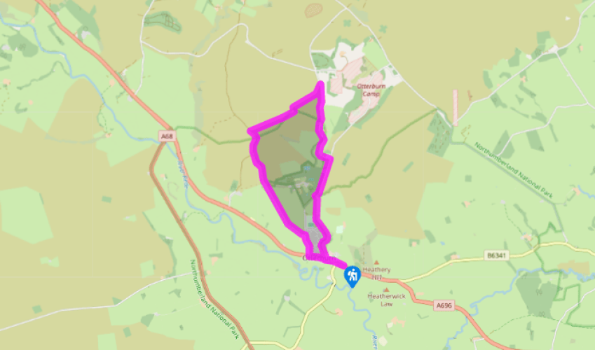
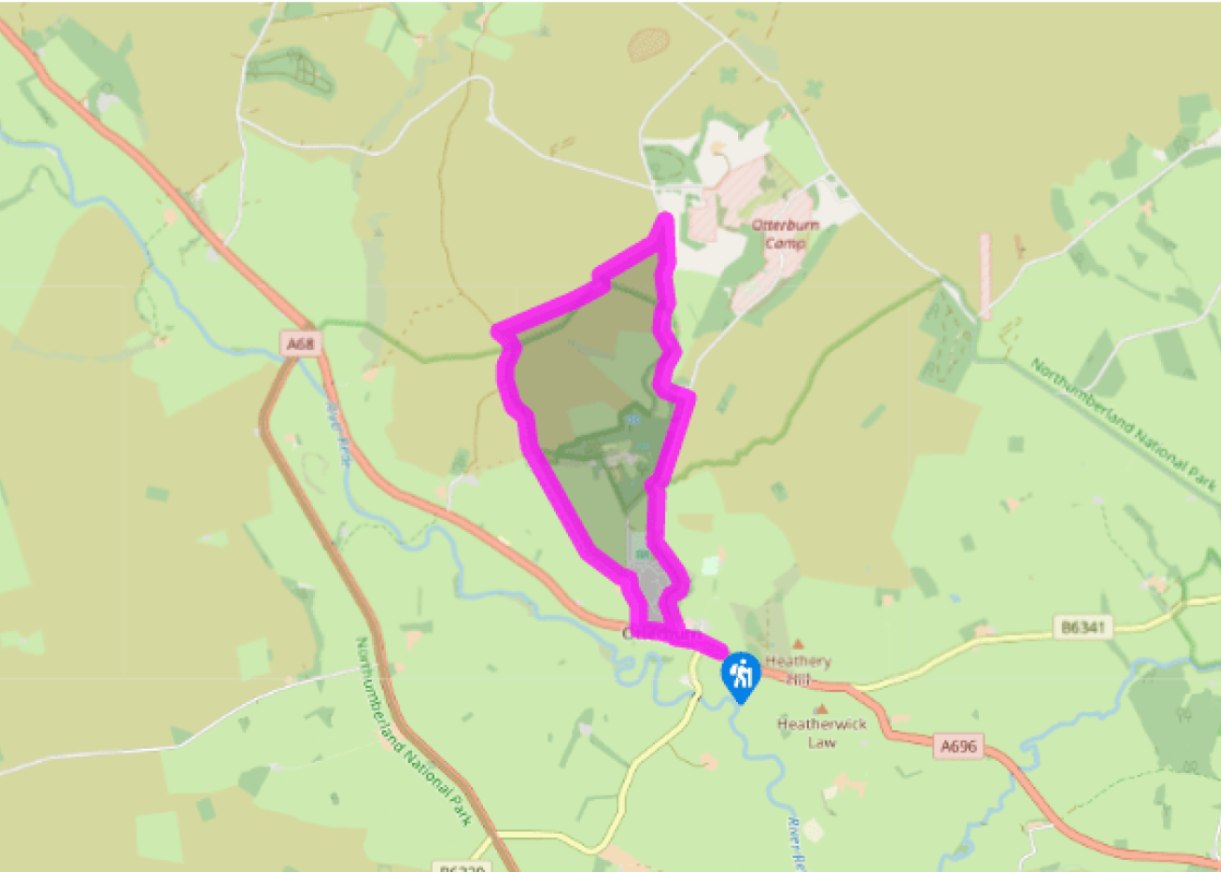
Bridleway, trackless moorland and metalled road, no stiles

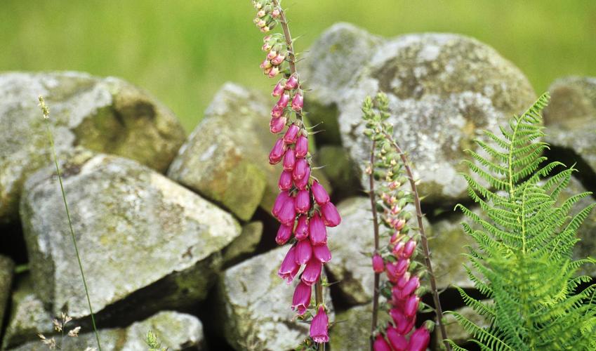
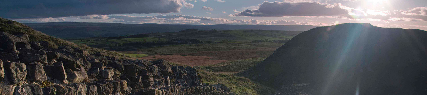
Open moorland with extensive views

Keep on lead on roads and near sheep

OS Explorer OL42 Kielder Water & Forest

Roadside lay-by on A696 at eastern end of Otterburn village

Beside bridge in Otterburn

Been on this walk?

Send us photos or a comment about this route.

Know a good walk?

Share your route with us.

WALKING IN SAFETY

Read our tips to look after yourself and the environment when following this walk.

Find out more

About the area

Discover Northumberland

If it’s history you’re after, there’s heaps of it in Northumberland. On Hadrian’s Wall you can imagine scarlet-cloaked Roman legionaries keeping watch for painted Pictish warriors while cursing the English weather and dreaming of home. Desolate battlefield sites and hulking fortresses such as Alnwick, Dunstanburgh, Bamburgh and Warkworth are reminders that this, until not so very long ago, was a contested border region. The ruins of Lindisfarne bear witness to the region’s early Christian history.

Northumberland also has some of Britain’s best beaches. On summer days, and even in winter, you’ll see surfers and other brave souls making the most of the coast. Inland, there are some great walks and bike rides in the dales of the Cheviot Hills and the Simonsides – just hilly enough to be interesting, without being brutally steep. There's dramatic scenery in the High Pennines, where waterfalls plunge into deep valleys, and there are swathes of heather-scented moorland. Northumberland National Park covers over 400 square miles of moorland and valleys with clear streams and pretty, stone-built villages. It’s just the place for wildlife watching too. You’ll find flocks of puffins, guillemots and other seabirds around the Farne Islands, and seals and dolphins offshore.

Why choose Rated Trips?

Your trusted guide to rated places across the UK
icon example
The best coverage

Discover more than 15,000 professionally rated places to stay, eat and visit from across the UK and Ireland.

icon example
Quality assured

Choose a place to stay safe in the knowledge that it has been expertly assessed by trained assessors.

icon example
Plan your next trip

Search by location or the type of place you're visiting to find your next ideal holiday experience.

icon example
Travel inspiration

Read our articles, city guides and recommended things to do for inspiration. We're here to help you explore the UK.