"Explore a prominent hilltop in east Leicestershire, once home to Iron Age tribes."
Walk directions
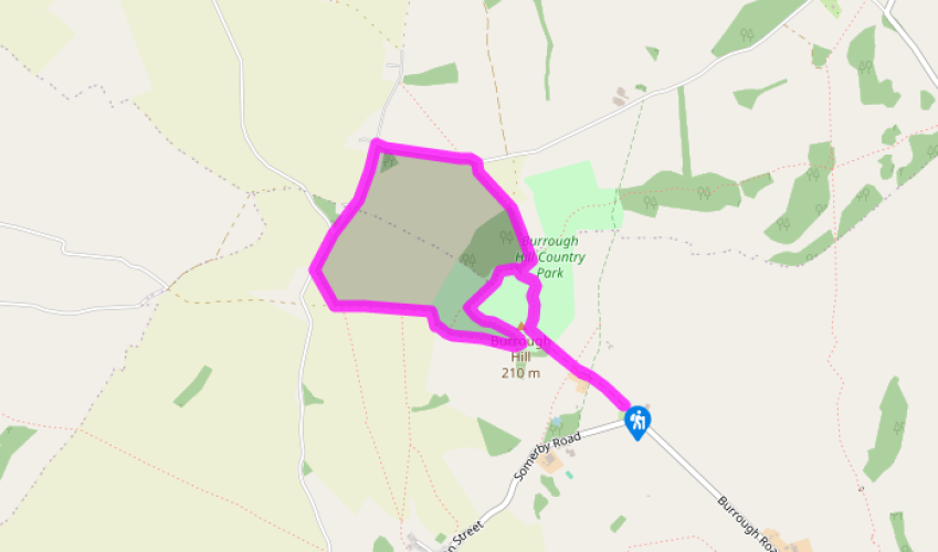
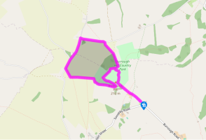
Walk out of the car park along the wide gated track past a riding stables all the way to the hill-fort at the far end. Go up and on to the earthworks that crown the summit of the hill and head right, towards the trig point, to go around the grassy ramparts in an anti-clockwise direction past the toposcope.
Continue all the way around the embankment until you’re facing the gate you entered by. Turn hard right and drop down the wide sunken track amid gorse bushes. This swings gently round and below the western edge of the hill, with the toposcope now above. At the end go through two gates for a wide path that heads right, around the field ahead. Follow this across to the far side, but before you reach the lane go through a gap in the hedge on the right for a short path, clearly indicated, across the corner of the adjoining field.
Go through another gap in the hedge and turn right, into the lane, and walk this for 0.5 miles (800m), going straight on at the junction (signposted ‘Little Dalby’). Follow the lane as it swings right at Moscow Farm, opposite a row of handsome brick sheds.
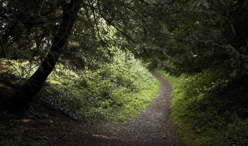
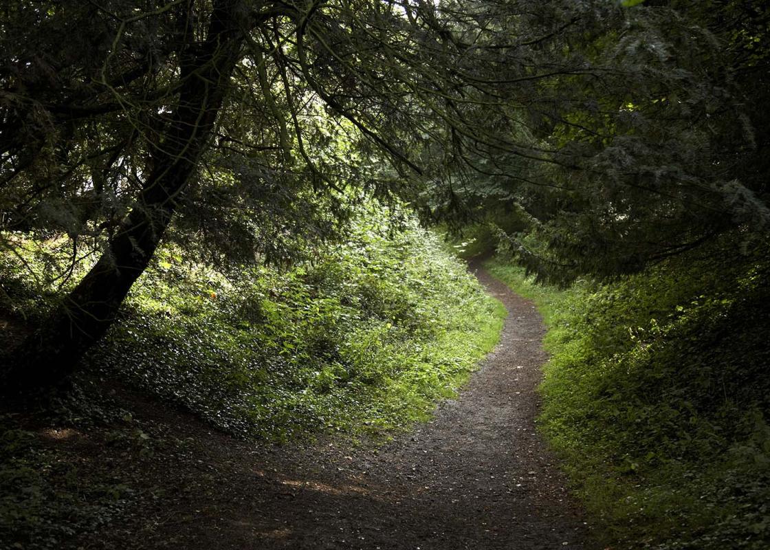
About 420yds (384m) beyond the farm turn right for a public footpath along the right-hand edge of a rising field. It continues through undergrowth to the left of a small area of woodland called Burrough Hill Covert. This steepens towards the top and the presence of a small spring can make the upper section, which is also used by horse riders and mountain bikers, a bit boggy.
Go through a set of double gates and continue up the steep, grassy path straight ahead, following the bottom of a small valley back into the country park. The ancient defences are high above to your right. When you reach the very top turn right and either follow the yellow-painted posts across the pasture for the main gate and the track back to the car park, or wander back over to the ramparts once more.
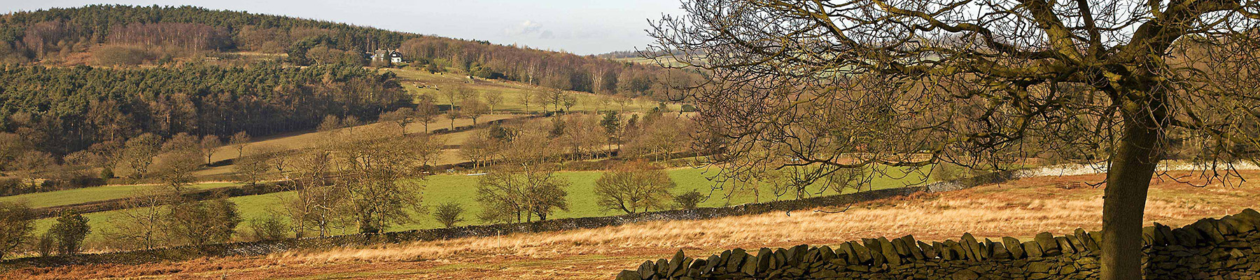
Burrough Hill is a small country park managed by Leicestershire County Council since 1970 and access is via a car park off the road between Burrough on the Hill and Somerby. At 690ft (210m) it’s one of the highest points in the east of the county, with sweeping views over the surrounding... countryside, which might explain why it was inhabited 2,000 years ago. Defensive position and meeting place The hilltop is ringed by the remains of a late Iron Age hill-fort, with pottery fragments suggesting that it was occupied from the last few centuries BC through to the 4th century AD, as Roman coins have also been found here. The hill-fort has a deep ditch and broad ramparts, which although faced by turf were actually built of stone that much later was plundered for road-building. If similar to other hill-forts of the same era, the embankment was likely topped by a high wooden fence with a timber gate. It would have been used as a place of refuge for local settlers and their livestock in times of attack, but it was also probably a place for other activities like festivals, ceremonies and trading, as well as emphasising the power and standing of individual tribes. A stretch of cobbled surface and the foundations of what might have been a guard house were unearthed near the main entrance to the fort, and quernstones (like later mill stones, used for grinding corn and making flour) were also found on the site. Near Burrough Hill Covert, a wooded slope on the edge of the fort, further pottery and a pit containing the bones of pigs, cows, sheep and horses have been discovered. However, since no detailed archaeological research has been carried out, the precise history of the late Iron Age hill-fort is still unclear – but perhaps that’s not such a bad thing after all. The absence of modern interpretation boards at every turn encourages us to use our imaginations and envisage what it must have been like in previous ages. A racing certainty In modern times the hilltop was the scene of sports events and hunting. In the 19th century the Somerby and Burrough Hill race meetings were held here, with crowds of spectators lining the slopes to watch the horses being ridden around in the arena below. The name of the well-known recent racehorse Burrough Hill Lad also remembers this connection. The hilltop location is certainly a great vantage point and the toposcope on the summit helps you identify the far-off sights. Leicester and Melton Mowbray are reasonably close to hand, but you will have to have good eyesight (and perhaps quite an imagination) to locate Boston Stump or Lincoln Cathedral, both over 40 miles (64m) distant.
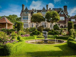
Leicestershire is divided between the large country estates of its eastern side and the industrial towns of the East Midlands to its west. Coal mining was an important part of the county’s industrial development in the 19th and 20th centuries.
"Explore a prominent hilltop in east Leicestershire, once home to Iron Age tribes."
Walk details
1hr 30min
Difficulty:
Medium
Gradient:
Moderate
Distance:
3.5 miles (5.7kms)
Ascent:
295ft (90m)
Walk directions
Walk out of the car park along the wide gated track past a riding stables all the way to the hill-fort at the far end. Go up and on to the earthworks that crown the summit of the hill and head right, towards the trig point, to go around the grassy ramparts in an anti-clockwise direction past the toposcope.
1 of 5
Continue all the way around the embankment until you’re facing the gate you entered by. Turn hard right and drop down the wide sunken track amid gorse bushes. This swings gently round and below the western edge of the hill, with the toposcope now above. At the end go through two gates for a wide path that heads right, around the field ahead. Follow this across to the far side, but before you reach the lane go through a gap in the hedge on the right for a short path, clearly indicated, across the corner of the adjoining field.
2 of 5
Go through another gap in the hedge and turn right, into the lane, and walk this for 0.5 miles (800m), going straight on at the junction (signposted ‘Little Dalby’). Follow the lane as it swings right at Moscow Farm, opposite a row of handsome brick sheds.
3 of 5
About 420yds (384m) beyond the farm turn right for a public footpath along the right-hand edge of a rising field. It continues through undergrowth to the left of a small area of woodland called Burrough Hill Covert. This steepens towards the top and the presence of a small spring can make the upper section, which is also used by horse riders and mountain bikers, a bit boggy.
4 of 5
Go through a set of double gates and continue up the steep, grassy path straight ahead, following the bottom of a small valley back into the country park. The ancient defences are high above to your right. When you reach the very top turn right and either follow the yellow-painted posts across the pasture for the main gate and the track back to the car park, or wander back over to the ramparts once more.
Burrough Hill is a small country park managed by Leicestershire County Council since 1970 and access is via a car park off the road between Burrough on the Hill and Somerby. At 690ft (210m) it’s one of the highest points in the east of the county, with sweeping views over the surrounding... countryside, which might explain why it was inhabited 2,000 years ago. Defensive position and meeting place The hilltop is ringed by the remains of a late Iron Age hill-fort, with pottery fragments suggesting that it was occupied from the last few centuries BC through to the 4th century AD, as Roman coins have also been found here. The hill-fort has a deep ditch and broad ramparts, which although faced by turf were actually built of stone that much later was plundered for road-building. If similar to other hill-forts of the same era, the embankment was likely topped by a high wooden fence with a timber gate. It would have been used as a place of refuge for local settlers and their livestock in times of attack, but it was also probably a place for other activities like festivals, ceremonies and trading, as well as emphasising the power and standing of individual tribes. A stretch of cobbled surface and the foundations of what might have been a guard house were unearthed near the main entrance to the fort, and quernstones (like later mill stones, used for grinding corn and making flour) were also found on the site. Near Burrough Hill Covert, a wooded slope on the edge of the fort, further pottery and a pit containing the bones of pigs, cows, sheep and horses have been discovered. However, since no detailed archaeological research has been carried out, the precise history of the late Iron Age hill-fort is still unclear – but perhaps that’s not such a bad thing after all. The absence of modern interpretation boards at every turn encourages us to use our imaginations and envisage what it must have been like in previous ages. A racing certainty In modern times the hilltop was the scene of sports events and hunting. In the 19th century the Somerby and Burrough Hill race meetings were held here, with crowds of spectators lining the slopes to watch the horses being ridden around in the arena below. The name of the well-known recent racehorse Burrough Hill Lad also remembers this connection. The hilltop location is certainly a great vantage point and the toposcope on the summit helps you identify the far-off sights. Leicester and Melton Mowbray are reasonably close to hand, but you will have to have good eyesight (and perhaps quite an imagination) to locate Boston Stump or Lincoln Cathedral, both over 40 miles (64m) distant.
Leicestershire is divided between the large country estates of its eastern side and the industrial towns of the East Midlands to its west. Coal mining was an important part of the county’s industrial development in the 19th and 20th centuries.