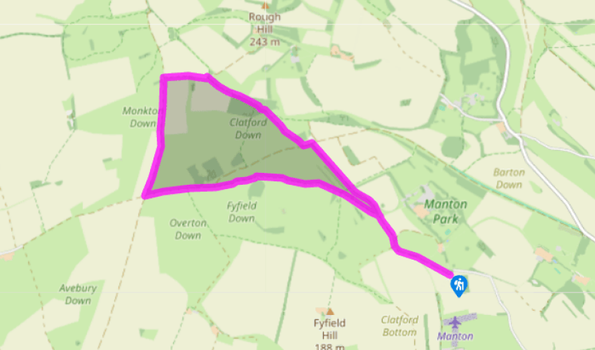
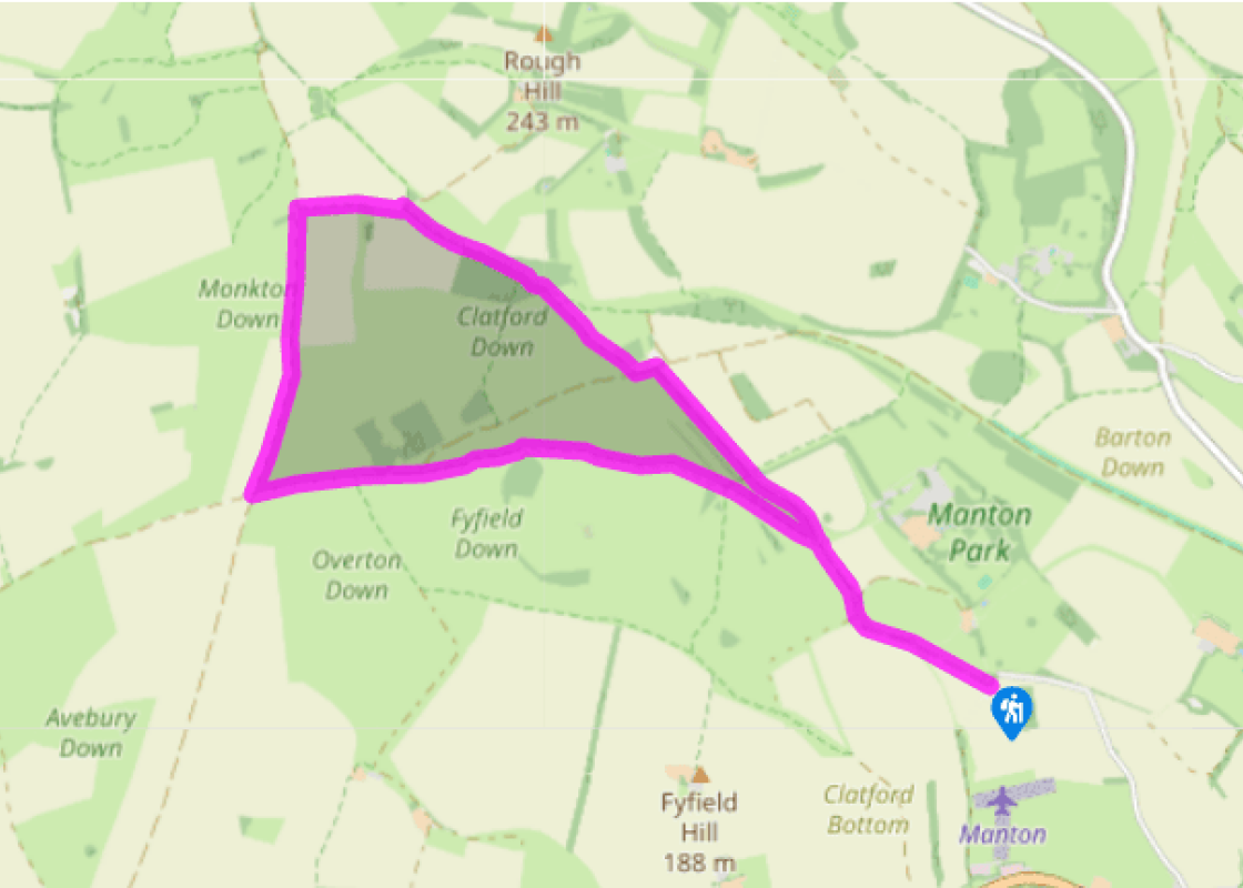
Leave the car park by the track in the top right-hand corner, signposted ‘White Horse Trail to Avebury and Hackpen’. Follow the track right and shortly fork left, continuing between high hedges.
Pass a private road to Manton House on the right. Stay on the gently rising track and continue straight on between the gallops on Clatford Down, with good views. On reaching a T-junction by a covered reservoir, turn left along the Herepath (Green Street).
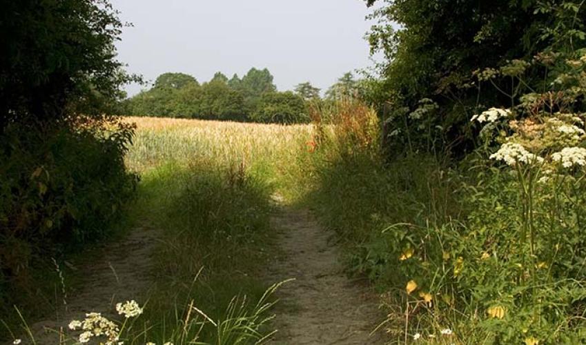
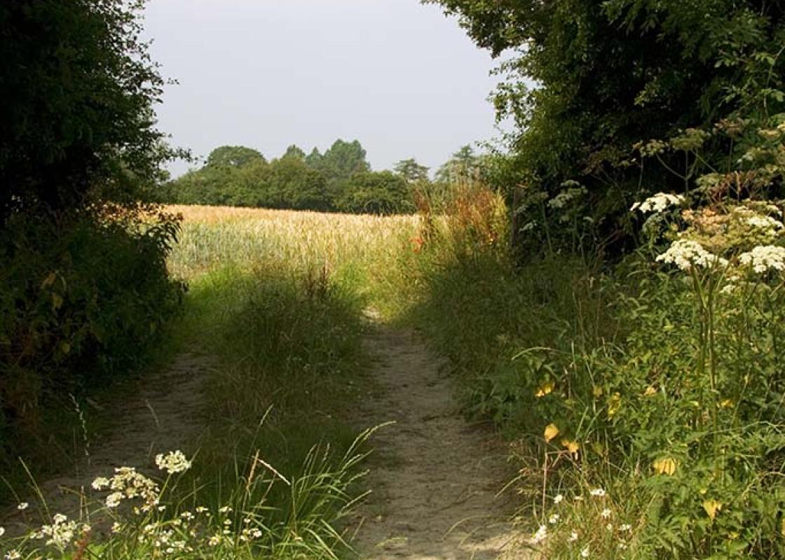
Shortly, turn right through a gate waymarked ‘Hackpen’, to join a grassy track alongside a conifer plantation, then head across pasture to a gate into conservation woodland. Follow the track (can be muddy) through the sparse woodland, passing a Natural England signboard in the middle. Reach the edge of the wood, cross over a track and keep straight ahead between hedges along the right-hand field-edge.
At a crossing of tracks, turn left through a gate by a cattle grid and walk parallel to the track. Keep to the right of gates ahead, and follow the grassy track straight ahead. Cross a gallop via two gates and reach the Ridgeway track, with views to the tumuli on Monkton Down to your right. Turn left and follow the rutted track along the escarpment and gently downhill for 0.75 miles (1.2km), enjoying extensive views to the west.
At the crossways by an information board, turn left to go through a gate and on to Fyfield Down. Proceed along a grassy track and cross a gallop via three gates. This is prime racehorse-training country and there are many racing stables in the area. Continue to the right of a wood, then in the valley bottom, fork right off the gravel track and ascend a grassy track, passing more sarsen stones.
At the top, go through a gate at the corner of a wooded enclosure and turn right along the field-edge. Pass through a gate in the bottom corner and continue straight on across grassland on a defined track. Pass a redundant gate, then follow the curving path round to the right over a further gallop to a furlong pole at the end of a line of trees. Swing left over a broad green gallop to a waymarker post beside a standing sarsen.
Bear half right diagonally across two broad gallops, and go through the gap in the hedge to reach the track. Turn right and follow the outward route back to the car park.
A feature of Fyfield Down and neighbouring Overton Down are the sarsen stones that litter this intriguing chalk limestone landscape. Sarsens are natural deposits of extremely hard siliceous sandstone that derive from Tertiary deposits, later eroded and moved by glaciation some 25 million years ago.... Although found elsewhere, they are not on the scale seen in the Marlborough district. Sarsens are also known as ‘druid stones’ or ‘grey wethers’, the latter due to their resemblance at a distance to a flock of sheep, the word ‘wether’ coming from the Old English for sheep. Sarsens have been of great importance to humans since prehistoric times. The hard flints were used to make hand axes and other useful tools during the Bronze Age. From the 5th century ad to the mid-19th century, sarsens were used for building stone, constructing the nearby villages of West Overton and Lockeridge, gateposts, and as paving stones and tramway setts. More importantly, Fyfield Down was the stone quarry supplying Avebury stone circle and possibly Stonehenge. Stones weighing as much as 40 tons were dug up, sometimes shaped, and dragged over the downs by hundreds of people pulling them on wooden rollers with woven grass ropes. In 1956 Fyfield Down was declared a National Nature Reserve, not only to protect this fine stretch of natural downland and Britain’s best assemblage of sarsen stones, which support nationally important lichens, but also to preserve the extensive prehistoric field systems that exist here. Ancient byways Two historic trackways are encountered on this downland circuit. The first, the Herepath, is an ancient east–west route across the Marlborough Downs. The name is derived from the Old English word ‘here’ meaning an army or multitude. It suggests that this may have been one of the defensive routes established by King Alfred in the 9th century AD in his struggle with the Danes. Today it forms part of the Wessex Ridgeway route, which crosses our circuit at points 3 and 5. The Ridgeway is an ancient highway incorporating a complicated network of green lanes, and follows a natural route on high ground. It was used as a drove road or trading route and served as a convenient means for invaders, peaceful or warlike, to penetrate the heartland of southern England before Anglo-Saxon times. The 87-mile (140km) Ridgeway National Trail forms only part of the route, although by linking several trails you can walk the entire route up through Oxfordshire and into Buckinghamshire.
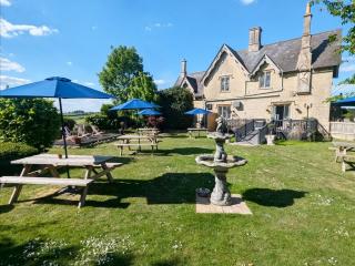
Wiltshire’s charm lies in the beauty of its countryside, with expansive chalk landscapes of the Marlborough and Pewsey downs and miles of uninterrupted views deep into Dorset, Somerset and the Cotswolds. Stroll through quaint timbered and thatched villages in the southern Woodford and Avon valleys and explore the historic streets of the stone villages of Lacock, Castle Combe and Sherston.
Leave the car park by the track in the top right-hand corner, signposted ‘White Horse Trail to Avebury and Hackpen’. Follow the track right and shortly fork left, continuing between high hedges.
1 of 7
Pass a private road to Manton House on the right. Stay on the gently rising track and continue straight on between the gallops on Clatford Down, with good views. On reaching a T-junction by a covered reservoir, turn left along the Herepath (Green Street).
2 of 7
Shortly, turn right through a gate waymarked ‘Hackpen’, to join a grassy track alongside a conifer plantation, then head across pasture to a gate into conservation woodland. Follow the track (can be muddy) through the sparse woodland, passing a Natural England signboard in the middle. Reach the edge of the wood, cross over a track and keep straight ahead between hedges along the right-hand field-edge.
3 of 7
At a crossing of tracks, turn left through a gate by a cattle grid and walk parallel to the track. Keep to the right of gates ahead, and follow the grassy track straight ahead. Cross a gallop via two gates and reach the Ridgeway track, with views to the tumuli on Monkton Down to your right. Turn left and follow the rutted track along the escarpment and gently downhill for 0.75 miles (1.2km), enjoying extensive views to the west.
4 of 7
At the crossways by an information board, turn left to go through a gate and on to Fyfield Down. Proceed along a grassy track and cross a gallop via three gates. This is prime racehorse-training country and there are many racing stables in the area. Continue to the right of a wood, then in the valley bottom, fork right off the gravel track and ascend a grassy track, passing more sarsen stones.
5 of 7
At the top, go through a gate at the corner of a wooded enclosure and turn right along the field-edge. Pass through a gate in the bottom corner and continue straight on across grassland on a defined track. Pass a redundant gate, then follow the curving path round to the right over a further gallop to a furlong pole at the end of a line of trees. Swing left over a broad green gallop to a waymarker post beside a standing sarsen.
6 of 7
Bear half right diagonally across two broad gallops, and go through the gap in the hedge to reach the track. Turn right and follow the outward route back to the car park.
A feature of Fyfield Down and neighbouring Overton Down are the sarsen stones that litter this intriguing chalk limestone landscape. Sarsens are natural deposits of extremely hard siliceous sandstone that derive from Tertiary deposits, later eroded and moved by glaciation some 25 million years ago.... Although found elsewhere, they are not on the scale seen in the Marlborough district. Sarsens are also known as ‘druid stones’ or ‘grey wethers’, the latter due to their resemblance at a distance to a flock of sheep, the word ‘wether’ coming from the Old English for sheep. Sarsens have been of great importance to humans since prehistoric times. The hard flints were used to make hand axes and other useful tools during the Bronze Age. From the 5th century ad to the mid-19th century, sarsens were used for building stone, constructing the nearby villages of West Overton and Lockeridge, gateposts, and as paving stones and tramway setts. More importantly, Fyfield Down was the stone quarry supplying Avebury stone circle and possibly Stonehenge. Stones weighing as much as 40 tons were dug up, sometimes shaped, and dragged over the downs by hundreds of people pulling them on wooden rollers with woven grass ropes. In 1956 Fyfield Down was declared a National Nature Reserve, not only to protect this fine stretch of natural downland and Britain’s best assemblage of sarsen stones, which support nationally important lichens, but also to preserve the extensive prehistoric field systems that exist here. Ancient byways Two historic trackways are encountered on this downland circuit. The first, the Herepath, is an ancient east–west route across the Marlborough Downs. The name is derived from the Old English word ‘here’ meaning an army or multitude. It suggests that this may have been one of the defensive routes established by King Alfred in the 9th century AD in his struggle with the Danes. Today it forms part of the Wessex Ridgeway route, which crosses our circuit at points 3 and 5. The Ridgeway is an ancient highway incorporating a complicated network of green lanes, and follows a natural route on high ground. It was used as a drove road or trading route and served as a convenient means for invaders, peaceful or warlike, to penetrate the heartland of southern England before Anglo-Saxon times. The 87-mile (140km) Ridgeway National Trail forms only part of the route, although by linking several trails you can walk the entire route up through Oxfordshire and into Buckinghamshire.
Wiltshire’s charm lies in the beauty of its countryside, with expansive chalk landscapes of the Marlborough and Pewsey downs and miles of uninterrupted views deep into Dorset, Somerset and the Cotswolds. Stroll through quaint timbered and thatched villages in the southern Woodford and Avon valleys and explore the historic streets of the stone villages of Lacock, Castle Combe and Sherston.