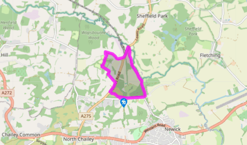
"From a heathland common pass the Bluebell Railway’s southern terminus and walk alongside the River Ouse."
Walk directions
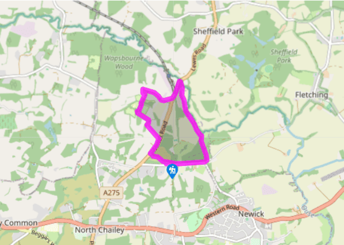
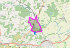
With the road to your left take the exit by the information board, heading half right, on a wide path that goes under power lines and gently descends. Where the main path bends right, go forward and maintain this direction to the main road, entering the trees about 50yds (46m) to the right of the power lines. In the tress find a gate (this may seasonally be blocked by fallen branches) and emerge on the A275.
Cross to a kissing gate opposite into a field and follow waymarkers down, over a stream and forward on the track, bearing to the right under the power lines. Follow marker arrows down along woods, through a small gate and straight on at a track junction (to the left is a picnic area of Wowo campsite), along an avenue of trees to reach a bridge.
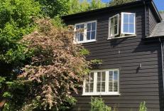
Keep ahead and go to the right of a barn and weave through the campsite's farmyard, noting the timber-framed Wapsbourne farmhouse on your right. Past this go right (ignoring a left fork) and along a metalled track.
Just before the road, the A275, bear left to walk inside the field and parallel to the road. At the end go down steps, cross the road and turn left along it as far as the entrance to the Bluebell Railway.
Opposite this go right to descend steps and over a stile, signposted ‘Sussex Ouse Valley Way’. The path roughly follows the banks of the River Ouse but cuts out many of its meanders. Through a gate and over a footbridge the path veers right into Rotherfield Wood. Immediately fork left, rise up under the power lines by a pylon, and go over a cross-track. Ascend to the crest and pass between gates to a road, via a hand gate.
Turn right to follow Mill Lane and at a junction continue ahead, signposted ‘Sheffield Park’, Rotherfield Wood on your right. Just after the brick parapets where the road crosses over the overgrown railway trackbed, take a path through a gate on the right and follow the powers to the car park.
Terrain
- Paths through fields and commons, short stretches of road and lane, 2 stiles
Landscape
- Heathland, rolling countryside and the valley of the River Ouse
Dog friendliness
- On lead in livestock fields and along roads and lanes, particularly the A275
Parking
- Lane End Common car park
Toilets en route
- None on route
About the walk
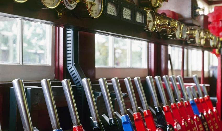
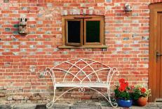
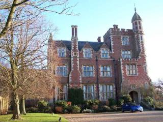
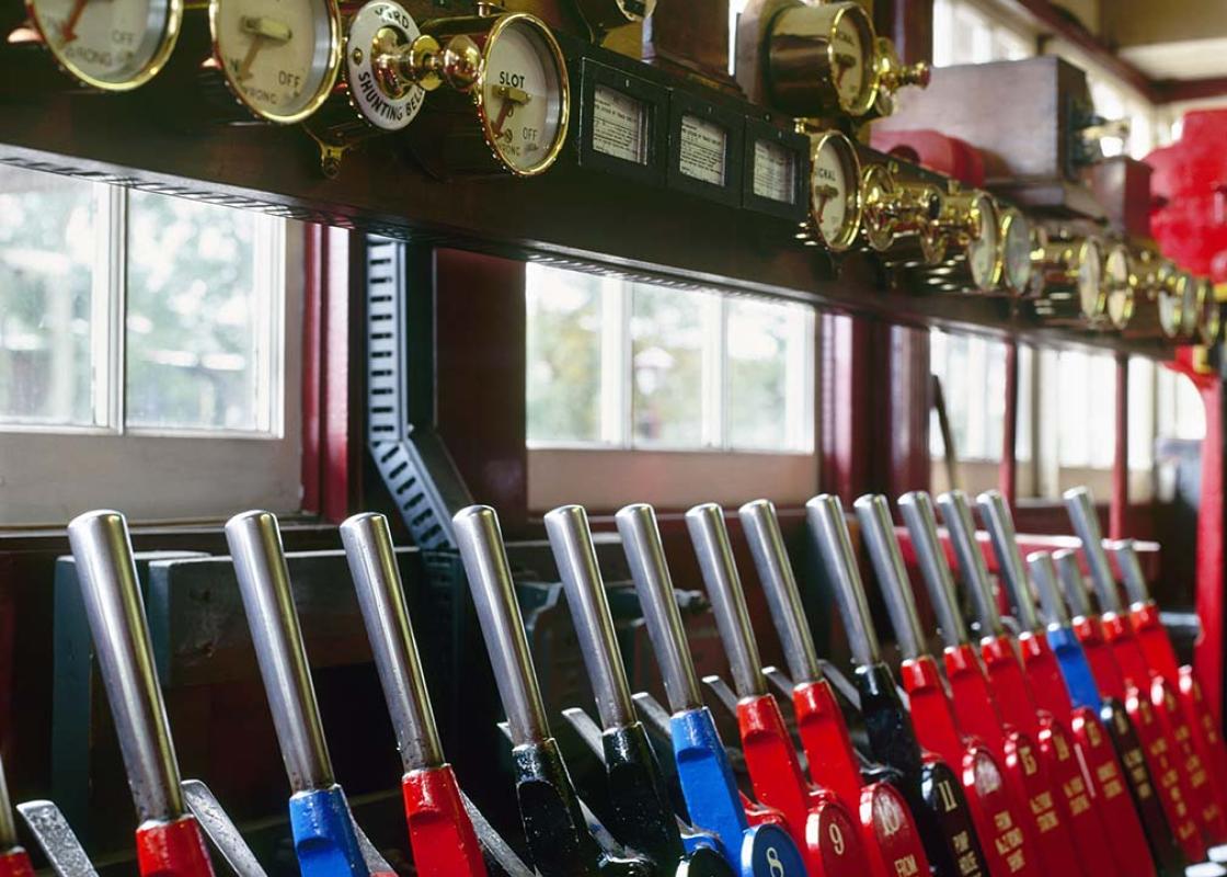
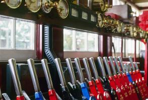
The walk passes the entrance to the southern terminus of the Bluebell Railway, which runs for 11 miles (17.5km) through the prettiest Sussex countryside to East Grinstead. Following a massive volunteer effort over many years to move a mountain of landfill that had been dumped on the track, this... pioneer of preserved steam locomotion and heritage railways was extended in 2013 to East Grinstead to link up with the national network. Originally opened in 1882 as the Lewes and East Grinstead Railway, the line carried passengers as well as agricultural produce, milk, coal and timber. Its last years under British Railways in the 1950s were bitter, with locals vigorously fighting closure, eventually in vain as the line was finally closed in 1958. The cumbersomely-named Lewes and East Grinstead Railway Preservation Society was set up, soon renamed the Bluebell Railway, and after much hard work the first train arrived under its own steam at Sheffield Park Station in May 1960. It was the first preserved standard gauge passenger railway – not just in England but in the whole world. Since then it has gone from strength to strength, expanding its steam locomotive stock from two small tank engines to over twenty, including top link express locomotives. Located in the old Southern Railway area, it focuses on locomotives, carriages and wagons from that region, as you would expect. It makes a wonderful day out and runs services almost all year round (www.bluebell-railway.co.uk). Wowo and Wapsbourne The walk passes Wapsbourne farmhouse, whose farm buildings and southern fields are used by the camping organization Wowo. Their tents range from tepees and Mongolian yurts to more conventional ones. It looks tremendous fun, as they believe in campfires and sing-songs, and favour family group camping. Wapsbourne farmhouse itself is one of those tall picturesque Sussex farmhouses with square panel timber framing, mullioned windows with old leaded lights, and a roof clad in Horsham stone slabs. These are a great weight when compared with roof tiles, and require a robust roof and frame to support them. The whole ensemble of this 16th-century farmhouse with its massive 17th-century brick chimneystacks is highly evocative of the superb yeoman houses that dot the Weald.
"From a heathland common pass the Bluebell Railway’s southern terminus and walk alongside the River Ouse."
Walk details
1hr 30min
Difficulty:
Easy
Gradient:
Gentle
Distance:
3.5 miles (5.7kms)
Ascent:
105ft (32m)
Walk directions
With the road to your left take the exit by the information board, heading half right, on a wide path that goes under power lines and gently descends. Where the main path bends right, go forward and maintain this direction to the main road, entering the trees about 50yds (46m) to the right of the power lines. In the tress find a gate (this may seasonally be blocked by fallen branches) and emerge on the A275.
1 of 6
Cross to a kissing gate opposite into a field and follow waymarkers down, over a stream and forward on the track, bearing to the right under the power lines. Follow marker arrows down along woods, through a small gate and straight on at a track junction (to the left is a picnic area of Wowo campsite), along an avenue of trees to reach a bridge.
2 of 6
Keep ahead and go to the right of a barn and weave through the campsite's farmyard, noting the timber-framed Wapsbourne farmhouse on your right. Past this go right (ignoring a left fork) and along a metalled track.
3 of 6
Just before the road, the A275, bear left to walk inside the field and parallel to the road. At the end go down steps, cross the road and turn left along it as far as the entrance to the Bluebell Railway.
4 of 6
Opposite this go right to descend steps and over a stile, signposted ‘Sussex Ouse Valley Way’. The path roughly follows the banks of the River Ouse but cuts out many of its meanders. Through a gate and over a footbridge the path veers right into Rotherfield Wood. Immediately fork left, rise up under the power lines by a pylon, and go over a cross-track. Ascend to the crest and pass between gates to a road, via a hand gate.
5 of 6
Turn right to follow Mill Lane and at a junction continue ahead, signposted ‘Sheffield Park’, Rotherfield Wood on your right. Just after the brick parapets where the road crosses over the overgrown railway trackbed, take a path through a gate on the right and follow the powers to the car park.
Terrain
- Paths through fields and commons, short stretches of road and lane, 2 stiles
Landscape
- Heathland, rolling countryside and the valley of the River Ouse
Dog friendliness
- On lead in livestock fields and along roads and lanes, particularly the A275
Parking
- Lane End Common car park
Toilets en route
- None on route
About the walk
The walk passes the entrance to the southern terminus of the Bluebell Railway, which runs for 11 miles (17.5km) through the prettiest Sussex countryside to East Grinstead. Following a massive volunteer effort over many years to move a mountain of landfill that had been dumped on the track, this... pioneer of preserved steam locomotion and heritage railways was extended in 2013 to East Grinstead to link up with the national network. Originally opened in 1882 as the Lewes and East Grinstead Railway, the line carried passengers as well as agricultural produce, milk, coal and timber. Its last years under British Railways in the 1950s were bitter, with locals vigorously fighting closure, eventually in vain as the line was finally closed in 1958. The cumbersomely-named Lewes and East Grinstead Railway Preservation Society was set up, soon renamed the Bluebell Railway, and after much hard work the first train arrived under its own steam at Sheffield Park Station in May 1960. It was the first preserved standard gauge passenger railway – not just in England but in the whole world. Since then it has gone from strength to strength, expanding its steam locomotive stock from two small tank engines to over twenty, including top link express locomotives. Located in the old Southern Railway area, it focuses on locomotives, carriages and wagons from that region, as you would expect. It makes a wonderful day out and runs services almost all year round (www.bluebell-railway.co.uk). Wowo and Wapsbourne The walk passes Wapsbourne farmhouse, whose farm buildings and southern fields are used by the camping organization Wowo. Their tents range from tepees and Mongolian yurts to more conventional ones. It looks tremendous fun, as they believe in campfires and sing-songs, and favour family group camping. Wapsbourne farmhouse itself is one of those tall picturesque Sussex farmhouses with square panel timber framing, mullioned windows with old leaded lights, and a roof clad in Horsham stone slabs. These are a great weight when compared with roof tiles, and require a robust roof and frame to support them. The whole ensemble of this 16th-century farmhouse with its massive 17th-century brick chimneystacks is highly evocative of the superb yeoman houses that dot the Weald.