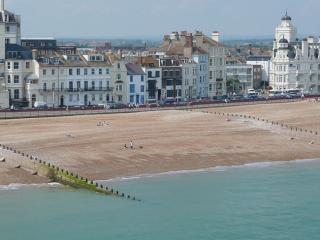
"Once with the sea on three sides, Pevensey has spectacular remains of a Roman fortress and Norman castle."
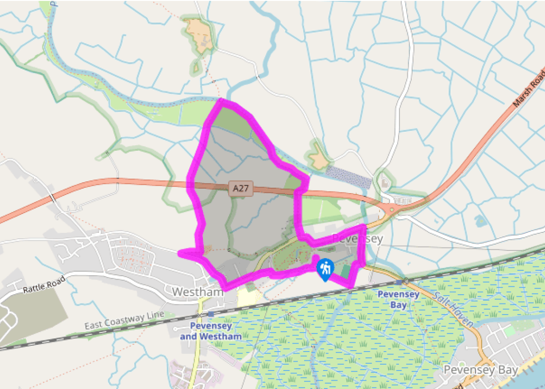
Walk directions
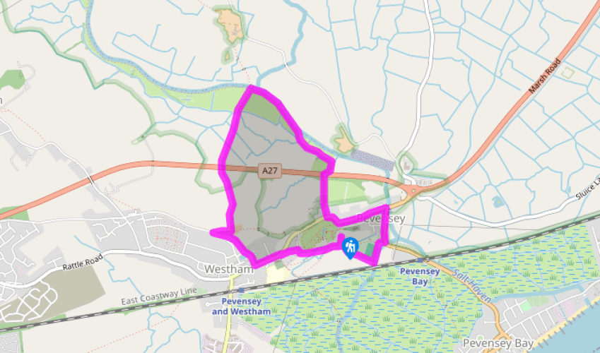
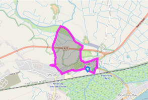
From the entrance of the car park, turn right down Church Lane, past the public lavatories. Visit St Nicholas' Church, then turn left to take Gaol Lane opposite the church lychgate.
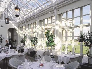
Turn left by the museum and old gaol to walk along Pevensey’s High Street towards the castle, then continue past the castle entrance and bear right into Castle Road, passing the Priory Court Hotel. Leave the road going right on a track, signed ‘1066 Country Walk’. Follow this to the A27, crossing it with care via a bridle gate each side.
Continue along a fenced path that bears left beyond Martin’s Ditch. Continue alongside this to a bridle gate. Through this bear right to walk along the river bank, the Pevensey Haven, as far as a footbridge.
Don't cross the footbridge, but turn left and head south to a stile beside a gate. Over this, go through a field gate to keep ahead, now in sheep pasture. Pass between gateposts and head for another pair of gateposts. Bear quarter left, aligning yourself with the sets of gateposts you have just passed through and continue to cross the A27 via a stile.
Descending to a stile, cross a footbridge with a stile at each end and head across pasture, aiming just to the right of Westham church tower, to a footbridge and stile. Over this aim slightly right, now ascending back onto the ridge, leaving the field by an entrance near Castle Farm. Go through the farmyard to a lane.
Turn left on this lane. Shortly pass a pond on your right and Westham Village Hall on your left. At the main street turn left to walk through Westham and past St Mary’s Church. Fork right by a small green with a Georgian cannon and enter Pevensey Castle’s grounds via a gate and then the Norman west gate. Visit the Norman castle keep and leave via the far (east) gate near the entrance to the car park.
Terrain
- Some lanes and farm tracks, woodland and field paths, several stiles
Landscape
- A low ridge with Pevensey and Westham above the Levels, drained former marshes, now rich sheep pasture
Dog friendliness
- On a lead in the Levels where sheep graze
Parking
- Pevensey Castle pay-and-display car park (outside the castle’s east gate)
Toilets en route
- In the car park
About the walk
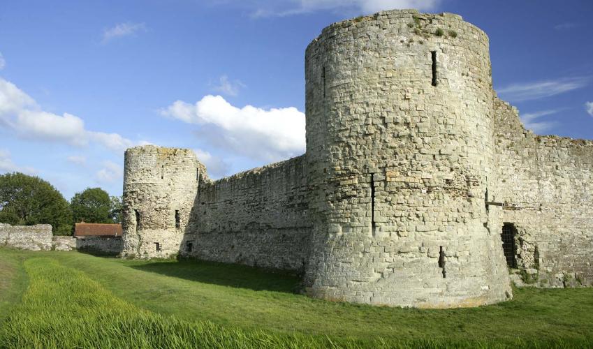
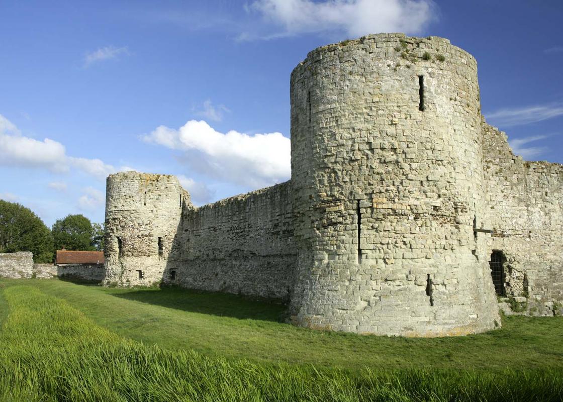
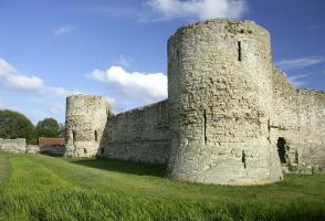
Pevensey Castle’s massive, craggy flint walls dominate this small town. It was not built as a castle but as a Roman fortress named Anderida, around AD 340, as a defence against marauding Saxons. Then the land was very different with the sea lapping its south walls and a deep harbour to its east and... north, and marshes beyond. After the Romans left, the local Britons were massacred in AD 491 by a Saxon army led by the fearsome Aella and Cissa. The latter made Sussex’s Chichester his capital (Cissa’s ceaster), and the Roman fort’s name was ‘Saxonised’ to Andredesceaster, meaning the fortified camp of Anderida. The name ‘Pevensey’ first appeared in the 10th Century, meaning the river of Pefen, the name of a local Anglo-Saxon lord. Pevensey reappeared in history when the Normans conquered England in 1066, landing here before marching east to Hastings and glory. Granted to Robert of Mortain, William the Conqueror’s half brother, the Roman fortress was turned into a fully fledged medieval castle, utilising the Roman walls as the outer bailey. The southeast corner of its 10 acres (4ha) was walled and moated to form an inner bailey with a tall keep. The castle had an active history during the Middle Ages but fell into disuse in Tudor times. It had a brief military revival in World War II as a fully garrisoned observation and command post. It is now in the care of English Heritage. Westham Outside the west gate, the village of Westham grew up with a partly Norman parish church and two fine 15th-century timber-framed houses to its west. Mentioned in the Domesday Book of 1087 and a separate parish from Pevensey, it looks more like a small market town. The Pevensey Levels Leaving Pevensey the route takes you out onto the Levels, as these vast flat areas of rich pasture are called. In Roman times they were marshes and fens, of use to neither man nor beast. The new Norman landowners, including the lords of Pevensey and the Abbot of Battle, set about converting the salt marshes into useful land, building sea dykes and drains, many of which survive. Salt making was also of importance on the salt marshes. However, the sea fought back in the later Middle Ages and much of the Levels were abandoned to the sea’s fury. In calmer times, Pevensey was marooned inland, its port long gone, and the Levels were eventually reclaimed again.
"Once with the sea on three sides, Pevensey has spectacular remains of a Roman fortress and Norman castle."
Walk details
1hr 30min
Difficulty:
Easy
Gradient:
Flat
Distance:
2.5 miles (4kms)
Ascent:
35ft (10m)
Walk directions
From the entrance of the car park, turn right down Church Lane, past the public lavatories. Visit St Nicholas' Church, then turn left to take Gaol Lane opposite the church lychgate.
1 of 6
Turn left by the museum and old gaol to walk along Pevensey’s High Street towards the castle, then continue past the castle entrance and bear right into Castle Road, passing the Priory Court Hotel. Leave the road going right on a track, signed ‘1066 Country Walk’. Follow this to the A27, crossing it with care via a bridle gate each side.
2 of 6
Continue along a fenced path that bears left beyond Martin’s Ditch. Continue alongside this to a bridle gate. Through this bear right to walk along the river bank, the Pevensey Haven, as far as a footbridge.
3 of 6
Don't cross the footbridge, but turn left and head south to a stile beside a gate. Over this, go through a field gate to keep ahead, now in sheep pasture. Pass between gateposts and head for another pair of gateposts. Bear quarter left, aligning yourself with the sets of gateposts you have just passed through and continue to cross the A27 via a stile.
4 of 6
Descending to a stile, cross a footbridge with a stile at each end and head across pasture, aiming just to the right of Westham church tower, to a footbridge and stile. Over this aim slightly right, now ascending back onto the ridge, leaving the field by an entrance near Castle Farm. Go through the farmyard to a lane.
5 of 6
Turn left on this lane. Shortly pass a pond on your right and Westham Village Hall on your left. At the main street turn left to walk through Westham and past St Mary’s Church. Fork right by a small green with a Georgian cannon and enter Pevensey Castle’s grounds via a gate and then the Norman west gate. Visit the Norman castle keep and leave via the far (east) gate near the entrance to the car park.
Terrain
- Some lanes and farm tracks, woodland and field paths, several stiles
Landscape
- A low ridge with Pevensey and Westham above the Levels, drained former marshes, now rich sheep pasture
Dog friendliness
- On a lead in the Levels where sheep graze
Parking
- Pevensey Castle pay-and-display car park (outside the castle’s east gate)
Toilets en route
- In the car park
About the walk
Pevensey Castle’s massive, craggy flint walls dominate this small town. It was not built as a castle but as a Roman fortress named Anderida, around AD 340, as a defence against marauding Saxons. Then the land was very different with the sea lapping its south walls and a deep harbour to its east and... north, and marshes beyond. After the Romans left, the local Britons were massacred in AD 491 by a Saxon army led by the fearsome Aella and Cissa. The latter made Sussex’s Chichester his capital (Cissa’s ceaster), and the Roman fort’s name was ‘Saxonised’ to Andredesceaster, meaning the fortified camp of Anderida. The name ‘Pevensey’ first appeared in the 10th Century, meaning the river of Pefen, the name of a local Anglo-Saxon lord. Pevensey reappeared in history when the Normans conquered England in 1066, landing here before marching east to Hastings and glory. Granted to Robert of Mortain, William the Conqueror’s half brother, the Roman fortress was turned into a fully fledged medieval castle, utilising the Roman walls as the outer bailey. The southeast corner of its 10 acres (4ha) was walled and moated to form an inner bailey with a tall keep. The castle had an active history during the Middle Ages but fell into disuse in Tudor times. It had a brief military revival in World War II as a fully garrisoned observation and command post. It is now in the care of English Heritage. Westham Outside the west gate, the village of Westham grew up with a partly Norman parish church and two fine 15th-century timber-framed houses to its west. Mentioned in the Domesday Book of 1087 and a separate parish from Pevensey, it looks more like a small market town. The Pevensey Levels Leaving Pevensey the route takes you out onto the Levels, as these vast flat areas of rich pasture are called. In Roman times they were marshes and fens, of use to neither man nor beast. The new Norman landowners, including the lords of Pevensey and the Abbot of Battle, set about converting the salt marshes into useful land, building sea dykes and drains, many of which survive. Salt making was also of importance on the salt marshes. However, the sea fought back in the later Middle Ages and much of the Levels were abandoned to the sea’s fury. In calmer times, Pevensey was marooned inland, its port long gone, and the Levels were eventually reclaimed again.