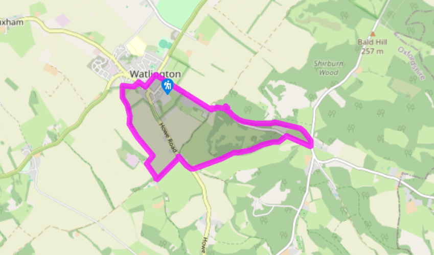
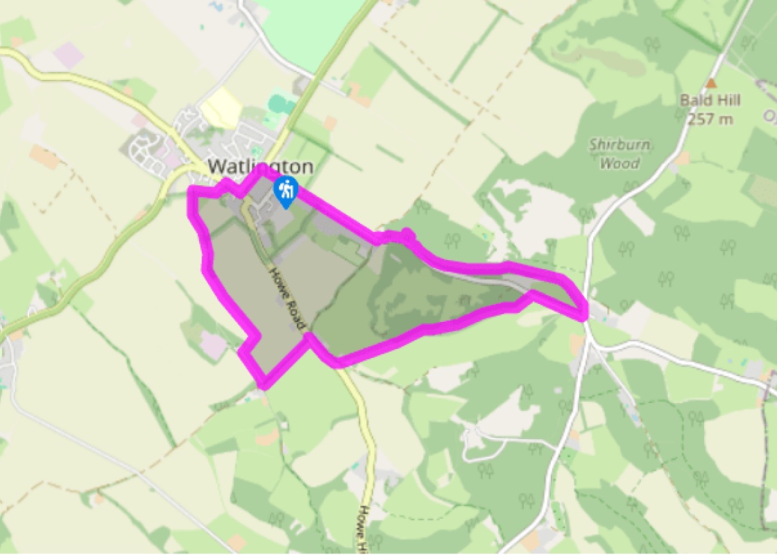
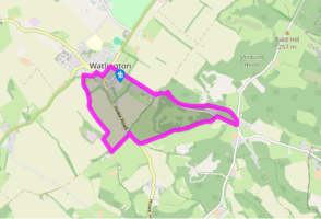
Turn left out of the car park towards the town centre. Turn left at the junction, by the Town Hall, and follow Couching Street to the junction with Brook Street. Turn right and walk along to No. 23. Take the footpath opposite and follow it between walls. Go through the kissing gate, keep right at the immediate fork and cross a field. Keep to the left of a tree and head for a second kissing gate. Go through this and take the path to the left. At the footpath signs, turn left onto the track.
At a junction of tracks keep right, passing a wide, black metal gate on the right. Walk on for a further 0.5 miles (800m), passing a pond and then rising very gently, bearing right to reach a concrete farm track. Reaching it, turn left to join a path along the field edge. Keep the hedge and trees on the right and follow it to a stile in the corner.
Turn left here and walk along the Ridgeway to the road. Turn right towards Nettlebed and then take the first left turning into Watlington Park Estate. Follow the track for about 70yds (64m) and, when it forks at a wooden post and brick pillar, keep left and follow the enclosed path through the trees to two gates. Continue on the path, climbing gently to a kissing gate. Take the left-hand track ahead at the fork and keep climbing beneath yew trees. Break cover from the trees and then enter woodland again. Go through a kissing gate and pass between beech trees to the next gate. Follow the path to the right of Watlington Hill car park and turn right at the road.
Head for Christmas Common and turn left at the next junction. Follow the road for about 50yds (46m) and turn left at the Oxfordshire Way sign. Go through a kissing gate and keep along the left field perimeter to a gap in the fence. Keep ahead for about 70yds (64m) to a kissing gate on the left and leave the Oxfordshire Way here. Follow the sunken path, looking for white arrows on the trees, and descend gradually for 0.75 miles (1.2km). Reach a kissing gate and turn left onto the track, and then right at the road. Follow it for 0.5 mile (800m) back to the car park.
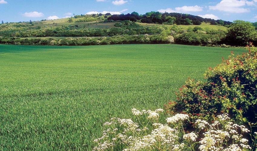
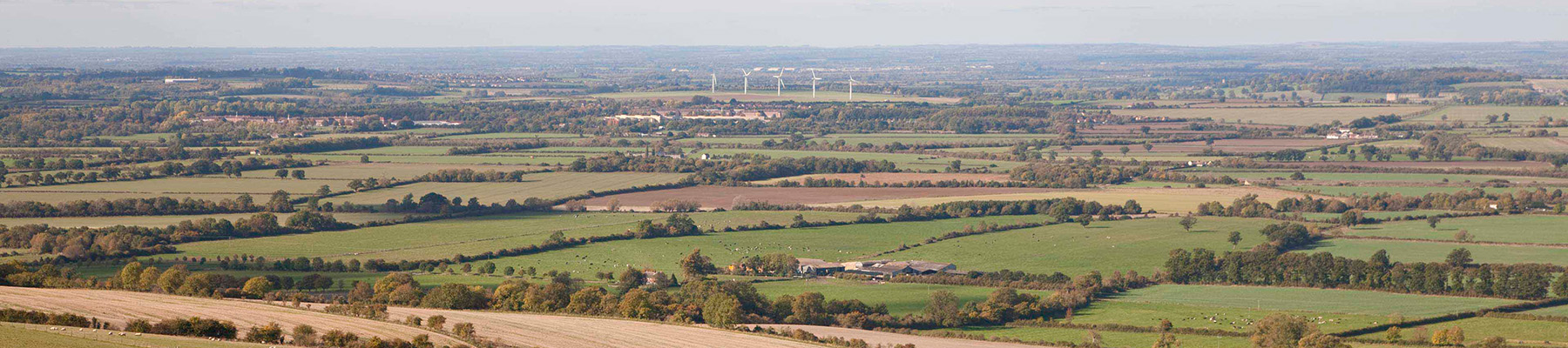
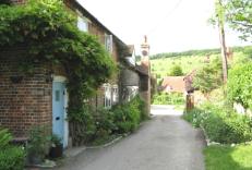
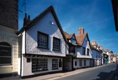
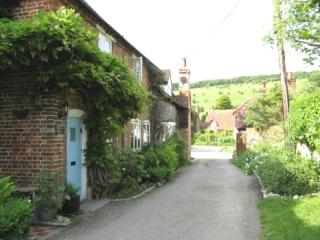
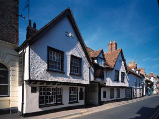
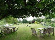
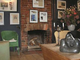
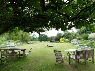
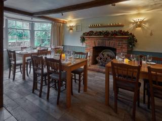
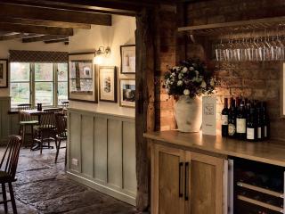
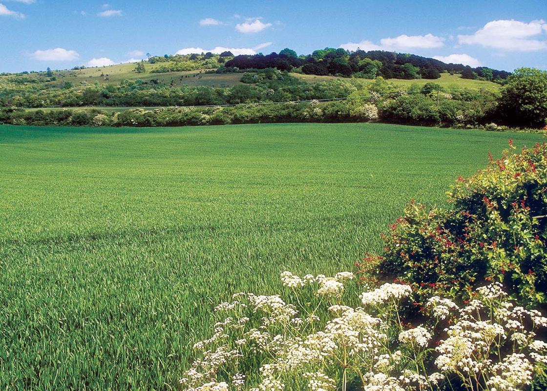
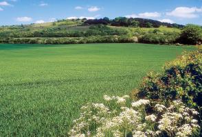
Standing at the foot of the Chilterns escarpment, close to the Icknield Way, Watlington is one of Oxfordshire’s classic old towns – small and compact, and surrounded by some of the prettiest scenery to be found in the county. During the Civil War, Watlington was very close to the fighting, with... opposing armies engaged in bitter conflict in the nearby fields. The quaint streets are lined with 17th-century half-timbered houses. Watlington’s focal point is the gabled Town Hall, constructed in 1664; it is one of the oldest in the county. At one time a bridge connected the Town Hall to the upper floors of the nearby Hare and Hounds Hotel, now closed. The Town Hall was originally used as a market hall, built with funds provided by one Thomas Stonor. The upper room was adapted for use as a Grammar School for boys until 1872, when a Board School was set up in premises in Davenport Place. Another interesting building is Chiltern Gate, between the car park and Couching Street. It was opened by Lord Macclesfield in 1865 as a training school for those in domestic service. Up to 14 girls boarded here and were trained in cooking, housework and laundry. Lady Macclesfield paid some of the girls as little as six shillings per quarter. The original Hare and Hounds, which occupied a site near by, is associated with Colonel John Hampden, an MP and leader of the Parliamentary forces in the Civil War. He stayed at the inn the night before the Battle of Chalgrove Field in June 1643 and is alleged to have given the landlord, Robert Parslow, a chest containing money for the payment of troops. Hampden was fatally wounded in battle and never returned to Watlington. What happened to the chest is not known but some years later, perhaps driven by guilt, Parslow established a local charity to help the poor. Watlington assumes the appearance of a small 18th-century market town, yet most of its streets were already complete by the 14th century. During the 1730s the existence of about 260 houses was recorded. Today, many of those buildings still recall their medieval origins – narrow on the street frontage but of considerable depth, with a side passage. The name of the town dates back to ad 880 when it was known as Watelingtone. This area is fed by chalk springs which creates the perfect environment for growing watercress, and the chalk from pits at the foot of the Chilterns was used as building material in the town’s early development. The people of Watlington were given certain rights – including quarrying their own chalk for building houses. By the late 17th century, Nettlebed bricks were in use, and tiles from the same Oxfordshire village began to replace thatch. To find the true heart of Watlington, walk along the High Street to New Road which is reputedly, the centre of the original settlement. During the 13th century a manor house stood on this site and the manor court was held here. The manor house later went into decline and the king’s bailiff was accused of pilfering its timber and stone. The remains of a moat can still be identified in the churchyard.
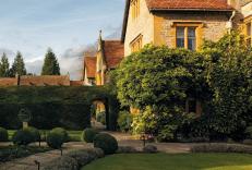
Located at the heart of England, Oxfordshire enjoys a rich heritage and varied scenery, with Oxford’s elegant streets a highlight for visitors. The landscape encompasses open chalk downland, picturesque rivers and attractive villages, while northwest of Oxfordshire is home to the sleepy backwaters of Abingdon, Wallingford, Wantage, Watlington and Witney that reveal how Oxfordshire’s old towns evolved over the centuries.
Turn left out of the car park towards the town centre. Turn left at the junction, by the Town Hall, and follow Couching Street to the junction with Brook Street. Turn right and walk along to No. 23. Take the footpath opposite and follow it between walls. Go through the kissing gate, keep right at the immediate fork and cross a field. Keep to the left of a tree and head for a second kissing gate. Go through this and take the path to the left. At the footpath signs, turn left onto the track.
1 of 4
At a junction of tracks keep right, passing a wide, black metal gate on the right. Walk on for a further 0.5 miles (800m), passing a pond and then rising very gently, bearing right to reach a concrete farm track. Reaching it, turn left to join a path along the field edge. Keep the hedge and trees on the right and follow it to a stile in the corner.
2 of 4
Turn left here and walk along the Ridgeway to the road. Turn right towards Nettlebed and then take the first left turning into Watlington Park Estate. Follow the track for about 70yds (64m) and, when it forks at a wooden post and brick pillar, keep left and follow the enclosed path through the trees to two gates. Continue on the path, climbing gently to a kissing gate. Take the left-hand track ahead at the fork and keep climbing beneath yew trees. Break cover from the trees and then enter woodland again. Go through a kissing gate and pass between beech trees to the next gate. Follow the path to the right of Watlington Hill car park and turn right at the road.
3 of 4
Head for Christmas Common and turn left at the next junction. Follow the road for about 50yds (46m) and turn left at the Oxfordshire Way sign. Go through a kissing gate and keep along the left field perimeter to a gap in the fence. Keep ahead for about 70yds (64m) to a kissing gate on the left and leave the Oxfordshire Way here. Follow the sunken path, looking for white arrows on the trees, and descend gradually for 0.75 miles (1.2km). Reach a kissing gate and turn left onto the track, and then right at the road. Follow it for 0.5 mile (800m) back to the car park.
Standing at the foot of the Chilterns escarpment, close to the Icknield Way, Watlington is one of Oxfordshire’s classic old towns – small and compact, and surrounded by some of the prettiest scenery to be found in the county. During the Civil War, Watlington was very close to the fighting, with... opposing armies engaged in bitter conflict in the nearby fields. The quaint streets are lined with 17th-century half-timbered houses. Watlington’s focal point is the gabled Town Hall, constructed in 1664; it is one of the oldest in the county. At one time a bridge connected the Town Hall to the upper floors of the nearby Hare and Hounds Hotel, now closed. The Town Hall was originally used as a market hall, built with funds provided by one Thomas Stonor. The upper room was adapted for use as a Grammar School for boys until 1872, when a Board School was set up in premises in Davenport Place. Another interesting building is Chiltern Gate, between the car park and Couching Street. It was opened by Lord Macclesfield in 1865 as a training school for those in domestic service. Up to 14 girls boarded here and were trained in cooking, housework and laundry. Lady Macclesfield paid some of the girls as little as six shillings per quarter. The original Hare and Hounds, which occupied a site near by, is associated with Colonel John Hampden, an MP and leader of the Parliamentary forces in the Civil War. He stayed at the inn the night before the Battle of Chalgrove Field in June 1643 and is alleged to have given the landlord, Robert Parslow, a chest containing money for the payment of troops. Hampden was fatally wounded in battle and never returned to Watlington. What happened to the chest is not known but some years later, perhaps driven by guilt, Parslow established a local charity to help the poor. Watlington assumes the appearance of a small 18th-century market town, yet most of its streets were already complete by the 14th century. During the 1730s the existence of about 260 houses was recorded. Today, many of those buildings still recall their medieval origins – narrow on the street frontage but of considerable depth, with a side passage. The name of the town dates back to ad 880 when it was known as Watelingtone. This area is fed by chalk springs which creates the perfect environment for growing watercress, and the chalk from pits at the foot of the Chilterns was used as building material in the town’s early development. The people of Watlington were given certain rights – including quarrying their own chalk for building houses. By the late 17th century, Nettlebed bricks were in use, and tiles from the same Oxfordshire village began to replace thatch. To find the true heart of Watlington, walk along the High Street to New Road which is reputedly, the centre of the original settlement. During the 13th century a manor house stood on this site and the manor court was held here. The manor house later went into decline and the king’s bailiff was accused of pilfering its timber and stone. The remains of a moat can still be identified in the churchyard.
Located at the heart of England, Oxfordshire enjoys a rich heritage and varied scenery, with Oxford’s elegant streets a highlight for visitors. The landscape encompasses open chalk downland, picturesque rivers and attractive villages, while northwest of Oxfordshire is home to the sleepy backwaters of Abingdon, Wallingford, Wantage, Watlington and Witney that reveal how Oxfordshire’s old towns evolved over the centuries.