"Mystery surrounds you on this atmospheric walk by the famous site of a pagan burial ground."
Walk directions
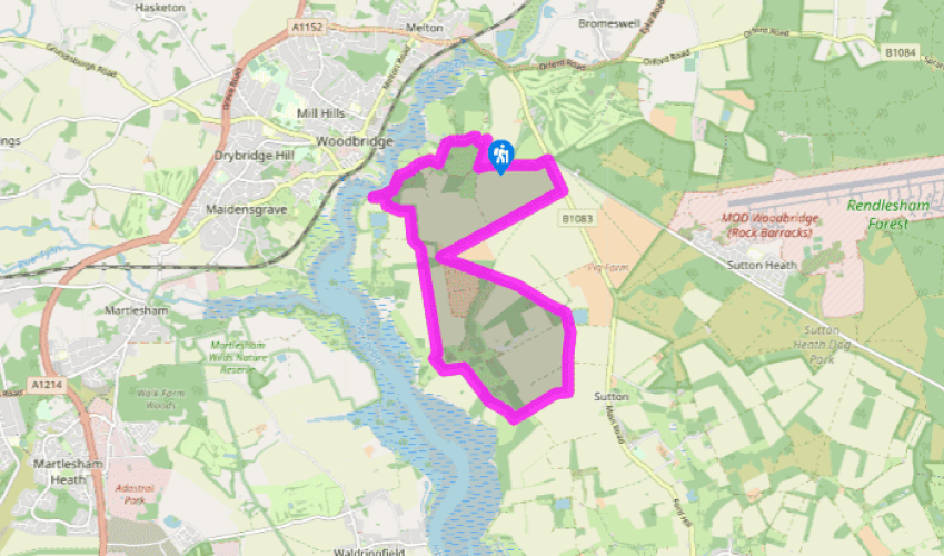
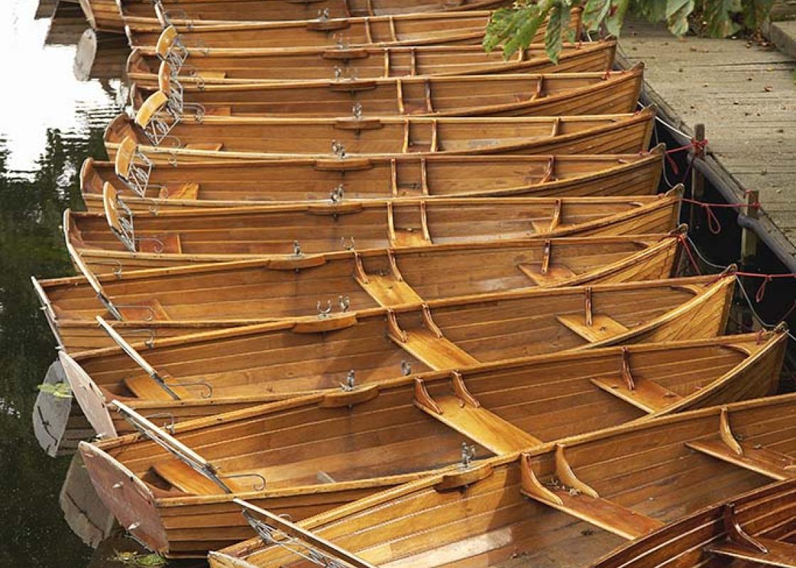
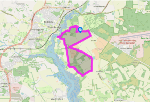
From the National Trust car park, take the signposted blue trail from behind the National Trust visitor centre, descending towards the River Deben on a gravel track. Turn left opposite the entrance to Little Haugh and turn right by a map of the Sutton Hoo Estate. The path narrows and turns left alongside a fence on its way to the river. Keep left around a meadow and climb a slope to the riverbank with Woodbridge visible on the opposite bank.
Turn left and walk along the riverbank. The path is overgrown in places and the plank bridges can be slippery in wet weather but the views are superb when you can glimpse them. After 400yds (366m), climb some steps to leave the river behind and turn left around a field. Keep to the left-hand side of this field, following the edge of the wood to walk away from the reservoir on your right.
Turn right at the top of a rise to follow a narrow bridleway along the field-edge with Deben Wood to your left. At the end of the wood, the path swings half left across a field, then passes through a hedge on to a lane. (You could turn left here for a short cut, picking up the walk again in 300yds (274m) at Point 6.)
Keep straight ahead for 0.75 miles (1.2km), crossing the drive to Haddon Hall. At Methersgate Hall bear right around farm buildings, then left on a footpath beside a brick wall. You pass a pair of cannon and an eagle on the lawn of the hall and continue ahead with the River Deben opening out in front of you. Go through a gate and turn left across a field then go through another gate and turn right along a lane. Stay on this lane for 1 mile (1.6km) and as it bends left past Cliff Farm.
At a three-finger signpost after the lane bears slightly to the right, turn left along a field-edge track, passing an embankment on the right. Keep to the public bridleway as it swings left around an area of woodland. At the end of the woodland, keep straight ahead between fields and continue as the path becomes a broad grass track through trees, passing a field of pigs and some cottages to reach a minor lane.
Turn right and stay on this lane for about 1 mile (1.6km) to the main road (B1083). Turn left and walk along a track through the trees parallel to the road for 400yds (366m), soon to take the footpath left opposite the road junction. When you see the burial mounds to your left-hand side, turn right just after a 'National Trust Sutton Hoo' sign to return to the visitor centre on a National Trust permissive path.
Terrain
- Field-edge and riverside paths, farm lanes, short section of busy road
Landscape
- Farmland, woodland and River Deben
Dog friendliness
- On lead on farmland and National Trust land (not allowed near burial mounds)
Parking
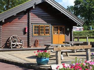
- National Trust car park - included in entry price for exhibition, or pay-and-display when exhibition is closed
Toilets en route
- At National Trust visitor centre - walkers' toilets behind building are open when visitor centre is closed
About the walk
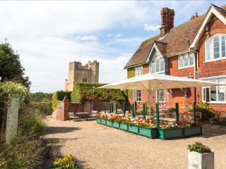
The discovery of an Anglo-Saxon ship burial at Sutton Hoo in 1939 shed new light on the Dark Ages and opened up a whole new chapter of English history. It all came about when Edith May Pretty, a widow with a keen interest in spiritualism, reported seeing visions of ghostly warriors dancing on the... burial mounds near her home. She called in a local archaeologist, Basil Brown, to investigate and before long he had made his extraordinary discovery. Many of the graves had been desecrated by robbers but in one of the mounds he found the remains of a 90ft (27m) wooden ship with a burial chamber inside. The timber had rotted, leaving nothing but rusty iron rivets and a dark stain in the sand but the treasures that had survived included Byzantine silver, gold buckles and a bejewelled helmet, sword and shield. The only thing missing was a body, presumably decomposed. Sutton Hoo treasure An inquest awarded the treasure to Mrs Pretty and she donated it to the British Museum, the single most generous gift ever received from a living donor. Archaeologists have been puzzling ever since over the identity of the missing man. Although weapon burials were not uncommon, the riches found at Sutton Hoo have led most experts to conclude that this was the burial ground of the early East Anglian kings, and that the burial chamber in the ship was that of King Raedwald, leader of the Wuffinga dynasty, who died around ad 625. In 2002 the National Trust opened an exhibition on the site with replicas of many of the items and some of the original treasures on display. There is a sword in its wooden scabbard, the sword-belt fittings exquisitely patterned in gold and red garnet from India. There's an ornamental shield, covered in golden dragons and eagles, and a warrior's helmet with designs of horsemen in wrought copper and bronze. The artists making the replicas were full of admiration for the skills of their Anglo-Saxon ancestors. 'They were highly sophisticated people with an appreciation of art and culture. Some of these objects are extremely difficult to make even today,' says The National Trust. Mystery preserved Most people agree that the new exhibition has made Sutton Hoo easier to understand. If, however, you prefer your lumps in the ground without any explanation, come here at dawn or on a misty morning in winter when the place still has an air of mystery about it and when you just might see ghostly figures dancing on the graves.
"Mystery surrounds you on this atmospheric walk by the famous site of a pagan burial ground."
Walk details
3hrs
Difficulty:
Medium
Gradient:
Moderate
Distance:
7.25 miles (11.7kms)
Ascent:
262ft (80m)
Walk directions
From the National Trust car park, take the signposted blue trail from behind the National Trust visitor centre, descending towards the River Deben on a gravel track. Turn left opposite the entrance to Little Haugh and turn right by a map of the Sutton Hoo Estate. The path narrows and turns left alongside a fence on its way to the river. Keep left around a meadow and climb a slope to the riverbank with Woodbridge visible on the opposite bank.
1 of 6
Turn left and walk along the riverbank. The path is overgrown in places and the plank bridges can be slippery in wet weather but the views are superb when you can glimpse them. After 400yds (366m), climb some steps to leave the river behind and turn left around a field. Keep to the left-hand side of this field, following the edge of the wood to walk away from the reservoir on your right.
2 of 6
Turn right at the top of a rise to follow a narrow bridleway along the field-edge with Deben Wood to your left. At the end of the wood, the path swings half left across a field, then passes through a hedge on to a lane. (You could turn left here for a short cut, picking up the walk again in 300yds (274m) at Point 6.)
3 of 6
Keep straight ahead for 0.75 miles (1.2km), crossing the drive to Haddon Hall. At Methersgate Hall bear right around farm buildings, then left on a footpath beside a brick wall. You pass a pair of cannon and an eagle on the lawn of the hall and continue ahead with the River Deben opening out in front of you. Go through a gate and turn left across a field then go through another gate and turn right along a lane. Stay on this lane for 1 mile (1.6km) and as it bends left past Cliff Farm.
4 of 6
At a three-finger signpost after the lane bears slightly to the right, turn left along a field-edge track, passing an embankment on the right. Keep to the public bridleway as it swings left around an area of woodland. At the end of the woodland, keep straight ahead between fields and continue as the path becomes a broad grass track through trees, passing a field of pigs and some cottages to reach a minor lane.
5 of 6
Turn right and stay on this lane for about 1 mile (1.6km) to the main road (B1083). Turn left and walk along a track through the trees parallel to the road for 400yds (366m), soon to take the footpath left opposite the road junction. When you see the burial mounds to your left-hand side, turn right just after a 'National Trust Sutton Hoo' sign to return to the visitor centre on a National Trust permissive path.
Terrain
- Field-edge and riverside paths, farm lanes, short section of busy road
Landscape
- Farmland, woodland and River Deben
Dog friendliness
- On lead on farmland and National Trust land (not allowed near burial mounds)
Parking
- National Trust car park - included in entry price for exhibition, or pay-and-display when exhibition is closed
Toilets en route
- At National Trust visitor centre - walkers' toilets behind building are open when visitor centre is closed
About the walk
The discovery of an Anglo-Saxon ship burial at Sutton Hoo in 1939 shed new light on the Dark Ages and opened up a whole new chapter of English history. It all came about when Edith May Pretty, a widow with a keen interest in spiritualism, reported seeing visions of ghostly warriors dancing on the... burial mounds near her home. She called in a local archaeologist, Basil Brown, to investigate and before long he had made his extraordinary discovery. Many of the graves had been desecrated by robbers but in one of the mounds he found the remains of a 90ft (27m) wooden ship with a burial chamber inside. The timber had rotted, leaving nothing but rusty iron rivets and a dark stain in the sand but the treasures that had survived included Byzantine silver, gold buckles and a bejewelled helmet, sword and shield. The only thing missing was a body, presumably decomposed. Sutton Hoo treasure An inquest awarded the treasure to Mrs Pretty and she donated it to the British Museum, the single most generous gift ever received from a living donor. Archaeologists have been puzzling ever since over the identity of the missing man. Although weapon burials were not uncommon, the riches found at Sutton Hoo have led most experts to conclude that this was the burial ground of the early East Anglian kings, and that the burial chamber in the ship was that of King Raedwald, leader of the Wuffinga dynasty, who died around ad 625. In 2002 the National Trust opened an exhibition on the site with replicas of many of the items and some of the original treasures on display. There is a sword in its wooden scabbard, the sword-belt fittings exquisitely patterned in gold and red garnet from India. There's an ornamental shield, covered in golden dragons and eagles, and a warrior's helmet with designs of horsemen in wrought copper and bronze. The artists making the replicas were full of admiration for the skills of their Anglo-Saxon ancestors. 'They were highly sophisticated people with an appreciation of art and culture. Some of these objects are extremely difficult to make even today,' says The National Trust. Mystery preserved Most people agree that the new exhibition has made Sutton Hoo easier to understand. If, however, you prefer your lumps in the ground without any explanation, come here at dawn or on a misty morning in winter when the place still has an air of mystery about it and when you just might see ghostly figures dancing on the graves.