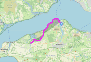
Isle of Wight Coastal Path: West Cowes to Shalfleet
Recommended by
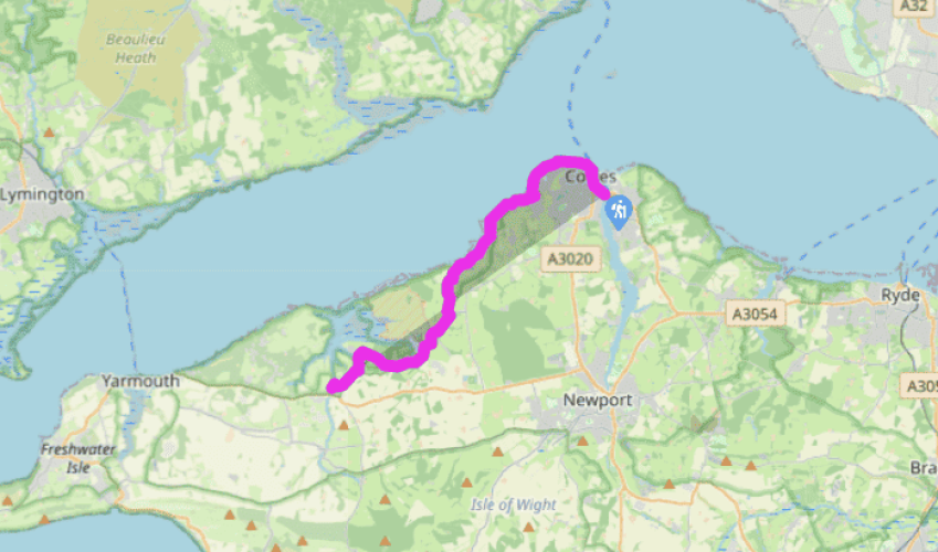
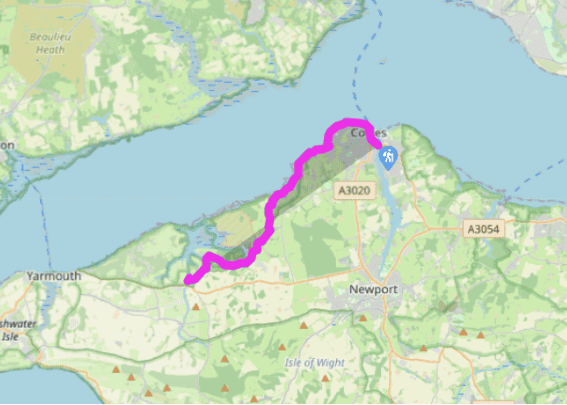
Walk directions
Walking west from the ferry, head for the pedestrian precinct. Here, in summer, there is a curious mix of holidaymakers and serious yachting types. Continue through the pedestrian zone until turning right down Watch House Lane in front of the Union Inn to the start of the esplanade walkway. This runs for about a mile to the edge of the town, passing in front of the Royal Yacht Squadron Headquarters and Egypt Point.
Continue ahead along the shore for another mile, towards Gurnard Bay. The path eventually leaves the road, passing a row of beach huts, to reach a sailing club with a slipway.
Turn uphill here and take the footpath up to the right between black bollards through a characterful community of wooden seaside chalets, many built before existing planning laws would have stopped their construction. Follow the path into broad Worsley Road and then turn first right (Solent View Road), downhill to Gurnard Bridge.
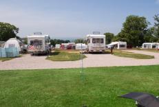
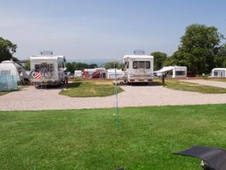
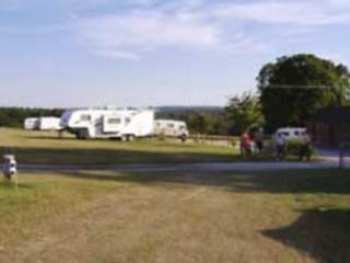
The route would ideally continue along the coast here, but after considerable coastal erosion, the path has been rerouted inland. After the first bridge (over the River Luck), turn left and follow the road for almost 2 miles (3km) over the brow of the hill. Look out for a path on the right, signed ‘CS3’. Take this path, which meanders gently uphill through a small wood and down through two kissing gates. Continue to a stile, and on through a green gateway, bearing left to follow the narrow path. On emerging at a field, cross the stile and turn right, following the path through fields and over several stiles, heading down towards the beach. On reaching a stile which leads onto the beach, turn left along the field boundary, eventually crossing a stile and small concrete bridge. Turn left along the beach to the sandy strip in front of Thorness Bay Holiday Park.
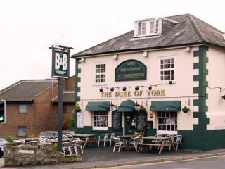
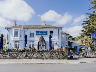
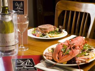
Bear left away from the beach here, following the unmetalled road uphill into the holiday park. The route meanders through the camp to the entrance gate. Turn uphill here for approximately 50m to continue the path over a stile in the hedgerow on your left. From here the footpath leads across several fields and stiles to the road, where you turn right, downhill, to the village of Porchfield. The Sportsman’s Rest pub makes a welcome stopping point.
The route is now well inland, avoiding the marshy tributaries of the Newtown River. Porchfield to Newtown is another 3 miles (5km) of road walk, finishing with a short cut across the fields, via a stile on the left approximately 200m after Old Vicarage Lane, picking up the route of Newtown’s Nature Trail.
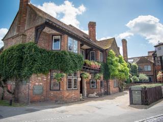
The walk continues up the road past the 17th-century Old Town Hall, and along towards Shalfleet. Branch right after Corfe Farm along a partly metalled track, bending sharp right onto an unmetalled path and over the footbridge by Shalfleet Mill. Turn left along the road to a car park (free), just before Shalfleet.
The route follows the Coastal Path (69 miles/111km), which is well signed on the ground with blue signs and a seagull symbol. Constant erosion of the island’s coastline means the path may be rerouted at any point, but this is usually clearly marked. Note that access for dogs to most of the island’s... beaches is restricted in summer. For information about bus links and timetables, see www.islandbuses.info The town of Cowes is steeped in marine history. From the chainlink ferry across the River Medina you can see the premises in which the J S White Company built and launched the first seaplane. Close by is the former home of the British Hovercraft Corporation, creators of the first hovercraft. Notwithstanding these technological achievements, Cowes is first and foremost a thriving yachting town, home of the National Sailing Centre, the Royal Yacht Squadron, Cowes Week and the Admiral’s Cup. In July and early August it will be very busy. Egypt Point is the most northerly point on the island, and the site of an anti-submarine boom that, during the war, stretched right cross the Solent to the mainland. The red and white beacon marks the position of a lighthouse that was operational there between 1897 and 1989, and is still used as a marker to assist passing vessels with navigation. Newtown is well worth a few moments’ pause, especially for a look at the estuary and quay, where ships of up to 500 tons used to dock. The most ancient of the island’s boroughs, Newtown was once known as Francheville and was the island’s capital after it was laid out by the Bishop of Winchester in 1256. It soon developed into a major seaport, with a thriving trade in local salt and oysters Everything changed in 1377 when the town was burned down by a Franco-Spanish raid. Now it’s a tranquil backwater, the estuary silted up and favoured by seabirds, with just the charming and eccentric Old Town Hall (National Trust) an echo of its former glory.
Small and intimate – at just 23 miles by 13 miles, the Isle of Wight is a popular holiday destination; with its mild climate, long hours of sunshine and colourful architecture, it has something of a continental flavour. Visitors can walk along the island’s varied coastline using the well-established Coast Path or step back in time to explore the island’s history at some of the forts and castles.
Isle of Wight Coastal Path: West Cowes to Shalfleet
Recommended by
Walk details
3hrs 30min
Difficulty:
Easy
Gradient:
Gentle
Distance:
10 miles (16kms)
Ascent:
551ft (168m)
Walk directions
Walking west from the ferry, head for the pedestrian precinct. Here, in summer, there is a curious mix of holidaymakers and serious yachting types. Continue through the pedestrian zone until turning right down Watch House Lane in front of the Union Inn to the start of the esplanade walkway. This runs for about a mile to the edge of the town, passing in front of the Royal Yacht Squadron Headquarters and Egypt Point.
1 of 7
Continue ahead along the shore for another mile, towards Gurnard Bay. The path eventually leaves the road, passing a row of beach huts, to reach a sailing club with a slipway.
2 of 7
Turn uphill here and take the footpath up to the right between black bollards through a characterful community of wooden seaside chalets, many built before existing planning laws would have stopped their construction. Follow the path into broad Worsley Road and then turn first right (Solent View Road), downhill to Gurnard Bridge.
3 of 7
The route would ideally continue along the coast here, but after considerable coastal erosion, the path has been rerouted inland. After the first bridge (over the River Luck), turn left and follow the road for almost 2 miles (3km) over the brow of the hill. Look out for a path on the right, signed ‘CS3’. Take this path, which meanders gently uphill through a small wood and down through two kissing gates. Continue to a stile, and on through a green gateway, bearing left to follow the narrow path. On emerging at a field, cross the stile and turn right, following the path through fields and over several stiles, heading down towards the beach. On reaching a stile which leads onto the beach, turn left along the field boundary, eventually crossing a stile and small concrete bridge. Turn left along the beach to the sandy strip in front of Thorness Bay Holiday Park.
4 of 7
Bear left away from the beach here, following the unmetalled road uphill into the holiday park. The route meanders through the camp to the entrance gate. Turn uphill here for approximately 50m to continue the path over a stile in the hedgerow on your left. From here the footpath leads across several fields and stiles to the road, where you turn right, downhill, to the village of Porchfield. The Sportsman’s Rest pub makes a welcome stopping point.
5 of 7
The route is now well inland, avoiding the marshy tributaries of the Newtown River. Porchfield to Newtown is another 3 miles (5km) of road walk, finishing with a short cut across the fields, via a stile on the left approximately 200m after Old Vicarage Lane, picking up the route of Newtown’s Nature Trail.
6 of 7
The walk continues up the road past the 17th-century Old Town Hall, and along towards Shalfleet. Branch right after Corfe Farm along a partly metalled track, bending sharp right onto an unmetalled path and over the footbridge by Shalfleet Mill. Turn left along the road to a car park (free), just before Shalfleet.
The route follows the Coastal Path (69 miles/111km), which is well signed on the ground with blue signs and a seagull symbol. Constant erosion of the island’s coastline means the path may be rerouted at any point, but this is usually clearly marked. Note that access for dogs to most of the island’s... beaches is restricted in summer. For information about bus links and timetables, see www.islandbuses.info The town of Cowes is steeped in marine history. From the chainlink ferry across the River Medina you can see the premises in which the J S White Company built and launched the first seaplane. Close by is the former home of the British Hovercraft Corporation, creators of the first hovercraft. Notwithstanding these technological achievements, Cowes is first and foremost a thriving yachting town, home of the National Sailing Centre, the Royal Yacht Squadron, Cowes Week and the Admiral’s Cup. In July and early August it will be very busy. Egypt Point is the most northerly point on the island, and the site of an anti-submarine boom that, during the war, stretched right cross the Solent to the mainland. The red and white beacon marks the position of a lighthouse that was operational there between 1897 and 1989, and is still used as a marker to assist passing vessels with navigation. Newtown is well worth a few moments’ pause, especially for a look at the estuary and quay, where ships of up to 500 tons used to dock. The most ancient of the island’s boroughs, Newtown was once known as Francheville and was the island’s capital after it was laid out by the Bishop of Winchester in 1256. It soon developed into a major seaport, with a thriving trade in local salt and oysters Everything changed in 1377 when the town was burned down by a Franco-Spanish raid. Now it’s a tranquil backwater, the estuary silted up and favoured by seabirds, with just the charming and eccentric Old Town Hall (National Trust) an echo of its former glory.
Small and intimate – at just 23 miles by 13 miles, the Isle of Wight is a popular holiday destination; with its mild climate, long hours of sunshine and colourful architecture, it has something of a continental flavour. Visitors can walk along the island’s varied coastline using the well-established Coast Path or step back in time to explore the island’s history at some of the forts and castles.