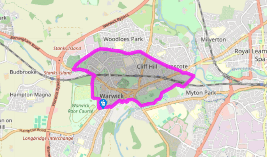
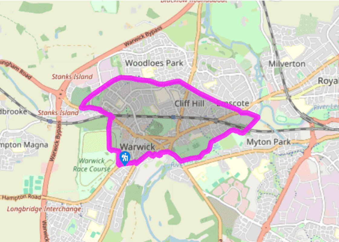
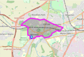
Walk to the far end of the car park and go left towards the golf clubhouse, the Warwick Golf Centre.
Beyond, go right and take the wide green track between the golf course and the driving range. In about 300yds (274m), cross over the racetrack and go through a kissing gate onto a footpath alongside modern housing. Continue ahead, and at the corner of common land go right through a kissing gate onto a lane, and descend to the road. Go left along the pavement beneath the railway bridge, then left opposite St Michael’s Road through a gate (locked 6pm–8am) onto grassland by the Saltisford Canal. Follow this grassy area to the tow path, passing a large narrowboat mooring area, and climb the steps up to the canal bridge onto the pavement beside a road. Go right along the pavement, Budbrooke Road, and in 50yds (46m), you will come to the A425 and a canal bridge over the Grand Union Canal.
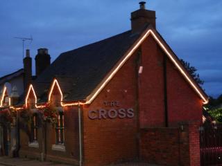
Cross the road with care. Go left over the canal bridge and, immediately across it, descend to take the tow path into Warwick, about 1.5 miles (2.4km) away. Pass a lock gate with The Cape of Good Hope pub opposite, and along the back of residential properties. After passing a supermarket on the opposite bank and just before reaching the aqueduct over the River Avon, go left down steps to join the ‘Waterside Walk’, turning right at the stream.
Proceed right under the aqueduct and follow the riverbank footpath. After 1 mile (1.6km) at Castle Bridge, climb steps onto the pavement of the A425 (Banbury) road and cross with care.
Stroll onto the bridge for the classic view of Warwick Castle, then turn around and follow the pavement towards Warwick town.
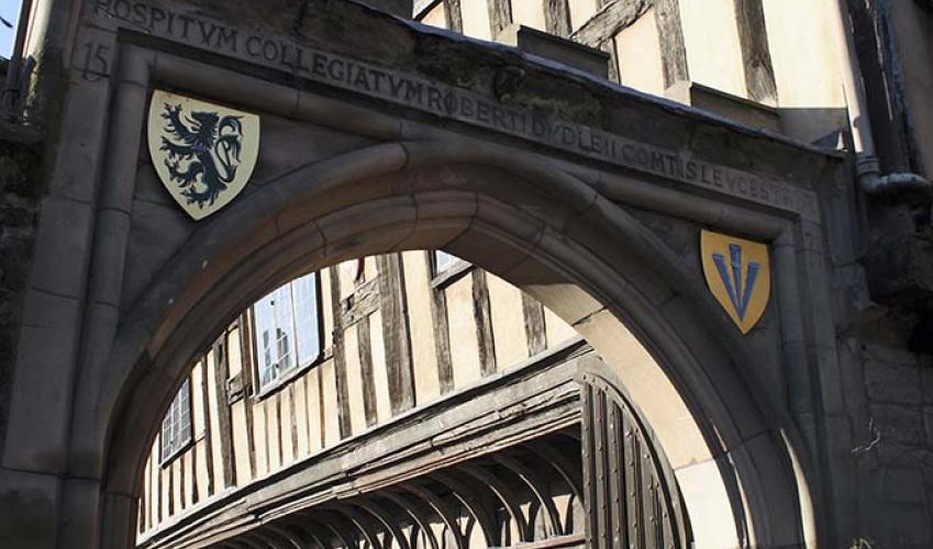
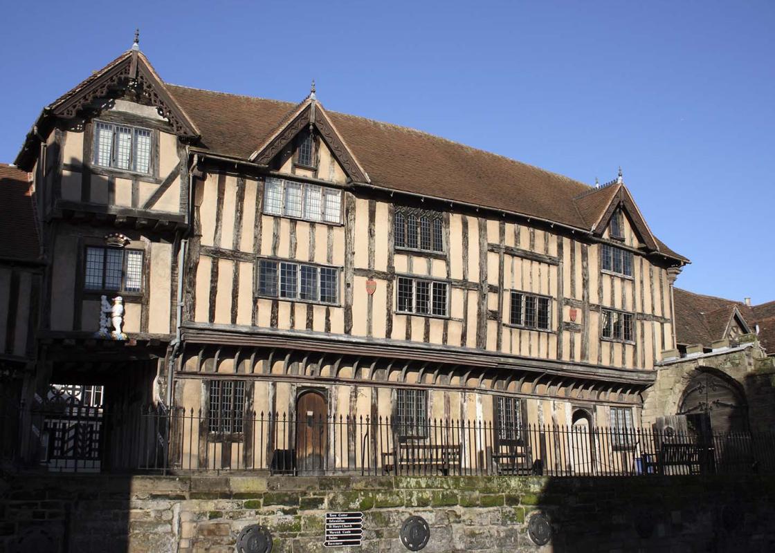
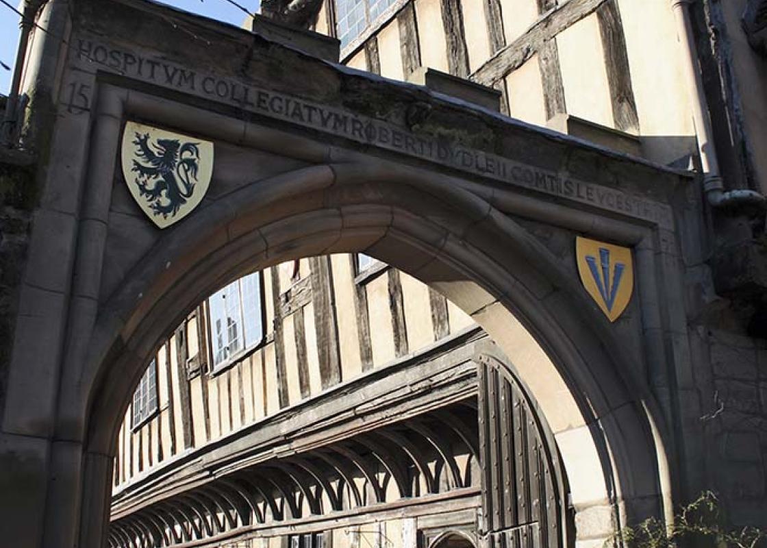
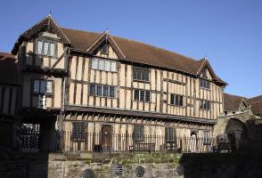
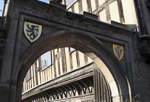
In 220yds (201m) go left and meander down picturesque Mill Street for the second favourite view of the castle. Return to the main road and go left through the main entrance gate to Warwick Castle grounds. Walk up the drive to the main gate, turn right up steps, pass the castle entrance and turn left on Castle Lane. Turn right on Castle Street and continue, passing Oken’s House, to reach the tourist information centre on the corner of the High Street. Turn left here and walk along High Street, going beneath the archway of Lord Leycester’s Hospital. Go right into Bowling Green Street, and in 50yds (46m) turn left down Friars Street. After 240 yds (250m), at the racecourse entrance turn right and right again into Bread and Meat Close car park.
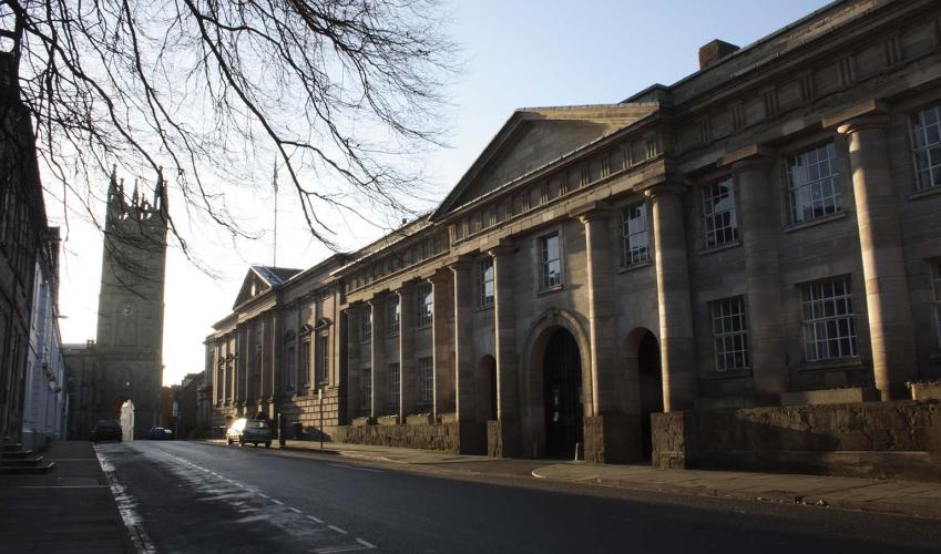
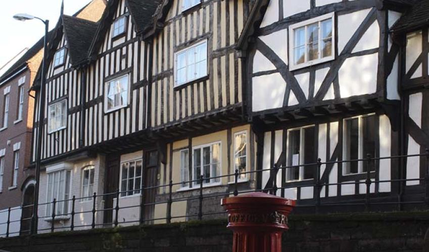
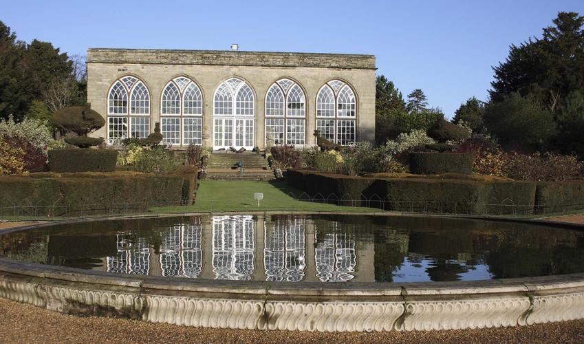
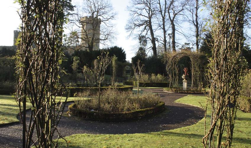
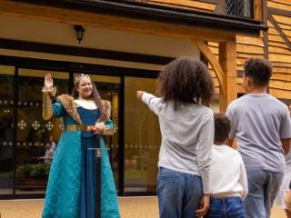
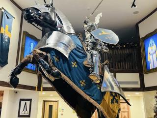
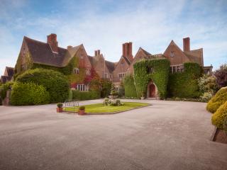
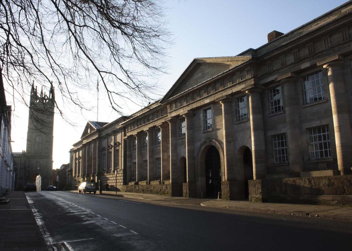
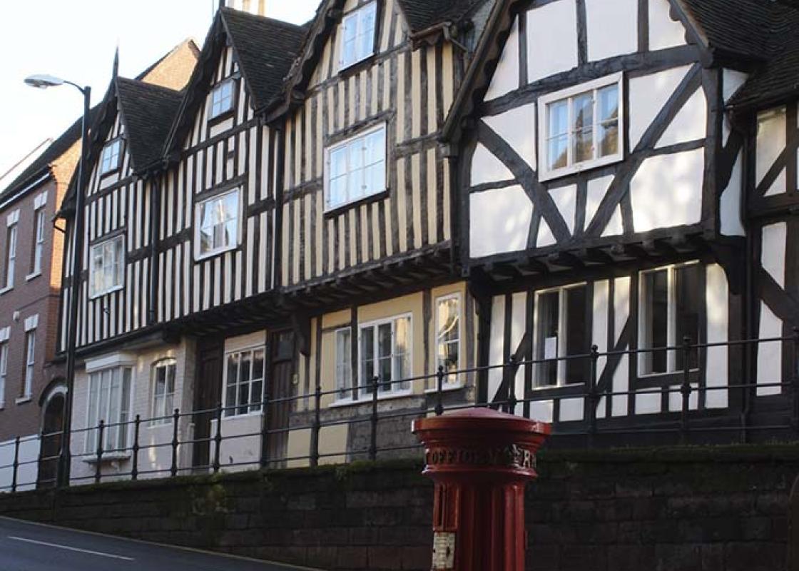
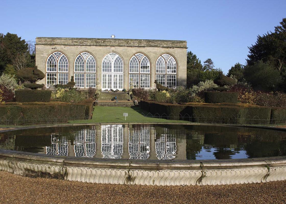
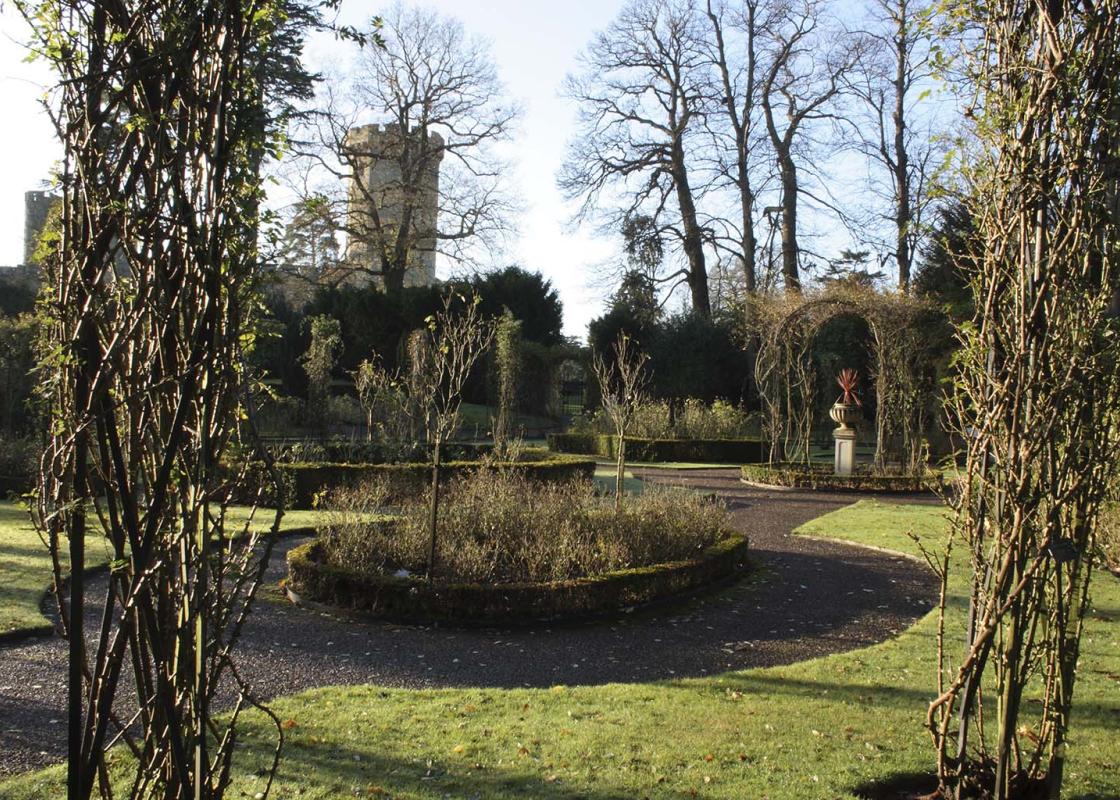
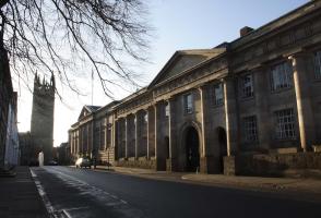
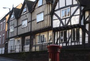
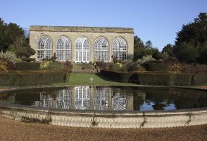
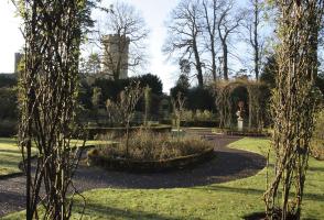
This walk offers you the opportunity to visit one of the most famous castles in England. Starting from the car park at Warwick Racecourse, a stroll along the tow path of the Grand Union Canal to the River Avon brings you to Castle Bridge. This has the classic view of Warwick Castle. There has been... a fortress on the site of the castle since 1068, but the current structure of Warwick Castle dates from the 14th century. It sits imperiously above the River Avon near the centre of the town. It is the ancestral home of the Earls of Warwick, of whom Richard Neville (1428–71), known as ‘the Kingmaker’, was probably the most famous. You can spend a whole day at Warwick Castle, there is so much to see: the Bailey, Guy’s Tower (128ft/39m high), Caesar’s Tower (147ft/45m high), the Gatehouse, the Clock Tower and the Old Bridge over the River Avon are all truly superb. Inside you can see the tapestry of the gardens of Versailles, Cromwell’s helmet and Queen Anne’s travelling trunk. Outside, there are gardens that were designed by Lancelot ‘Capability’ Brown in the 18th century. Tear yourself away from the castle to continue the walk through the county town. It displays a fascinating blend of Georgian and Tudor architecture. In Castle Street, you pass the timbered home of Thomas Oken, a weathly wool merchant and one of the town’s benefactors. It now houses a doll museum. St Mary’s Church is up the road opposite. You can climb its great 174ft (53m) tower for a fantastic view over the town and the surrounding countryside. Inside the church is the 15th-century Beauchamp Chapel where Richard Beauchamp’s tomb takes centre stage. Beauchamp was father-in-law to Richard Neville and the 13th Earl of Warwick; he lived through the reigns of three kings and was present at the burning of Joan of Arc. Also in St Mary’s is the tomb of Robert Dudley, Earl of Leicester, a favourite of Elizabeth I. Before heading back to the racecourse you’ll pass Lord Leycester’s Hospital. This was originally the Guild House of St George, which became the Almshouse in 1571, founded by Robert Dudley. Now it is probably the most famous medieval building in this wonderful town.
The sparkle of sunlight on a gentle river as it meanders through beautiful countryside; the reflections of sailing boats on a lake; relaxing with a pint in the garden of an old English pub in a picturesque village; brightly coloured narrow boats making their way through a flight of lock gates; the imposing silhouette of an historic castle. These are the scenes that make Warwickshire a delight.
Walk to the far end of the car park and go left towards the golf clubhouse, the Warwick Golf Centre.
1 of 6
Beyond, go right and take the wide green track between the golf course and the driving range. In about 300yds (274m), cross over the racetrack and go through a kissing gate onto a footpath alongside modern housing. Continue ahead, and at the corner of common land go right through a kissing gate onto a lane, and descend to the road. Go left along the pavement beneath the railway bridge, then left opposite St Michael’s Road through a gate (locked 6pm–8am) onto grassland by the Saltisford Canal. Follow this grassy area to the tow path, passing a large narrowboat mooring area, and climb the steps up to the canal bridge onto the pavement beside a road. Go right along the pavement, Budbrooke Road, and in 50yds (46m), you will come to the A425 and a canal bridge over the Grand Union Canal.
2 of 6
Cross the road with care. Go left over the canal bridge and, immediately across it, descend to take the tow path into Warwick, about 1.5 miles (2.4km) away. Pass a lock gate with The Cape of Good Hope pub opposite, and along the back of residential properties. After passing a supermarket on the opposite bank and just before reaching the aqueduct over the River Avon, go left down steps to join the ‘Waterside Walk’, turning right at the stream.
3 of 6
Proceed right under the aqueduct and follow the riverbank footpath. After 1 mile (1.6km) at Castle Bridge, climb steps onto the pavement of the A425 (Banbury) road and cross with care.
4 of 6
Stroll onto the bridge for the classic view of Warwick Castle, then turn around and follow the pavement towards Warwick town.
5 of 6
In 220yds (201m) go left and meander down picturesque Mill Street for the second favourite view of the castle. Return to the main road and go left through the main entrance gate to Warwick Castle grounds. Walk up the drive to the main gate, turn right up steps, pass the castle entrance and turn left on Castle Lane. Turn right on Castle Street and continue, passing Oken’s House, to reach the tourist information centre on the corner of the High Street. Turn left here and walk along High Street, going beneath the archway of Lord Leycester’s Hospital. Go right into Bowling Green Street, and in 50yds (46m) turn left down Friars Street. After 240 yds (250m), at the racecourse entrance turn right and right again into Bread and Meat Close car park.
This walk offers you the opportunity to visit one of the most famous castles in England. Starting from the car park at Warwick Racecourse, a stroll along the tow path of the Grand Union Canal to the River Avon brings you to Castle Bridge. This has the classic view of Warwick Castle. There has been... a fortress on the site of the castle since 1068, but the current structure of Warwick Castle dates from the 14th century. It sits imperiously above the River Avon near the centre of the town. It is the ancestral home of the Earls of Warwick, of whom Richard Neville (1428–71), known as ‘the Kingmaker’, was probably the most famous. You can spend a whole day at Warwick Castle, there is so much to see: the Bailey, Guy’s Tower (128ft/39m high), Caesar’s Tower (147ft/45m high), the Gatehouse, the Clock Tower and the Old Bridge over the River Avon are all truly superb. Inside you can see the tapestry of the gardens of Versailles, Cromwell’s helmet and Queen Anne’s travelling trunk. Outside, there are gardens that were designed by Lancelot ‘Capability’ Brown in the 18th century. Tear yourself away from the castle to continue the walk through the county town. It displays a fascinating blend of Georgian and Tudor architecture. In Castle Street, you pass the timbered home of Thomas Oken, a weathly wool merchant and one of the town’s benefactors. It now houses a doll museum. St Mary’s Church is up the road opposite. You can climb its great 174ft (53m) tower for a fantastic view over the town and the surrounding countryside. Inside the church is the 15th-century Beauchamp Chapel where Richard Beauchamp’s tomb takes centre stage. Beauchamp was father-in-law to Richard Neville and the 13th Earl of Warwick; he lived through the reigns of three kings and was present at the burning of Joan of Arc. Also in St Mary’s is the tomb of Robert Dudley, Earl of Leicester, a favourite of Elizabeth I. Before heading back to the racecourse you’ll pass Lord Leycester’s Hospital. This was originally the Guild House of St George, which became the Almshouse in 1571, founded by Robert Dudley. Now it is probably the most famous medieval building in this wonderful town.
The sparkle of sunlight on a gentle river as it meanders through beautiful countryside; the reflections of sailing boats on a lake; relaxing with a pint in the garden of an old English pub in a picturesque village; brightly coloured narrow boats making their way through a flight of lock gates; the imposing silhouette of an historic castle. These are the scenes that make Warwickshire a delight.