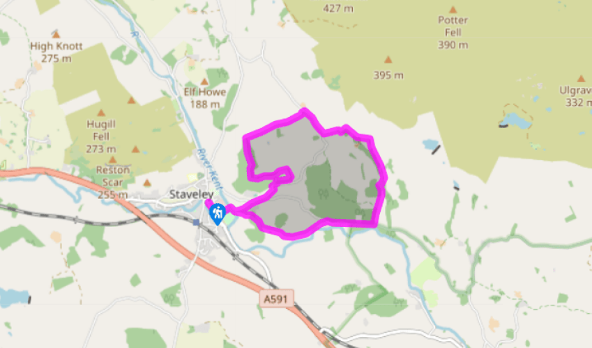
Staveley's Mill Yard and Craggy Wood
Recommended by

"How wood and water power brought industry to Staveley."
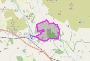
Walk directions
Walk down Main Street, heading southeast to reach the old tower of St Margaret’s Church. A footpath runs down the side of the churchyard and along the back of the Mill Yard. At the river, cross the bridge and follow the path beyond to the right. Turn left, at the corner of the wall, and go through a kissing gate between farm buildings. Continue straight ahead through a gate to the right of a barn, and keep a wall on your left as you pass through trees and another gate to a minor road. Turn right to a junction.
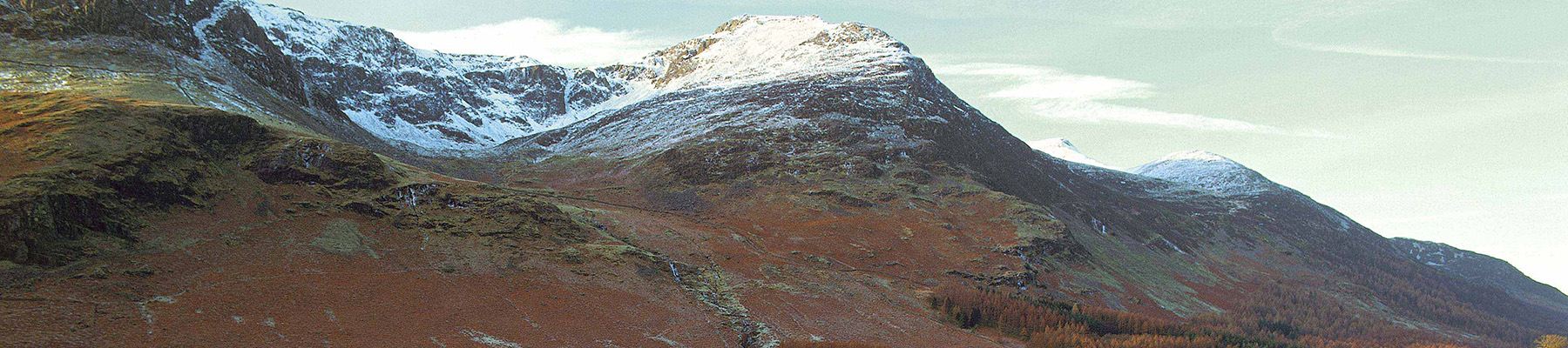
Turn left up the hill and, at a right-hand bend, dodge left into Craggy Wood. The single path is obvious and first takes you parallel with the road before swinging steeply up to the left towards the crest of the woods. At the highest point a magnificent view is revealed of the fells around Kentmere. Stay with the path through the woods as it undulates, trending downhill slightly, to emerge suddenly at a stile into a field.
View all directions
Additional information
Terrain
- Woodland and grassy paths and tracks, road, 6 stiles
Landscape
- Village, woods and fields
Dog friendliness
- Fields grazed by sheep, otherwise reasonably suitable for dogs
Parking
- On-street parking around Staveley Main Street, or in Mill Yard
Toilets en route
- Beside bus stop in Abbey Square, Staveley
About the walk
It’s no coincidence that this walk starts and finishes by the modern-day buildings of Staveley Mill Yard. The history of the village and its surrounding area is closely linked to the fortunes of the mills that developed on the banks of the River Kent – at its peak, there were 30 mills drawing power...
Read more

Been on this walk?
Send us photos or a comment about this route. Or recommend a route of your own.

Walking in Safety
Read our tips to look after yourself and the environment when following this walk.

Get an AA guide
Explore our range of ‘50 Walks in’ guides - they’re the ideal companion for a ramble.
Been on this walk?
Send us photos or a comment about this route. Or recommend a route of your own.
Walking in Safety
Read our tips to look after yourself and the environment when following this walk.
Get an AA guide
Explore our range of ‘50 Walks in’ guides - they’re the ideal companion for a ramble.
About the area
Cumbria's rugged yet beautiful landscape is best known for the Lake District National Park that sits within its boundaries. It’s famous for Lake Windermere, England’s largest lake, and Derwent Water, ‘Queen of the English Lakes', but other lesser-known areas in the south, such as the Lune Valley and the coastal towns, are secret gems of wide cobbled streets and rolling hills.
Nearby places to stay
View all (8)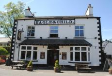


Nearby places to stay
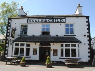
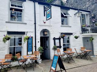
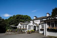
Eagle and Child Inn
With a charming riverside beer garden, the Eagle and Child bed and breakfast inn is a few minutes away from the scenic Kentmere Valley. And it’s not much more to the bustling towns of B...
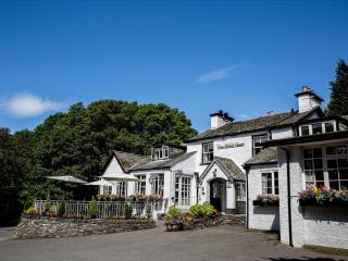
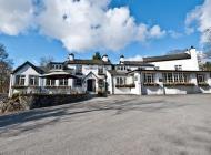
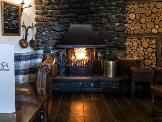
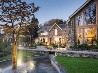
Wild Boar Estate
Wild Boar Estate is a traditional Lakeland Inn, ideally situated between Kendal and Windermere in the rolling countryside of the Gilpin Valley. The estate has 72 acres of private woodla...

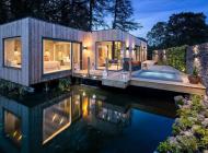
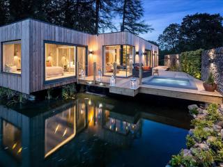
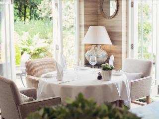
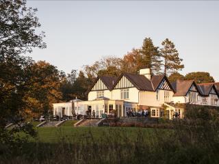
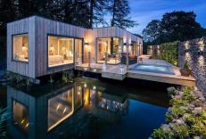
Gilpin Hotel & Lake House
Gilpin Hotel & Lake House is a smart Victorian residence set in delightful gardens leading to the fells, just a short drive from Lake Windermere. Individually designed bedrooms are styl...
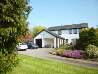
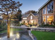
Roman How
Occupying an elevated position between Windermere and Bowness, Roman How is ideal for exploring the South Lakes and beyond. Including a garden with a patio – perfect for watching the su...
Roman How
Occupying an elevated position between Windermere and Bowness, Roman How is ideal for exploring the South Lakes and beyond. Including a garden with a patio – perfect for watching the su...
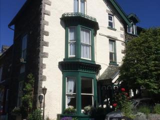
The Haven
Built from Lakeland slate and stone, The Haven is just a 50-metre stroll from the town centre and shops. The bright, spacious bedrooms are individually styled and offer en suite facilit...
Alexandra Cottage
Alexandra Cottage is located in a quiet residential area of Windermere in the south of the Lake District. It sleeps five and offers comfortable, homely accommodation within easy reach o...
Alexandra Cottage
Alexandra Cottage is located in a quiet residential area of Windermere in the south of the Lake District. It sleeps five and offers comfortable, homely accommodation within easy reach o...