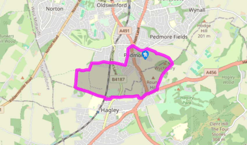
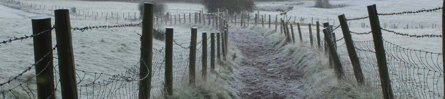
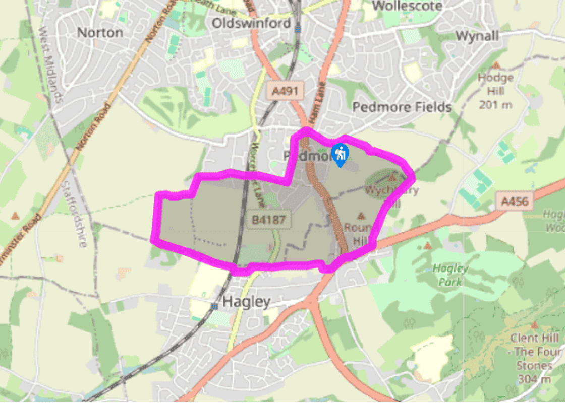
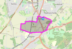
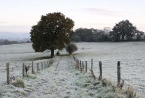
From Pedmore Lane, walk into the centre of Pedmore to a roundabout junction with the A491. Go around the island, cross the A491 and continue down the public bridleway signed ‘Hagley Road’. Follow this path along the back of houses and past a primary school then more houses, bearing right at a path junction.
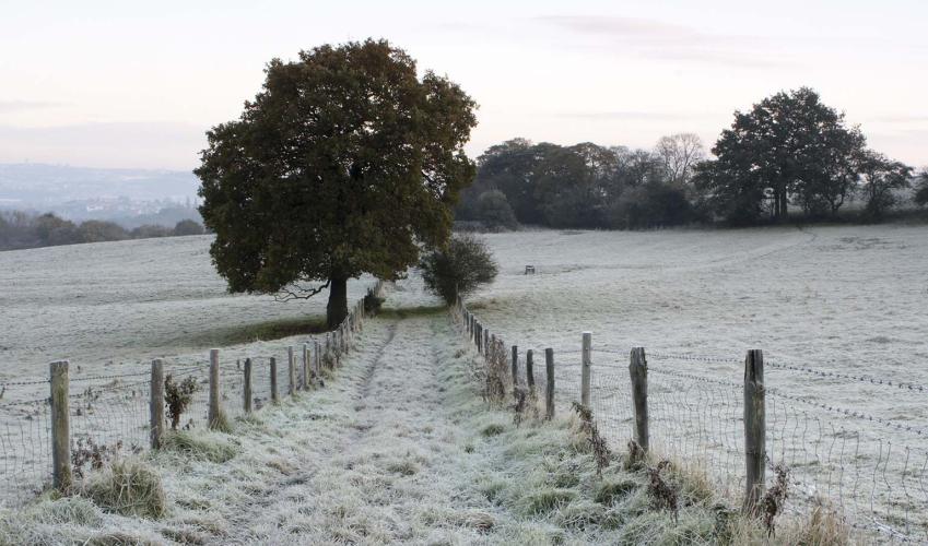
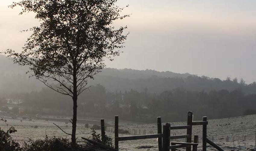
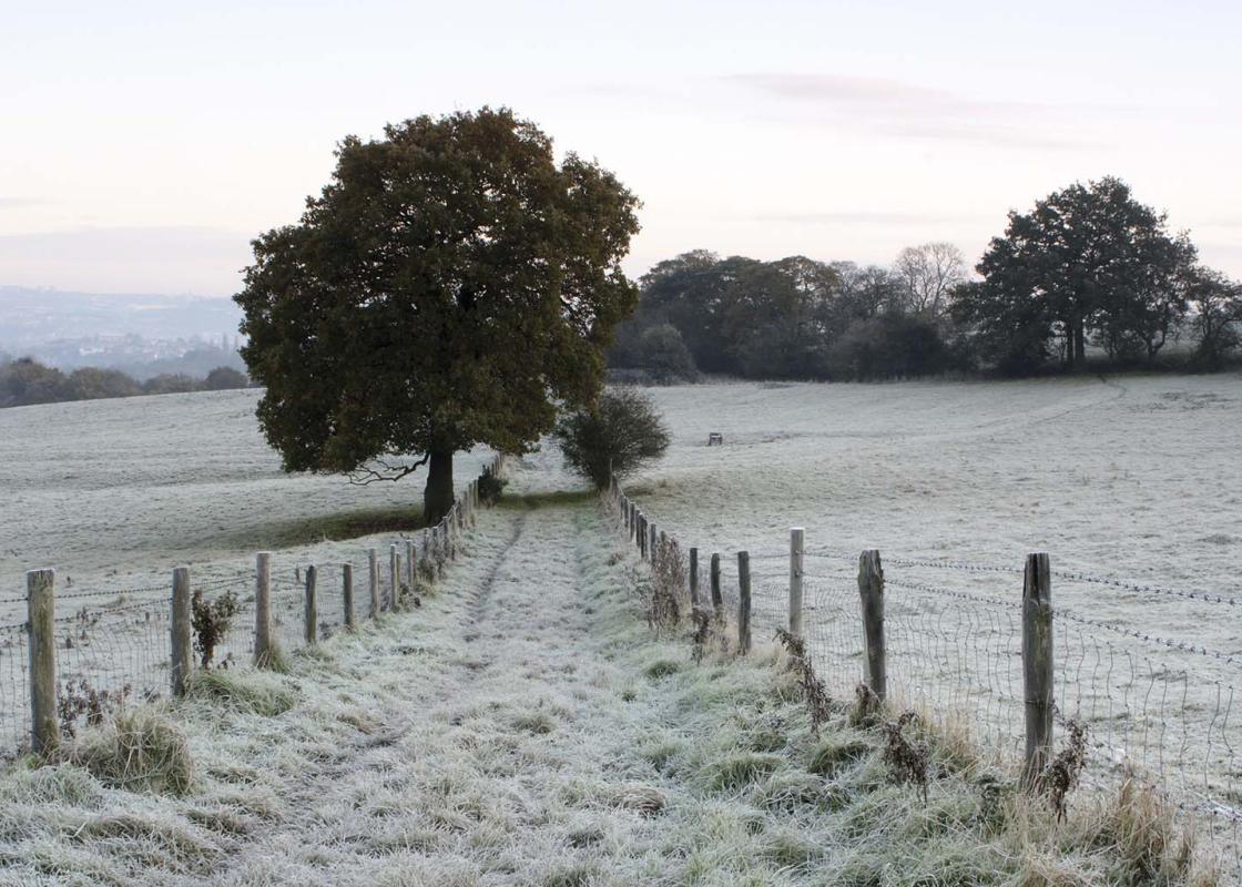
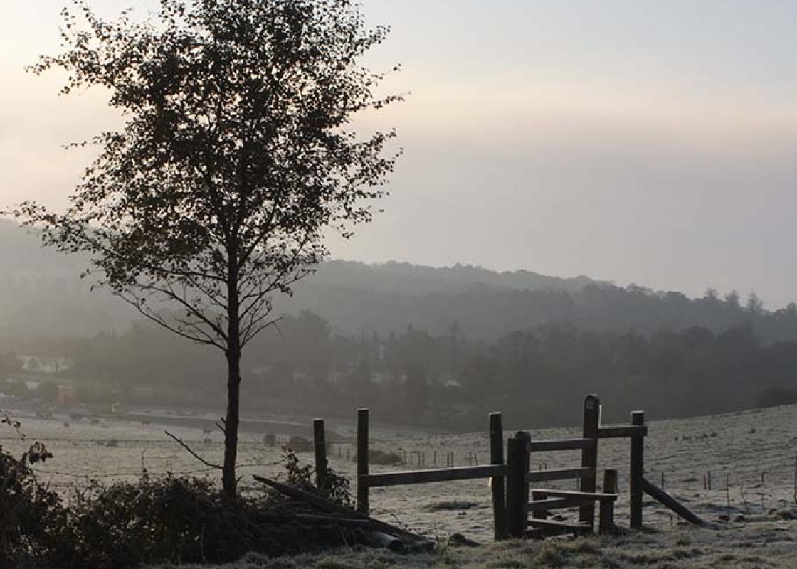
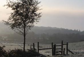
At the footpath T-junction, go right and continue on footpaths to the B4187 (Worcester Lane). Cross the lane and the main line railway bridge into Quarry Park Road. Continue along the path, following the public bridleway sign to Ounty John Lane, eventually turning left onto a stone track until you come to open countryside. When you reach the track junction go right, soon passing a Severn Trent reservoir. At the end of the reservoir, go immediately left and walk along a farm track over undulating ground, with views to the right towards the hills and Bewdley.
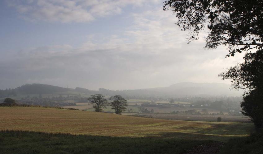
At the junction of paths by The Birches copse, go left (east) over a stile along the North Worcestershire Path, Monarch’s Way. Initially this is to the left of The Birches, then it veers to the other side of a field hedge, via a stile, descending to cross the railway line once again. It then continues straight ahead through a small housing estate in Hagley, first along the road and then on a footpath beyond No. 60. Eventually the Way comes to a road corner on the B4187 (Worcester Lane). Cross the road, following the footpath sign opposite, and take the hedged path via a stile and continue ahead at the bottom of a series of fields, crossing two stiles, until you reach the busy A456. Go left beside the road, walking to the left of the traffic island and cross the A491 (Stourbridge Road).
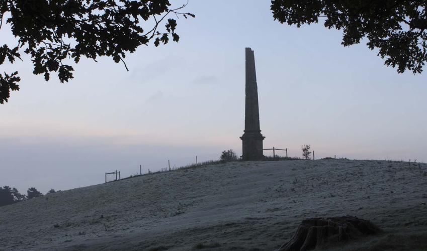
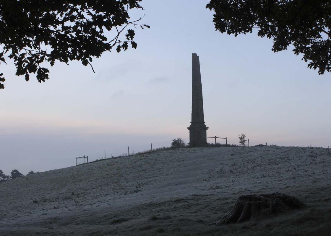
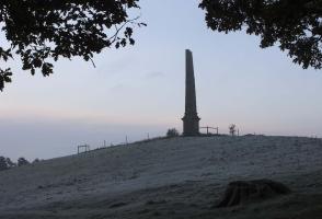
After following the pavement along the A456 for about 350yds (320m), go left up Monument Lane. Take the lane to the end, then continue on the Monarch’s Way via two gates as it climbs towards the Obelisk on Wychbury Hill. Beyond a stile the path goes to the left of the monument and along the side of Roundhill Wood to a junction of footpaths by the trees.
Take the path on the left through a kissing gate and a belt of trees and, through a gate, continue down a fenced path, turning right to return to Pedmore Lane.
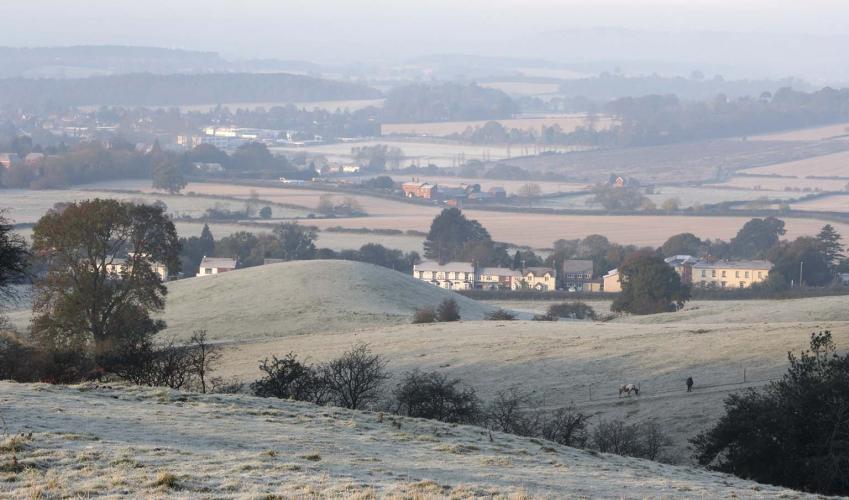
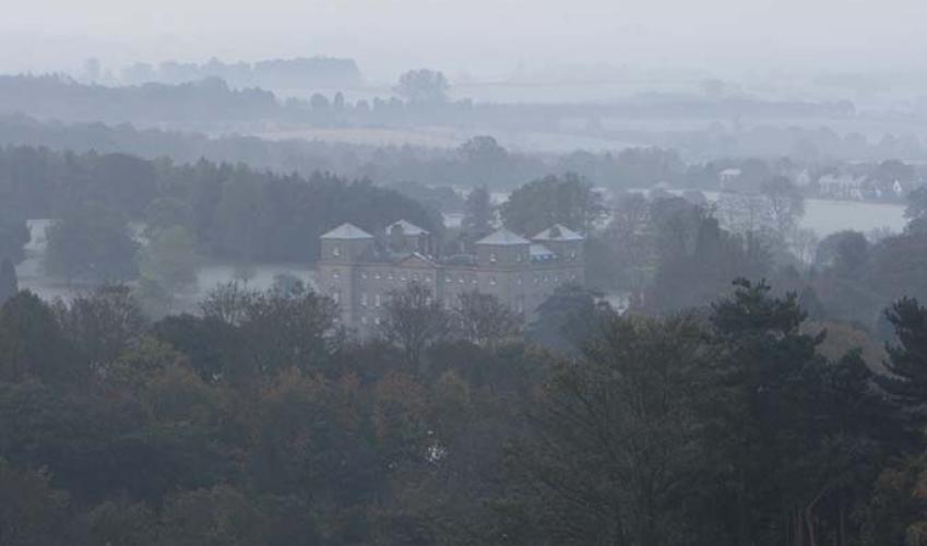
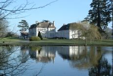
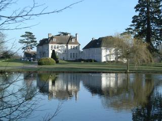
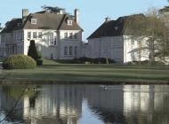
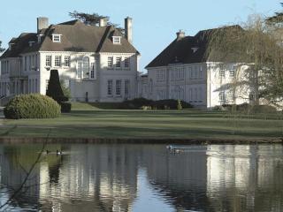
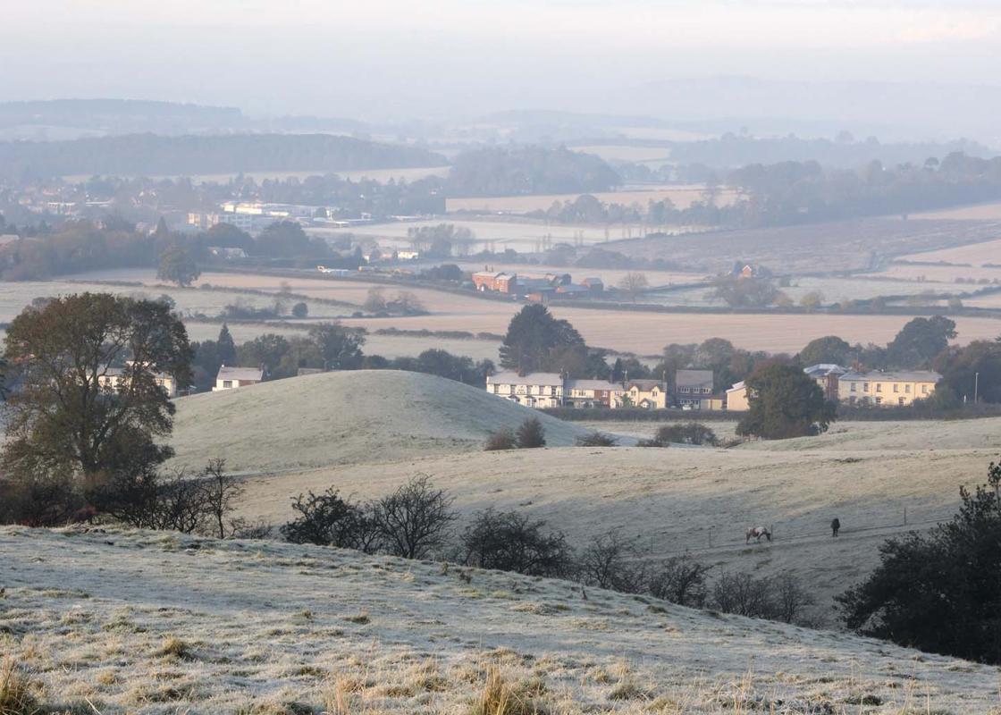
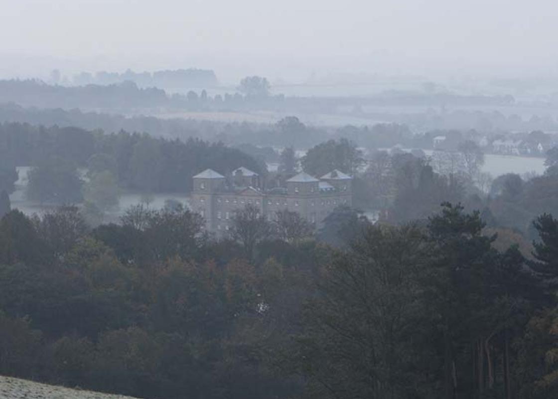
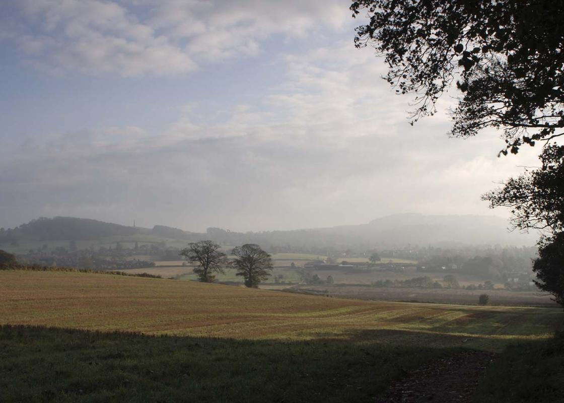
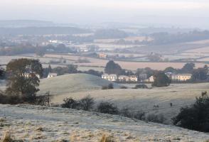
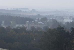
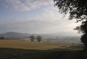
For much of this walk, there are fine views into Worcestershire over the Clent Hills, and the best of these is from the Obelisk, with Hagley Hall in the valley below. From the suburban West Midlands, town paths take you into the countryside, then link with farm tracks and the North Worcestershire... Path, following part of the Monarch’s Way over Wychbury Hill. Set below the range of the Clent Hills, on the outskirts of the village of Hagley, is one of the stateliest houses in England. Hagley Hall was the last of the great Palladian houses to be built. It was designed by Sanderson Miller and built between 1754 and 1760 for George, the 1st Lord Lyttelton (who was secretary to the Prince of Wales), on the site of an earlier house. The impressive building is constructed of brown stone, a rich colour that contrasts well with the Clent Hills in the background and the hall’s raised lawns. Its roof balustrades run the length of the four square-towered wings. In 1925, a serious fire caused a great deal of damage to the interior of the building but, thankfully, it has since been restored to its former glory. The entrance hall is decorated with lovely stucco work and the dining room, one of the rooms most badly affected by the fire, has an impressive rococo ceiling. Rich tapestries and fine Van Dyke paintings are the main feature of the gallery. The 2nd Lord Lyttleton was a founder member of the notorious Hellfire Club of 18th-century aristocratic libertines. Littleton was a great gambler and on one occasion gambled the whole of Hagley Hall against a single painting. Luckily, he won the bet and kept his home. The hall is set in some 350 acres (142ha) of imaginatively landscaped deer park, with an Ionic temple, a weathered rotunda and a folly in the form of a Gothic ruin. The Obelisk was built in 1758. Behind, the Clent Hills rise to 997ft (304m), forming the perfect backdrop for the views that will follow you along this walk. Today, Hagley is home to Lord and Lady Cobham and is now a location for conferences, business meetings, fairy-tale weddings and dinner parties. It can also be visited on a guided tour.
After Greater London, the West Midlands is the UK’s biggest county by population, and after London, Birmingham is the UK’s largest city. There’s a lot to seek out here – it has a vibrant culture, with exceptionally good nightlife.
From Pedmore Lane, walk into the centre of Pedmore to a roundabout junction with the A491. Go around the island, cross the A491 and continue down the public bridleway signed ‘Hagley Road’. Follow this path along the back of houses and past a primary school then more houses, bearing right at a path junction.
1 of 5
At the footpath T-junction, go right and continue on footpaths to the B4187 (Worcester Lane). Cross the lane and the main line railway bridge into Quarry Park Road. Continue along the path, following the public bridleway sign to Ounty John Lane, eventually turning left onto a stone track until you come to open countryside. When you reach the track junction go right, soon passing a Severn Trent reservoir. At the end of the reservoir, go immediately left and walk along a farm track over undulating ground, with views to the right towards the hills and Bewdley.
2 of 5
At the junction of paths by The Birches copse, go left (east) over a stile along the North Worcestershire Path, Monarch’s Way. Initially this is to the left of The Birches, then it veers to the other side of a field hedge, via a stile, descending to cross the railway line once again. It then continues straight ahead through a small housing estate in Hagley, first along the road and then on a footpath beyond No. 60. Eventually the Way comes to a road corner on the B4187 (Worcester Lane). Cross the road, following the footpath sign opposite, and take the hedged path via a stile and continue ahead at the bottom of a series of fields, crossing two stiles, until you reach the busy A456. Go left beside the road, walking to the left of the traffic island and cross the A491 (Stourbridge Road).
3 of 5
After following the pavement along the A456 for about 350yds (320m), go left up Monument Lane. Take the lane to the end, then continue on the Monarch’s Way via two gates as it climbs towards the Obelisk on Wychbury Hill. Beyond a stile the path goes to the left of the monument and along the side of Roundhill Wood to a junction of footpaths by the trees.
4 of 5
Take the path on the left through a kissing gate and a belt of trees and, through a gate, continue down a fenced path, turning right to return to Pedmore Lane.
For much of this walk, there are fine views into Worcestershire over the Clent Hills, and the best of these is from the Obelisk, with Hagley Hall in the valley below. From the suburban West Midlands, town paths take you into the countryside, then link with farm tracks and the North Worcestershire... Path, following part of the Monarch’s Way over Wychbury Hill. Set below the range of the Clent Hills, on the outskirts of the village of Hagley, is one of the stateliest houses in England. Hagley Hall was the last of the great Palladian houses to be built. It was designed by Sanderson Miller and built between 1754 and 1760 for George, the 1st Lord Lyttelton (who was secretary to the Prince of Wales), on the site of an earlier house. The impressive building is constructed of brown stone, a rich colour that contrasts well with the Clent Hills in the background and the hall’s raised lawns. Its roof balustrades run the length of the four square-towered wings. In 1925, a serious fire caused a great deal of damage to the interior of the building but, thankfully, it has since been restored to its former glory. The entrance hall is decorated with lovely stucco work and the dining room, one of the rooms most badly affected by the fire, has an impressive rococo ceiling. Rich tapestries and fine Van Dyke paintings are the main feature of the gallery. The 2nd Lord Lyttleton was a founder member of the notorious Hellfire Club of 18th-century aristocratic libertines. Littleton was a great gambler and on one occasion gambled the whole of Hagley Hall against a single painting. Luckily, he won the bet and kept his home. The hall is set in some 350 acres (142ha) of imaginatively landscaped deer park, with an Ionic temple, a weathered rotunda and a folly in the form of a Gothic ruin. The Obelisk was built in 1758. Behind, the Clent Hills rise to 997ft (304m), forming the perfect backdrop for the views that will follow you along this walk. Today, Hagley is home to Lord and Lady Cobham and is now a location for conferences, business meetings, fairy-tale weddings and dinner parties. It can also be visited on a guided tour.
After Greater London, the West Midlands is the UK’s biggest county by population, and after London, Birmingham is the UK’s largest city. There’s a lot to seek out here – it has a vibrant culture, with exceptionally good nightlife.